Goal for the day: Forester Pass (13,160 feet)
The final climb to the last pass began. After Forester Pass (13,160 feet), only Mt Whitney was higher along the JMT.


The trail started with some simple switchbacks along with some straighter parts of the trail, but nothing extreme. Passing the first set of campsites, a little stream crossing the trail was dry but it did look like Bubbs Creek might be reachable from the campsites with a little downhill walk. Maybe I should have continued hiking a little further the day before after all.


After that, I came to a open area with multiple campsites at a bend in the trail. This would have been a great place to camp, but no use dwelling on my prior day’s choice.


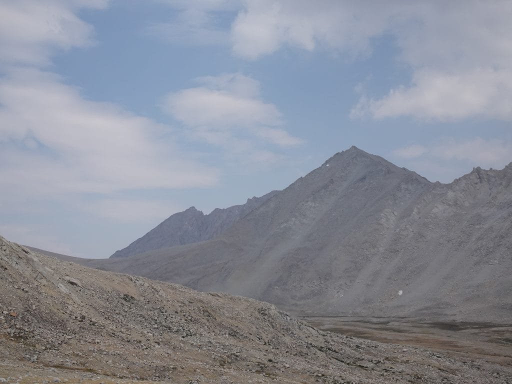
It was around there that I fixated on the wrong spot on the ridge as being the pass (and not for the first time on this trek). Maybe I should have reviewed my old notes and photos more, but I saw what I thought looked like the pass with the snowfield I remembered underneath.


But as I climbed closer, it became obvious that couldn’t be the correct pass. It would be at least a class 3 climb up that ridge.

When the trail finally pointed me in the right direction, it didn’t look nearly as bad as the false pass. But I was a little confused by the switchbacks that I (barely) saw right below the pass. I didn’t recall them from my previous climb of Foresters Pass. My memory insisted that it was mostly a straight slog up the trail. Was I still not looking at the correct pass?


As I got closer, it became clear why I didn’t remember them: After heavy snowfall in the Winter of 2017, there were several snow fields that covered several spots of the trail and most of the switchbacks. The alternate scrambles back in 2017 that I had to do to get around the snowfields were hard, but made me misremember that there were less switchbacks on this part of the trail than there were.


But the switchbacks weren’t really hard or particularity grueling. In the end, my memory of it mostly being a hard slog to climb up the trail to Forester Pass was correct. Hard, but rewarding.
But I made it!
Forester Pass – 13,160 feet
The final and highest pass on the JMT!!!
I enjoyed the view, took a million pictures, and then took a break.


Unlike the last time I climbed Forester Pass, I wasn’t exhausted after the climb. I credit that to getting closer to the pass the day before, being in better condition than 3 years earlier, and the past 21 days of hiking that had me so used to the altitude and long days of hiking. They say that when doing thru hiking your body gets used to the long hikes and it becomes easier the further you go. I’m not sure I’d call this ‘easy’, but I was pleasantly surprised at how well I was doing.


Descending, I saw a plaque to a worker killed during the construction of the JMT. Thanks, Mr Downs.


The rest of the day was mostly downhill as I descended towards the Shepherd Pass Trail junction. This was also a point where I could have chosen to abort out via Shepherd Pass, but I never had any thought of giving up at that point.


What I did think about, although only briefly and not seriously (probably), was that I could hike eastward and climb Mt Williamson (14,375 feet). The previous year, I had hiked up the very hard Shepherd Pass to climb Mt Tyndall, Williamson, Russell, and Whitney. My ambitious plan ended when I dislocated a finger on my left hand on the second day of that hike.
I managed to snap the finger back into place and scramble up Mt Tyndall (14,018 feet), but after testing the strength of my hand and finger to support me for some of the vertical climbing I’d need to do on Mt Williamson, I decided to abort during that hike.
So, getting a chance to at least try to climb Mt Williamson since it was somewhat close did occur to me. But that wasn’t the goal for this trek. I didn’t want to chance getting hurt and failing to finish the JMT, so I pushed aside the thoughts of Mt Williamson and continued southward.


It wasn’t far past the Shepherd Pass Trial junction that I decided to stop at Tyndall Frog Ponds for the night. First, I was getting tired from the log climb up Forester. Second, it was at least an hour and a mile and half to Bighorn Plateau-the next good camping area. Third, I started to feel some rain drops falling from the sky. No thunder, but it was enough for me to decide to stop for the day.


Setting up my tent in a solo spot near the biggest pond, I only had a couple brief scattered rain sprinkles that made me take cover a couple of times that evening. Nothing compared to some of the storms I had to endure previously, but it did mean the previous two days of no rain hadn’t led to a third.
Longish day, but worth it.
2 days to Mt Whitney’s summit!
10 miles hiked, 7:45 hours, 3,200 feet climbed
246 total miles hiked on the JMT
Highlights:
• Forester Pass – 13,160 feet (Pass #10 Conquered!) Final pass!!
• Daily Goal Achieved!!


Comments by WanderingJim
JMT 2020 Day 3
"I'm afraid I have no idea. Not really a fisherman, so don't..."
JMT 2020 Trek Day by Day
"Yeah, but with 9,000 pictures, it's hard to label each one..."
Kilimanjaro – October 2019
"Everest Base camp is on my list too. Mostly since I know..."
Kilimanjaro
"You started hiking with Kilimanjaro first? Even I worked my..."