Goal for the day: A campsite with a view of at least some of Owens Valley
Originally, I had targeted a place closer to Horseshoe Meadows for the campsite for this day, but based on where I had stopped at the night before I determined there was a good likelyhood that at near the end of the day I’d be climbing across a ridge with occasional views of Owens Valley and also the mountains to the west. So, I set my sights a little shorter. I could also continue north if no good campsites with views presented themselves.
I almost titled this day ‘That’s one boot for a man, one boot for the trail’.
Why?
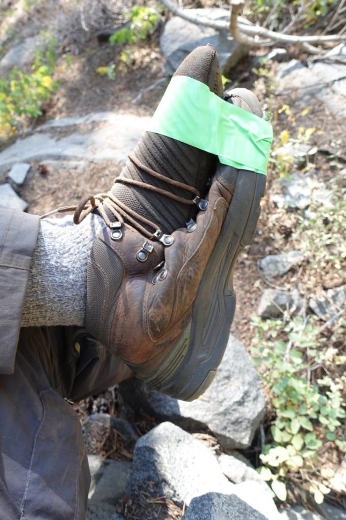
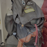
Because for the past two days, the gap between my boot’s sole and the upper was widening. I did my best to keep it from detaching completely with super glue and duct tape. The problem with duct tape is that it tends to fray and disintegrate when wrapped around a boot’s sole when walking on dirt, rocks, and other assorted trail materials.
I had extra duct tape in my resupply pail at Horseshoe Meadows, but would probably not have enough to reach Onion Valley. I even resorted to using some spare paracord wrapped around the boot sole to try to keep it in place. It lasted a bit longer than duct tape, but was hard to keep in place.
My boot was starting to look a little like the ‘trail cast’ I had made when I injured my foot at Dicks Pass near Lake Tahoe. See below for the cast. Somehow, I can’t find a picture of my duct-taped boot this time. Guess I didn’t want to preserve it for prosperity.
I started to think about how best to address the boot problem as I started my hike for the day.
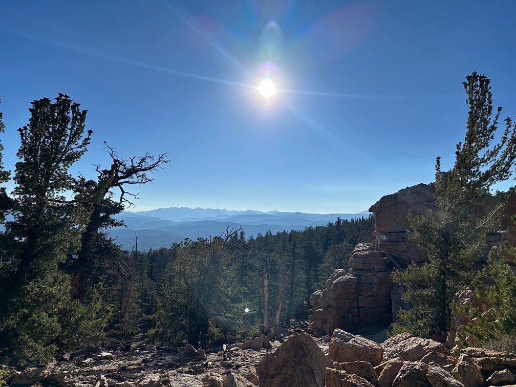
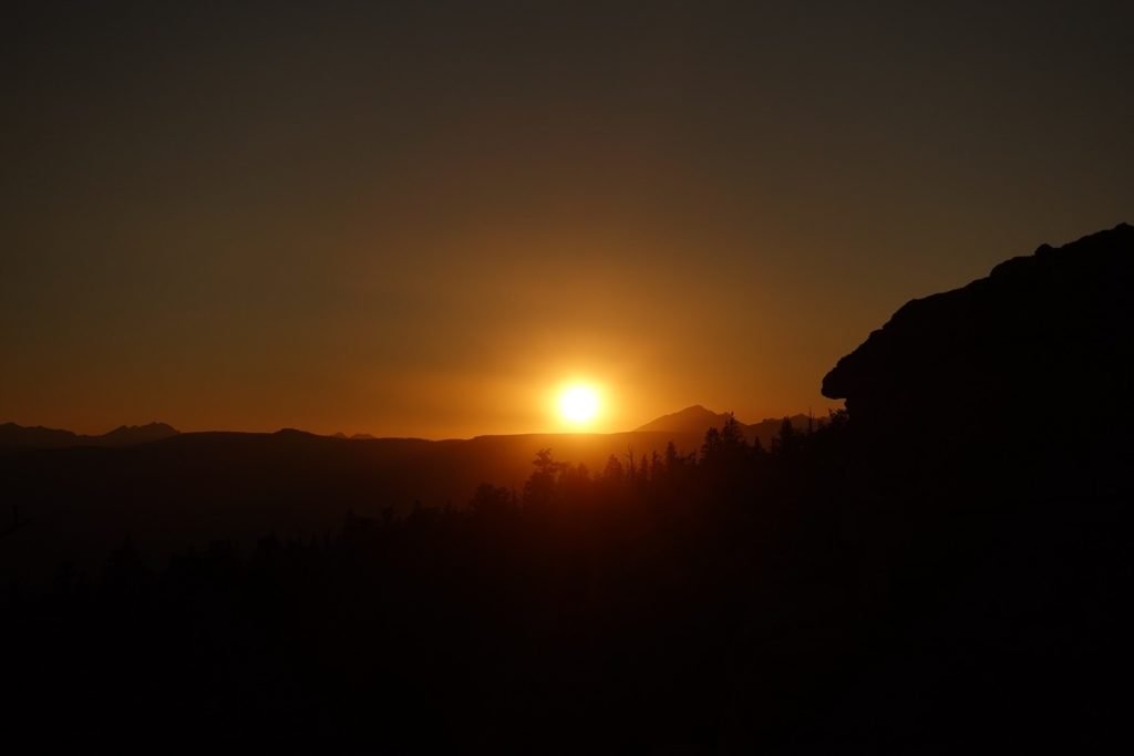
As usual in the mountains, a pretty glow appeared on the horizon due to the unseen rising sun.

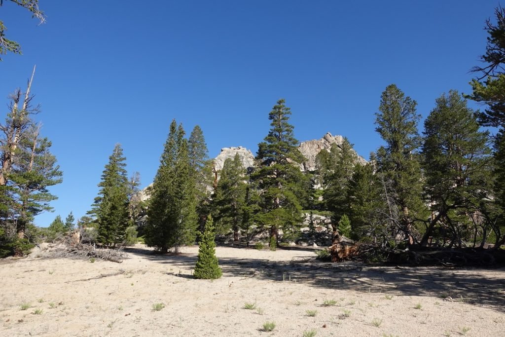
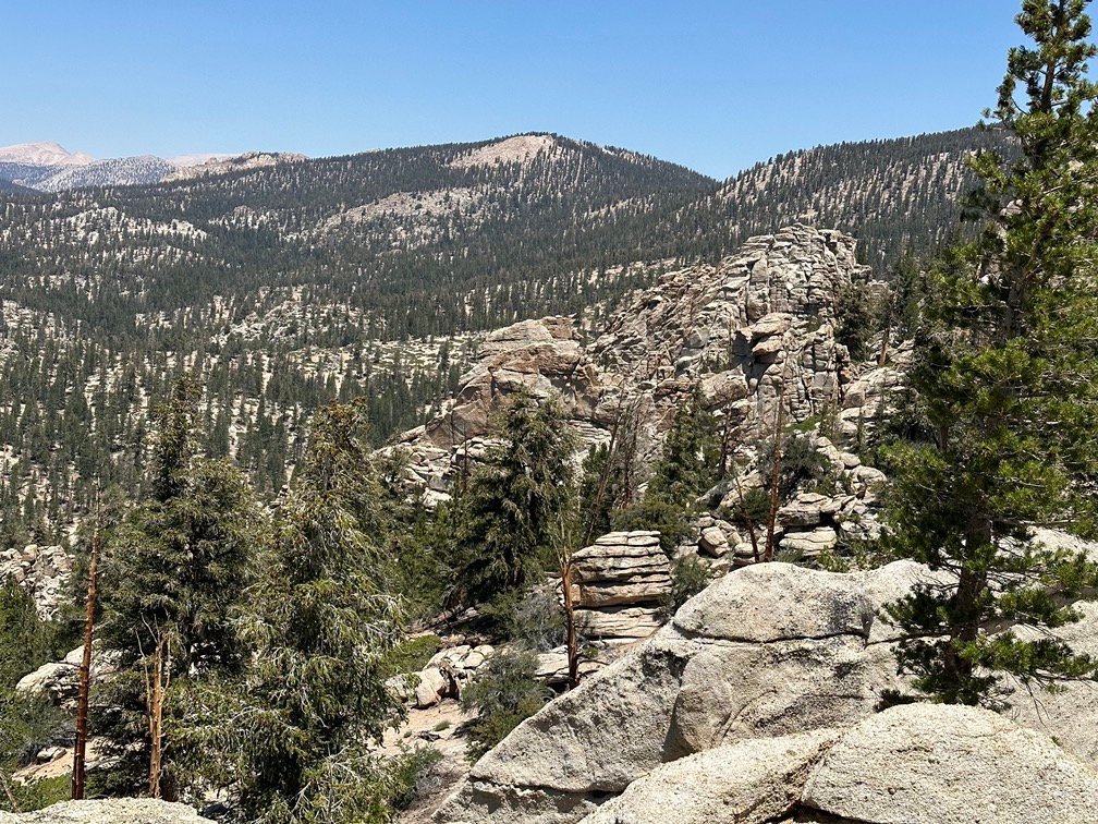
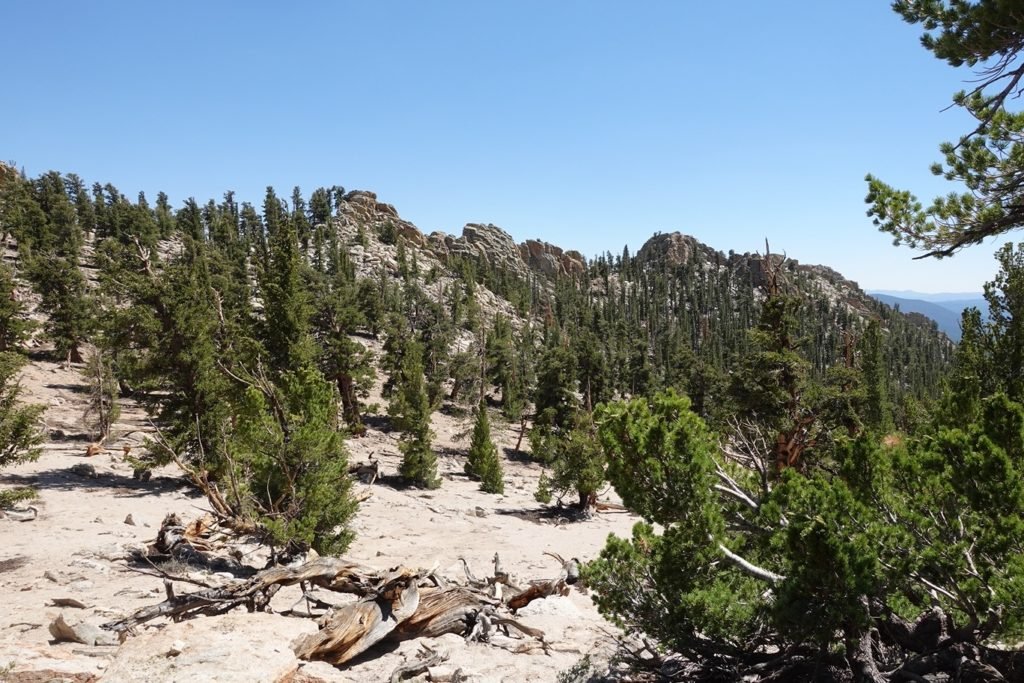
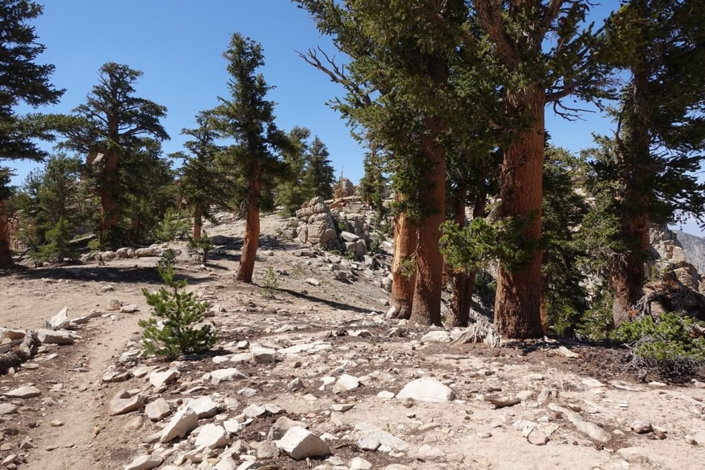
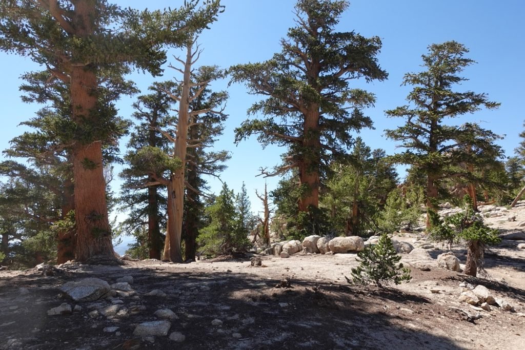
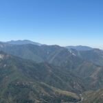
The first part of the day was mostly level across a tree lined ridge.
But the slow climb up to 10,000 feet began soon enough. It was later in the day when the hard part of the hike began, so it seemed steeper to my tired legs. The only good thing about that climb was the views it afforded me on the way up.
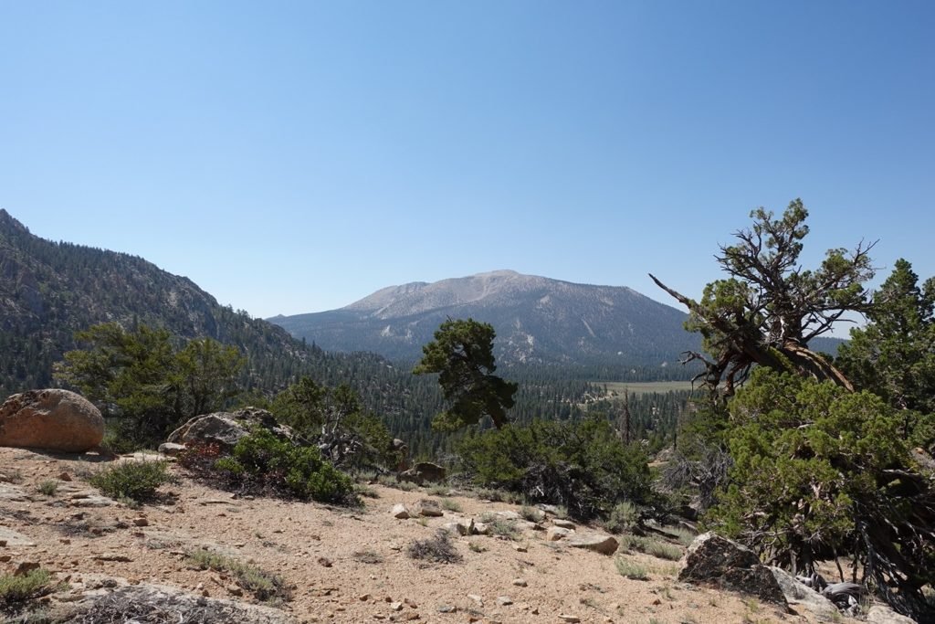
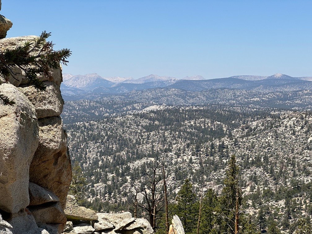
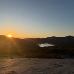
Looking behind me, I saw the unmistakable outline of Olancha Peak. I knew it was there the previous day, but never really saw it from the trail that would around it’s west side. It always seemed to be covered by trees (or I just didn’t pay attention).
Now, I could look back and see what I had been hiking across for the prior couple of days. Pretty nice view from here.

The view ahead was nice too.

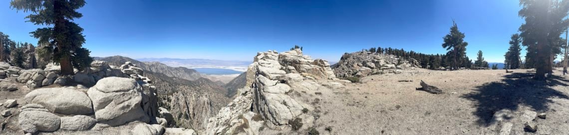
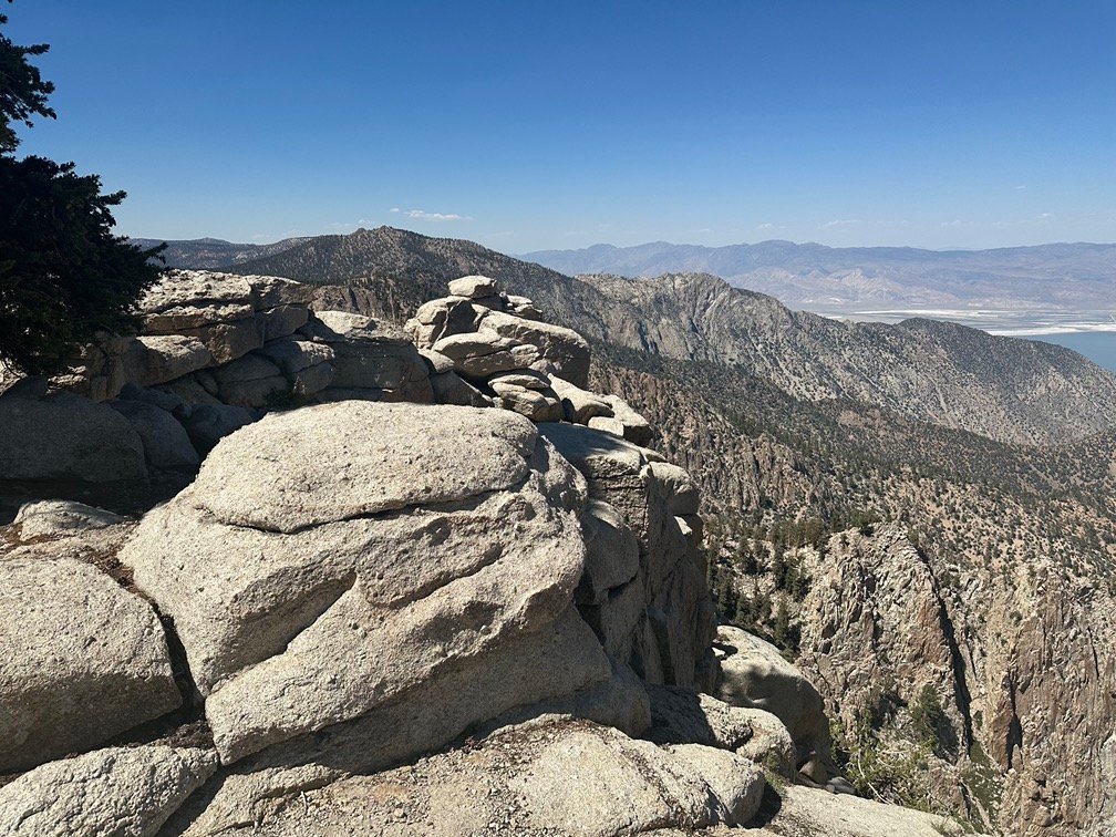
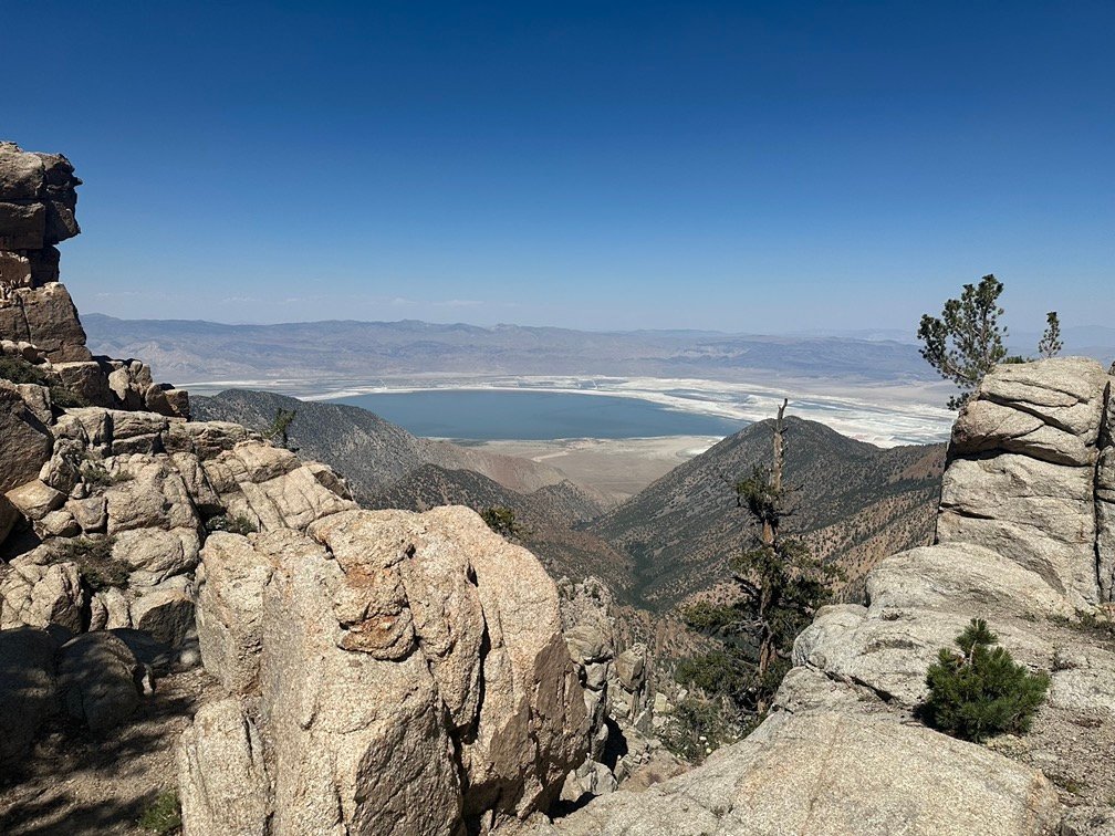
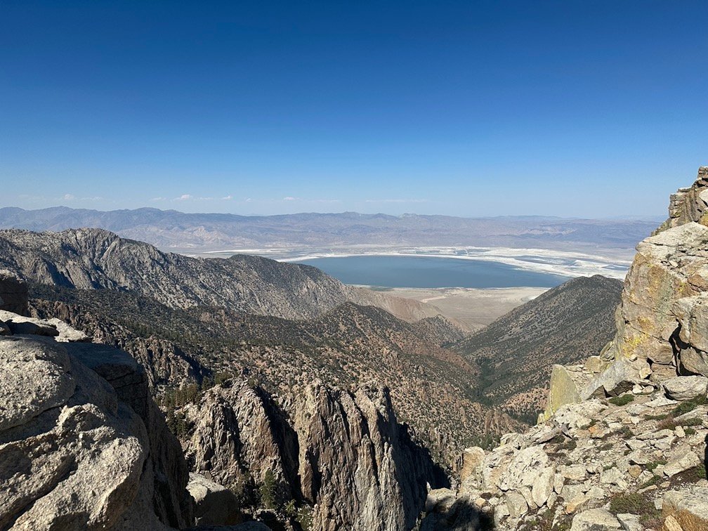
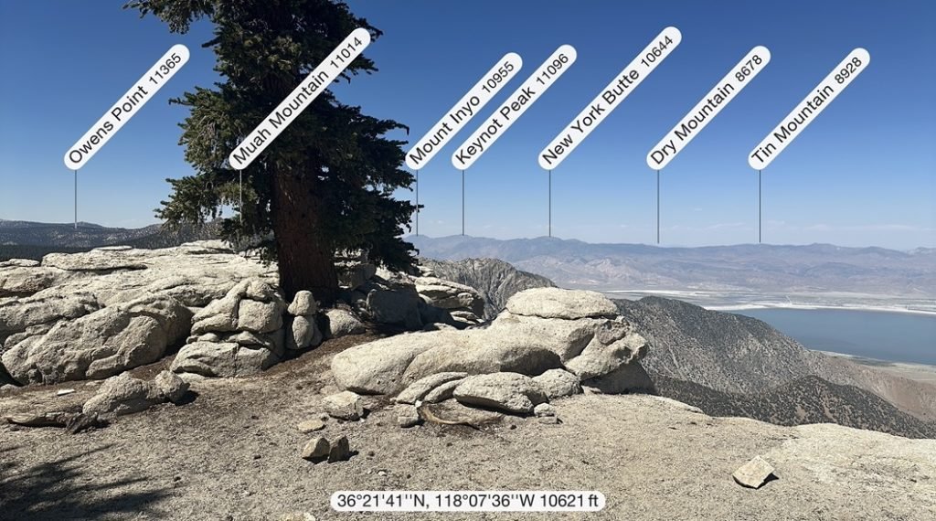
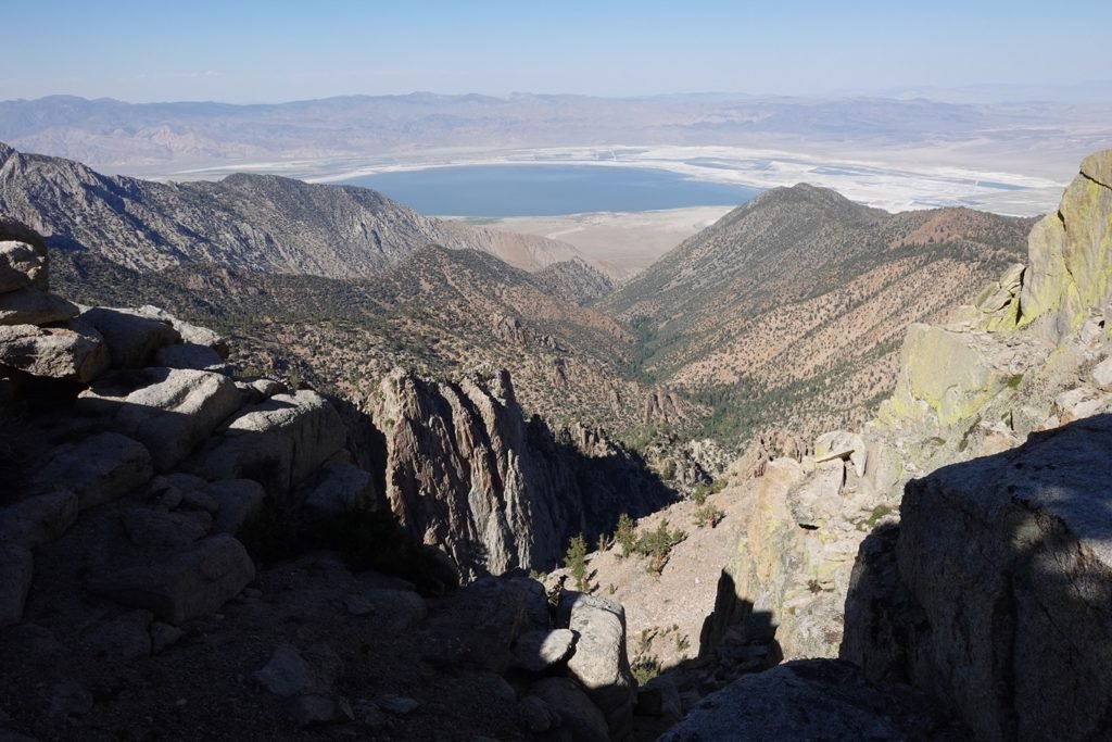
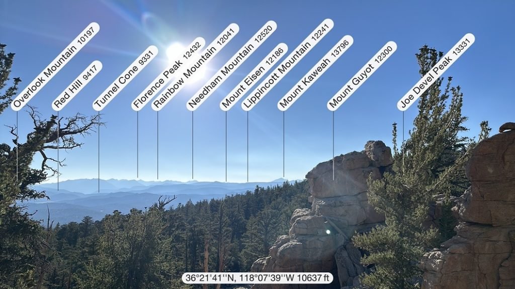
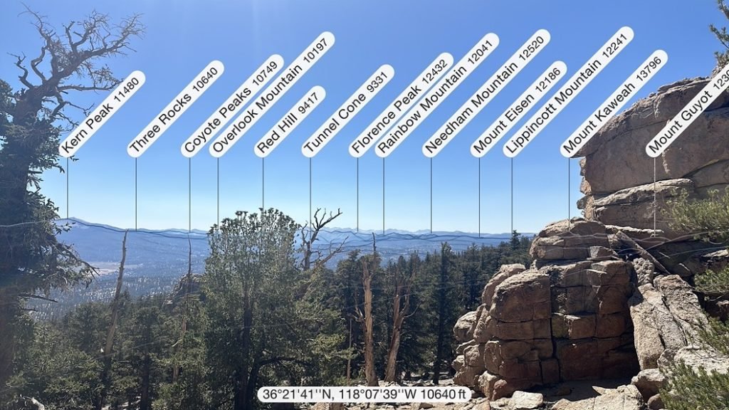
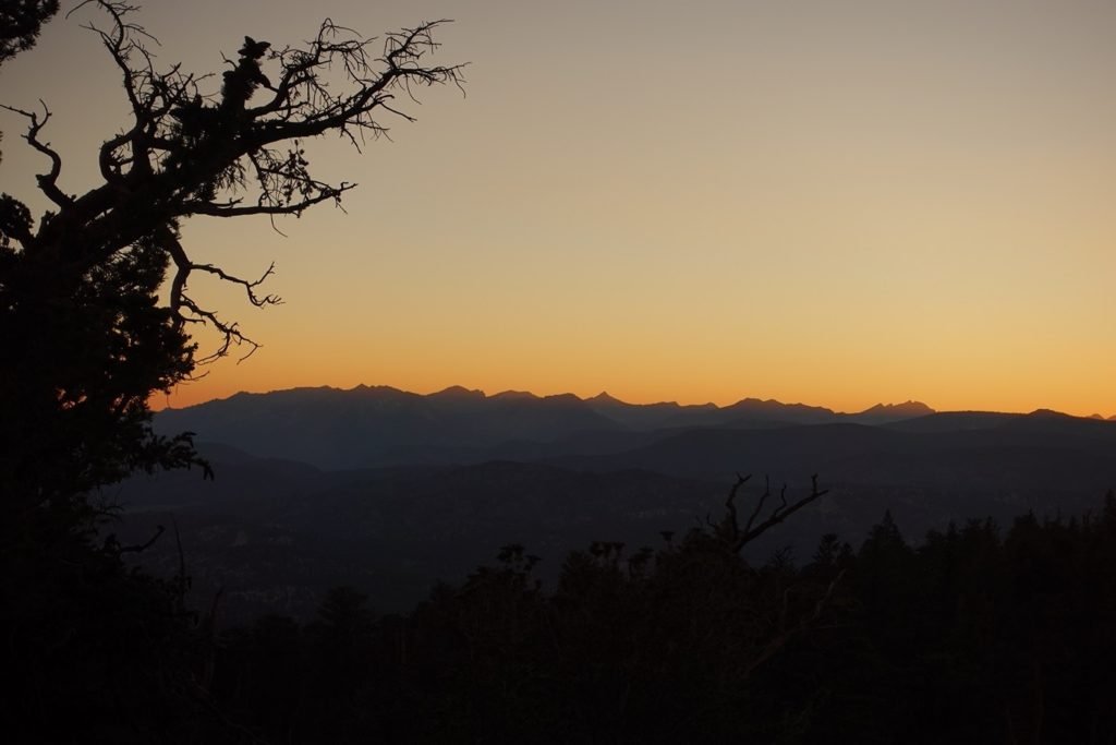
Exhausted by the climb, I almost missed seeing a fantastic view of Owens Valley to the east of the trail.
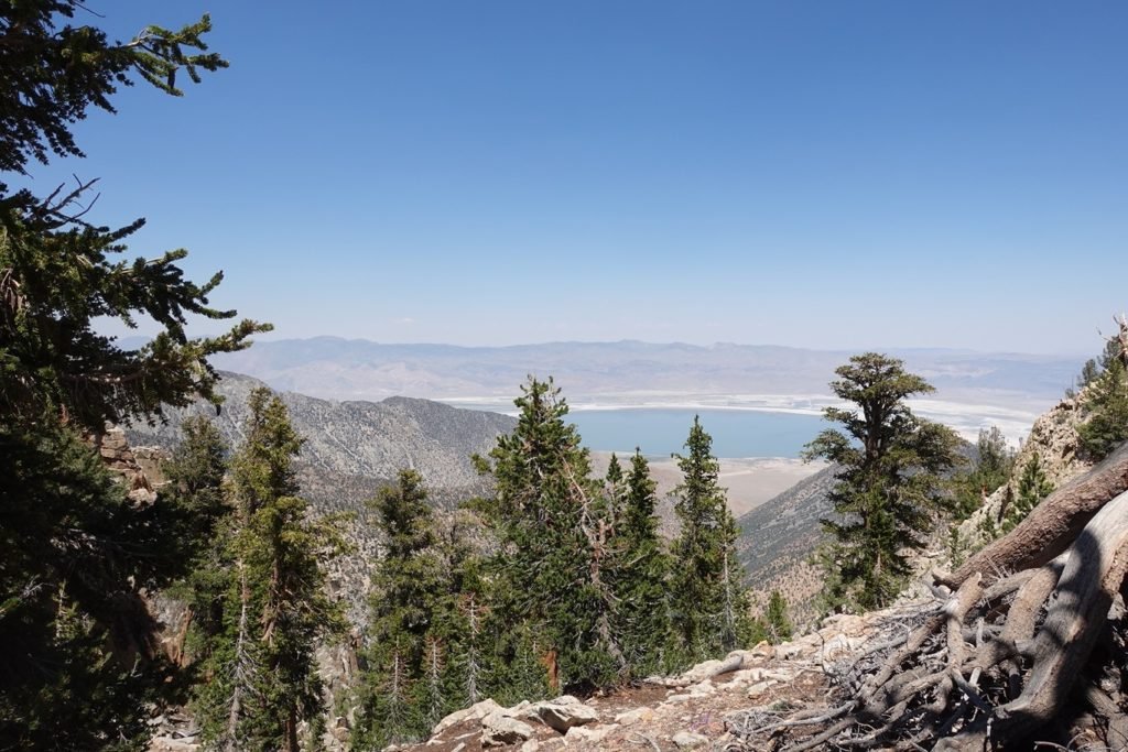
I came pretty close to looking for a place to setup my tent there, but after reviewing my trail info and relief maps, I still had over a mile to go along the ridge line I was on, mostly along the top if it.
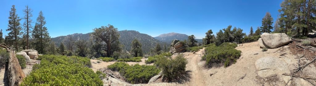
Being on top of a ridge line typically allowed for some great views, so I took a chance and continued up and along the ridge line.
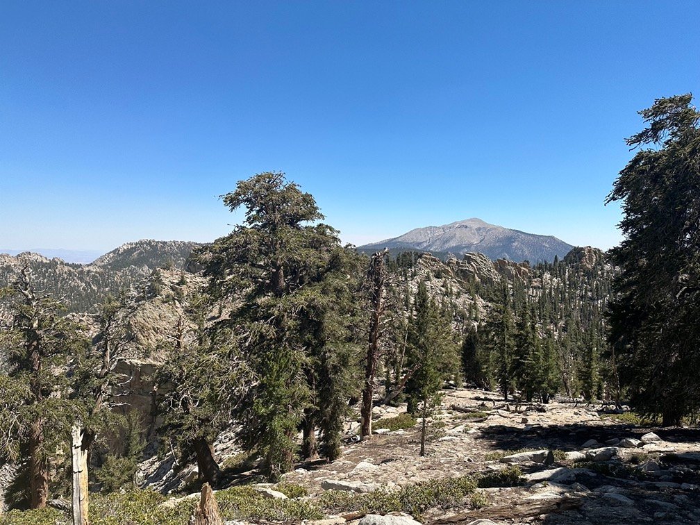
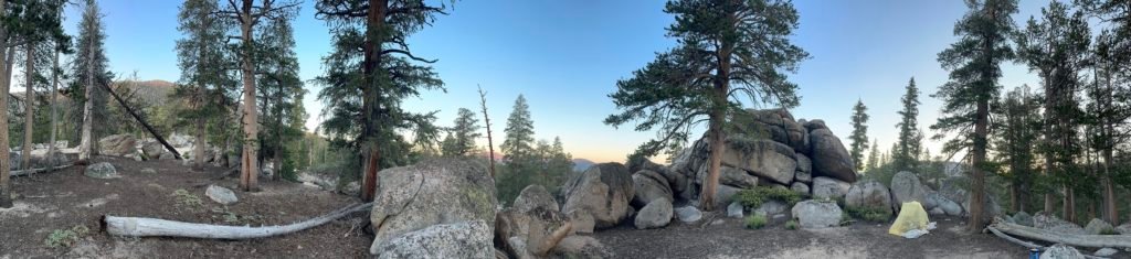
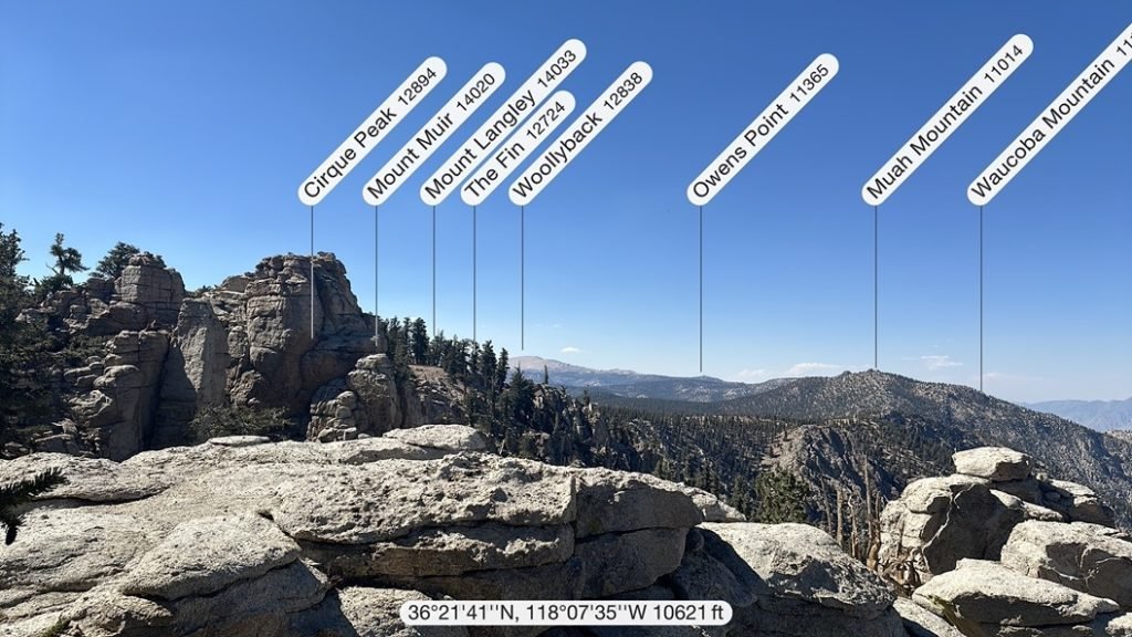
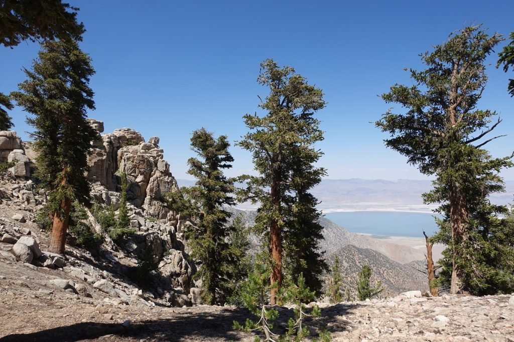
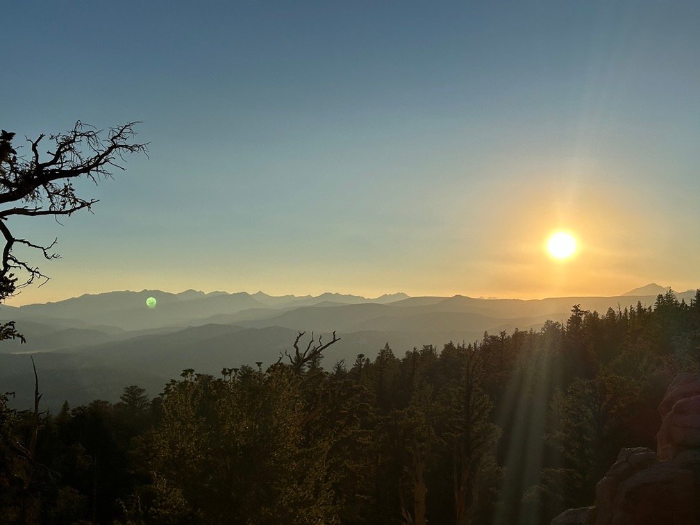
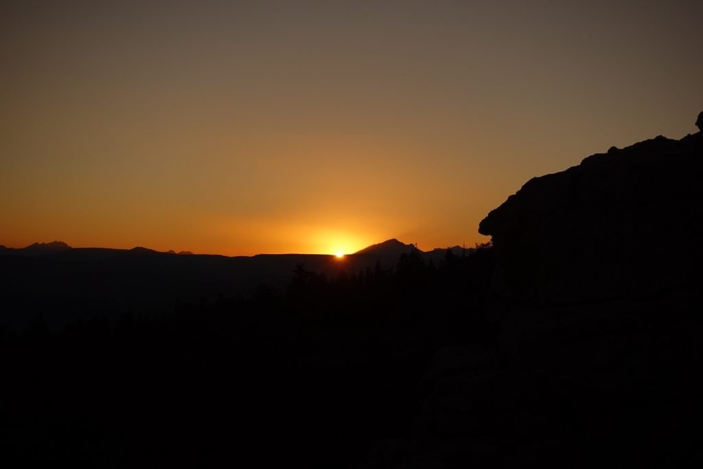
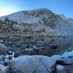
My decision to continue paid off! I came across a clearing that had a even more spectacular view of Owens Valley to the east, views of Mt Langley to the north, and a view to the west through some trees. And multiple choices of flat areas to setup my tent.
Perfection!


But I’d been fooled before and settled down in one spot, only to find an even better spot the next morning. So, with the map still showing a half mile before the trail started descending, I decided to check out the trail ahead of me.
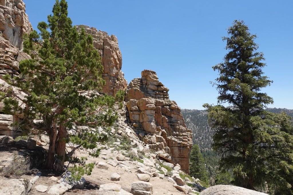
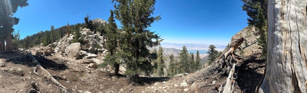
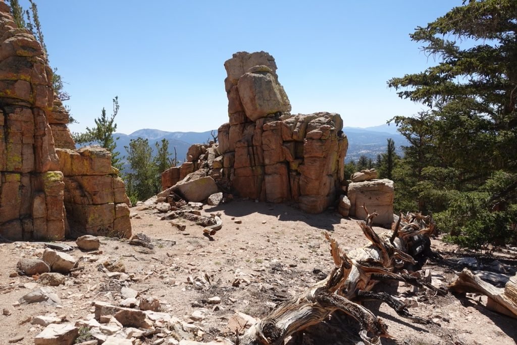
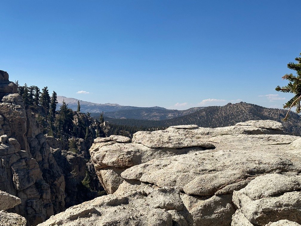
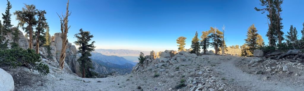
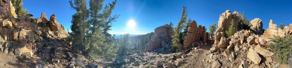
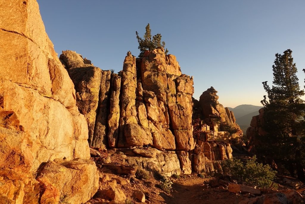
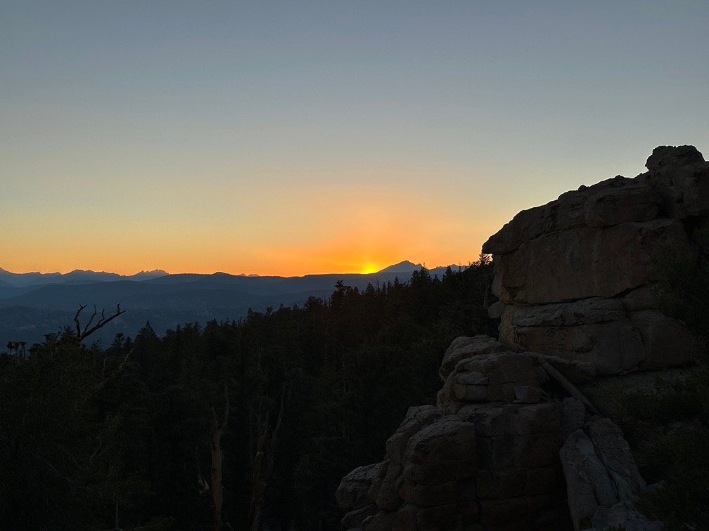
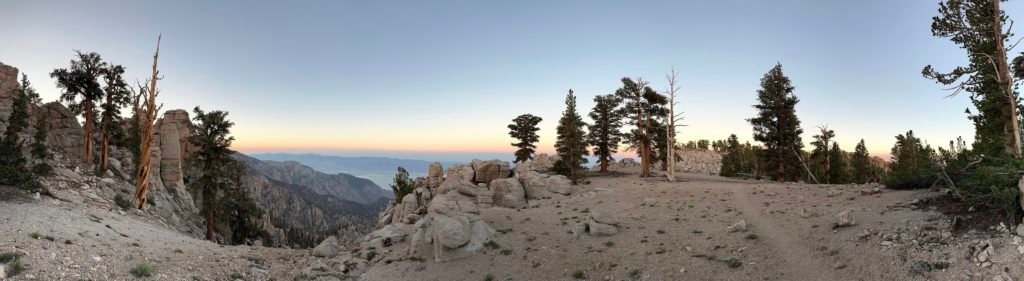
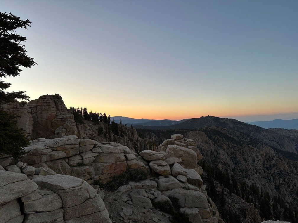
The trail actually took a turn into a rock outcropping and emerged with a great view of the western skies. Would be a good place to see the sunset from. And a tent pad close by. Maybe…
Then I continued a little further and the trail turned east again and revealed another great view of Owens Valley with some tent sites nearby. Not bad.
After considering the options, I did something I usually DON’T do on the trail: I reversed course and walked backwards on the trail
I ended up setting up my tent overlooking Owens Valley under a nice shade tree. It wasn’t that hot in the Sun at 10,600 feet, but it still helped give me someplace to take the weight off my feet in the shade. There was a tent pad closer to the edge of the rim, but I didn’t want to wake up in the middle of the night to visit the bushes and end up getting out of the wrong side of the tent. That first step was a doozy. 😀
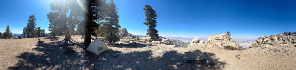
I didn’t spend too much time in the tent that evening anyway. Great views all around and I had a dinner with a view. Fortunately, I had thought I could end up camping along the water-less ridge and carried enough water with me for dinner and breakfast. Barely.
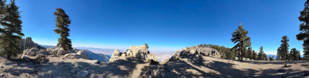
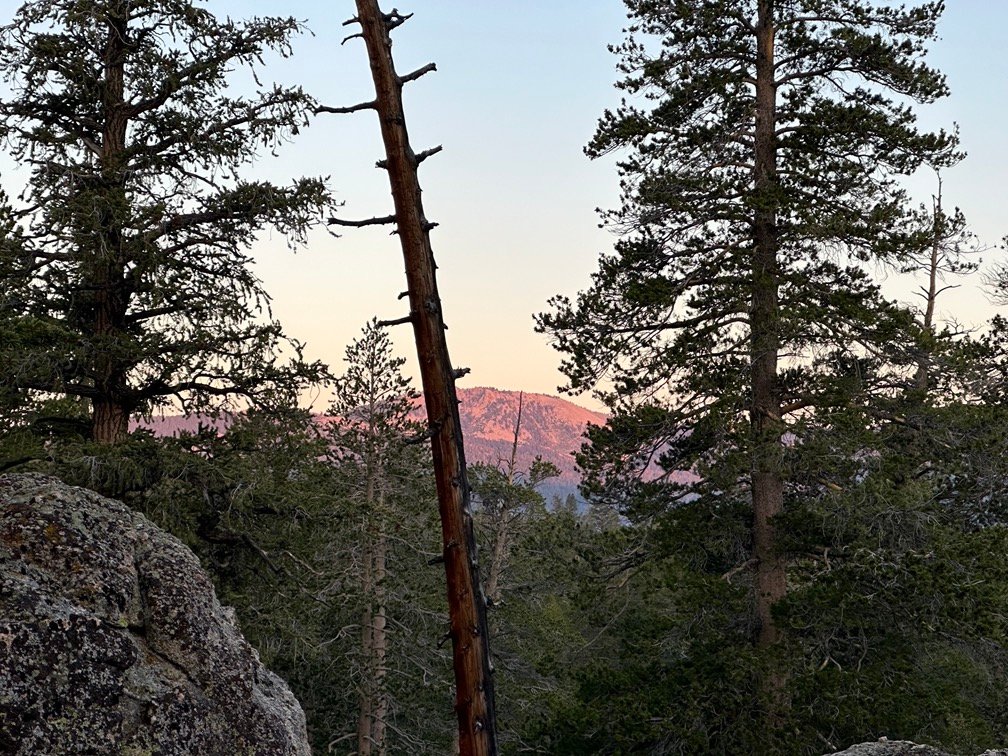
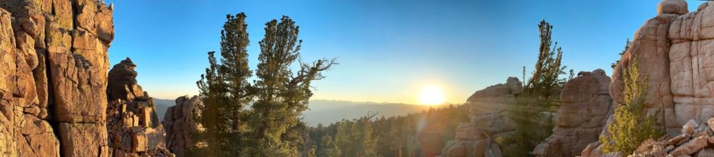
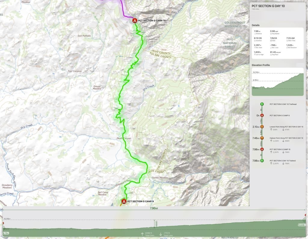
As sunset neared, I split my time between the great view of Owens Valley and the great view to the west by walking 100 feet through the rock outcropping separating the two views.

Why go back and forth between them? Because sometimes the views of the sunset are great in all directions. This was one of those times.
And the golden glow from the Sun made it even more spectacular.
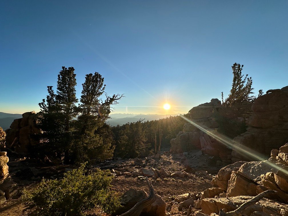
Easily the best sunset of the trip so far. I had chosen wisely.
Very wisely.
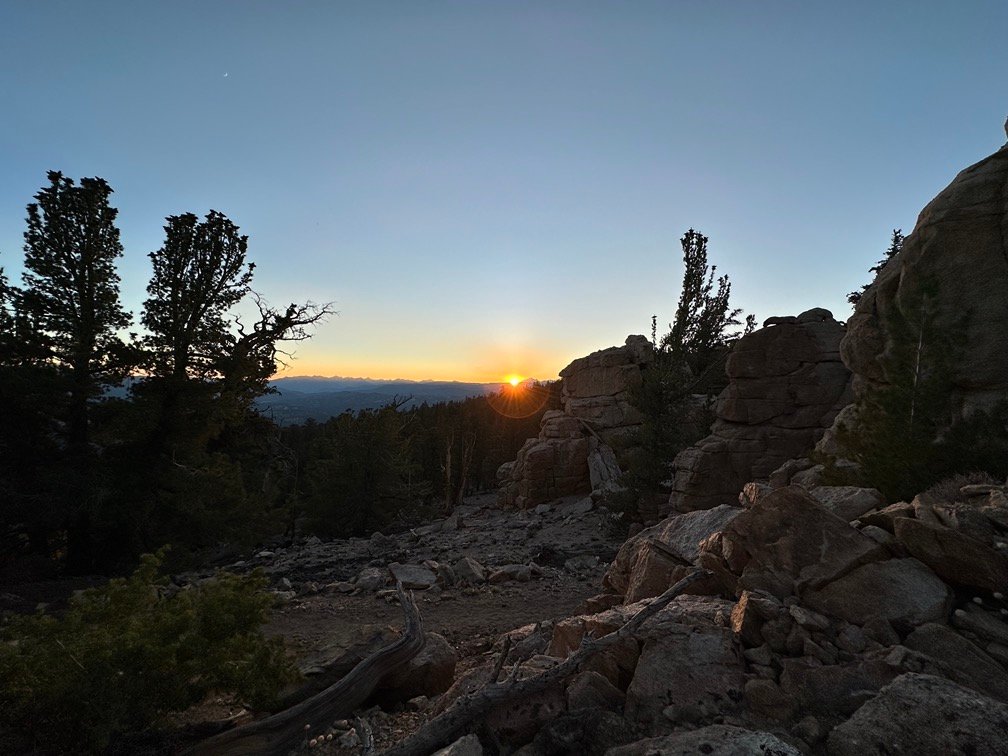
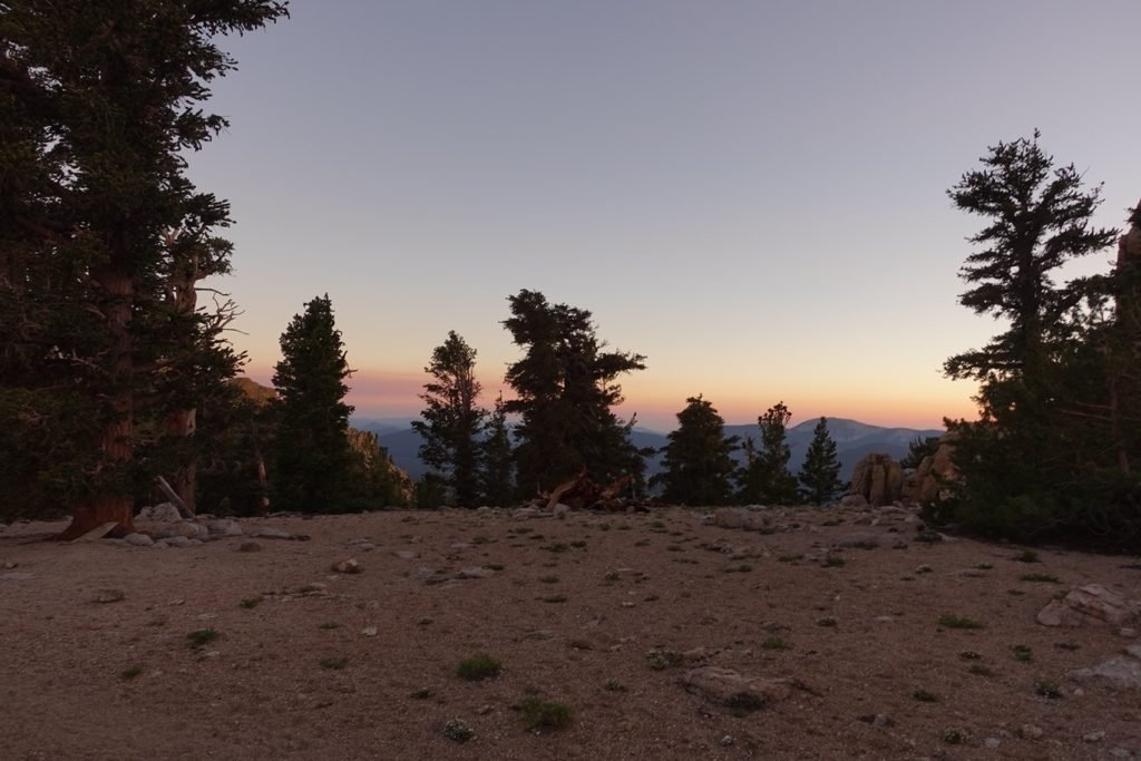
Eventually, I settled into my tent, but ended up popping out several times to catch some last bits of light from the sunset.


Even through the little gap in the trees to the west.
Goal for the day: Spectacular Success!!
Day 10 – 8 miles – 8 hours 10 minutes
PCT section G – 83.1 trail miles out of 115 total miles
(mileage and time approximate and based on GPS tracks which may not be exact and include diversions from the trail)


1 Pingback