Goal for the day: Restart from Onion Valley to get back on the PCT heading North.
It took me two weeks in July to (mostly) recover from the 19 days I spent going 160 miles plus from Walker Pass to Onion Valley and to get used to going to work most days.
Then I spent the next two weeks longing to go back to the trail. The thought that I was nuts to go back to the trail this year did cross my mind a few times.
As John Muir said: “The mountains are calling and I must go.”
Shortly after I had completed doing the entire 211 mile John Muir Trail Southbound in 2020, I had already thought about doing it going Northbound. I even wrote out my desired places to stop for camping.
So, that was one of the reasons I had started to think about continuing from Onion Valley during planning, occasionally on the first 160 miles, and after I returned to civilization at the end of those 160 miles.
Another reason is there was a part of the PCT that diverted from the JMT up near Reds Meadow. To be able to say I’ve done the entire PCT Section H, I had to do that 14 mile part. I could just go to Mammoth Lakes and do a short 3-4 day loop to finish it off, but where would the fun be in doing that?
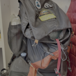
Once my body recovered (mostly), those thoughts started popping up in my head more and more. I started looking for permits and prepping my gear. I did have to do some repairs on my tent poles that had a few bent joints that may cause problems. Other than those, the tent was in good condition. Had to get a little more food, but I had most of what I needed. For my repaired boots, I decided to use a pair that I mostly used for day hikes. The thread on the sole was a little more worn than the repaired boots, but I didn’t want to have to trust that my boot repairs would hold up over the very rough terrain I would be encountering when I returned to the trail. The repaired boots would have to become my day hike boots.
I had already sent a resupply bucket to the Muir Trail Ranch in the possibility that I had continued North in July. I just had to let them know I’d be reaching them a little later than I expected. For resupplying at Reds Meadow, my plan would be to hope I could get all the resupply food and gear that I needed at the Reds Meadow General Store. I had sent a resupply bucket there when I did the JMT because you couldn’t be sure what they had in stock (especially during COVID), but heading North from there would be a shorter hike so I decided to take my chances with the food menu. They generally had enough backpacking food there, but I might have less of a choice of what to eat.
Looking at the weather and my work schedule, I ended up starting two weeks before Labor Day weekend. That should give me enough time to reach Tuolumne Meadows.
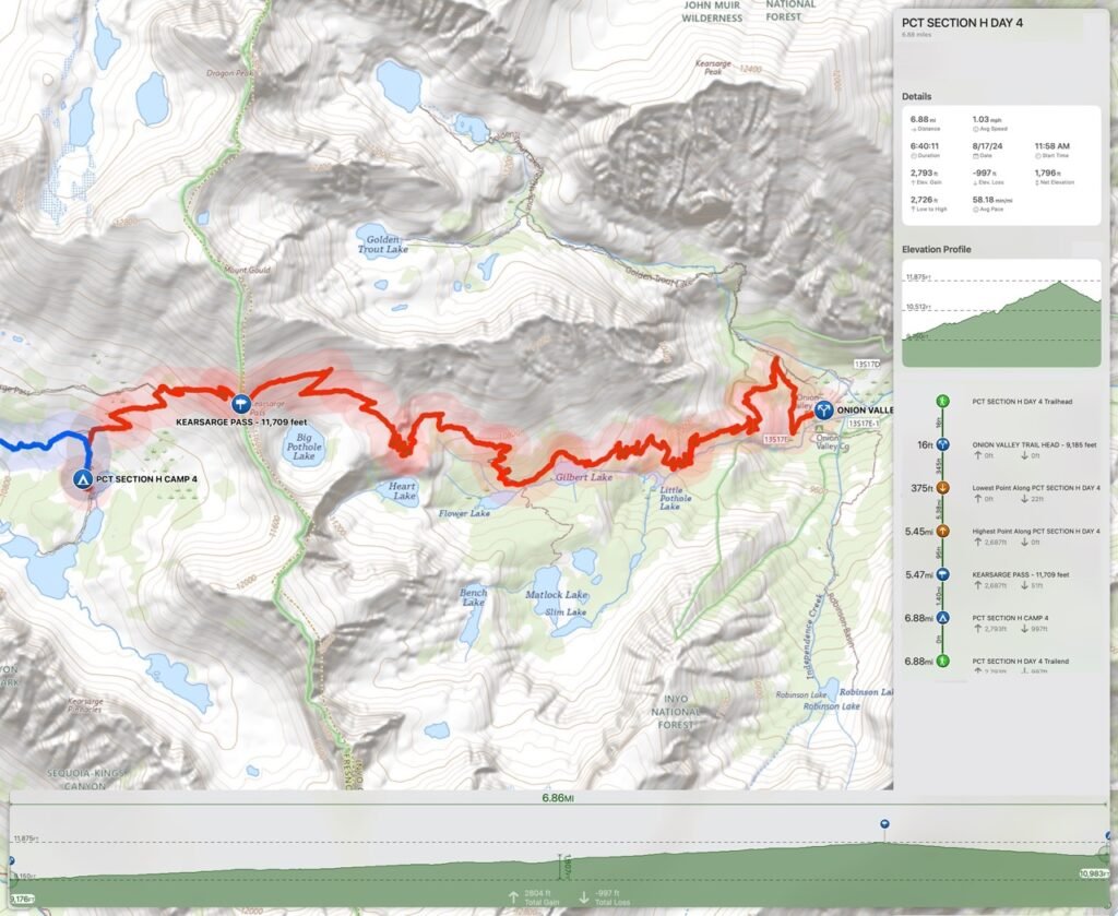
The first 7 days would entail climbing and descending from not one, not two, but FOUR passes near 12,000 feet in elevation along the JMT/PCT. I’d also have to rejoin the PCT trail from Onion Valley, which meant another near 12,000 foot pass to climb: Kearsarge Pass
Having hated descending from that pass in July, I wasn’t particularly eager to climb up it to restart my trek. But I knew it was a necessary evil if I was going to go back to the trail.
Since that 7 day segment was one of the hardest part of the PCT/JMT that I had barely made it through during my JMT trek in 2020, also made me hesitate returning to the trail in July and why I procrastinated about a possible restart this year.
But it was also one of the most beautiful sections of the JMT, so was very enticing to return to it.
I decided that I would leave my Jeep at Mammoth Mountain. With the Reds Meadow road under heavy construction this year, the road was only open Friday through Sunday and only to the shuttle buses. Leaving my Jeep there would give me options on where to finish my hike when the time came. If I made it to Tuolumne Meadows, I could take the YARTS bus directly from there to Mammoth Mountain. If I had to abort near Mammoth Lakes, I could get back to my Jeep fairly easily. I could also spend a night at a hotel nearby at 8,000 feet to acclimatize a little bit.
Unfortunately, that meant that I had to find a way to get from Mammoth Lakes to Onion Valley. One option was a ETSA bus from Mammoth Lakes that ran south along highway 395. I could get off at Independence and then get a shuttle ride to the Onion Valley trail head.
I could also get a shuttle ride direct from Mammoth Mountain to Onion Valley. More expensive, but a little more direct and less worrying about space on the bus and making connections.
So, after a short Zero Month… I headed back to the East side of the Sierra Nevada Mountains to restart my PCT Section H hike.
But it wasn’t going to start smoothly.
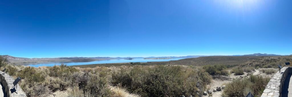
After a stop at Mono Lake and a warmup hiked at Inyo Craters that allowed me to do some sightseeing, I got a hotel room at Mammoth Lakes, soaked in a hot tub, and prepared to get to bed.

But before I could get to sleep, I got a text that my shuttle driver would be late picking me up the next morning. Instead of 7am, he would probably get there around 8:30am.
Having expected to have just enough time in the morning to get breakfast at Carls Jr and drive my Jeep down to Mammoth Mountain where the shuttle driver would pick me up from, I hadn’t staged it there ahead of time (my mistake). I tried to get a local Uber or Taxi, but Mammoth does not have a lot of on-call drivers, so could not arrange anything that evening. If had known about the late pickup earlier, I could have staged my Jeep and gotten a bus ride back to the center of town. Then I still would have the option of taking the ESTA bus the next morning. But I didn’t have time to arrange all that. I could drive down to Onion Valley and leave my Jeep there again, but getting back to my Jeep at the end of my hike would be more difficult.
I went to bed unsure of my ability to restart my hike from Onion Valley.
I woke up, but things weren’t looking any better. On short notice, I couldn’t get an alternate, so was stuck waiting for my shuttle driver near Mammoth Mountain in the long term parking for hikers (bus stop B along the road).
Unfortunately, I didn’t get picked up up until close to 10am. That would make my start from Onion Valley around mid-day. My informal hope to at least get back to the actual PCT trail from Onion Valley was unlikely. I’d have to camp along the Kearsarge Pass Trail somewhere before reaching the PCT.
During the long drive down to Onion Valley, I learned he was late that morning because he had helped a hiker who had injured himself trying to abort over Sawmill Pass (an very rough unmaintained trail). Instead of trying to contact SAR or emergency services, he used his Inreach to contact a friend and find a shuttle driver who could help. I’m all for helping hikers get out of the wilderness safely, but asking a shuttle driver to drive as far down a dirt road as his car could reach, then hike along the trail 3-4 miles to help someone get back to civilization was a bit much. It sounded like a situation where a call to have SARs help out was called for.
I tried to shake off my disappointment at the late start and just focus on the half day of hiking.
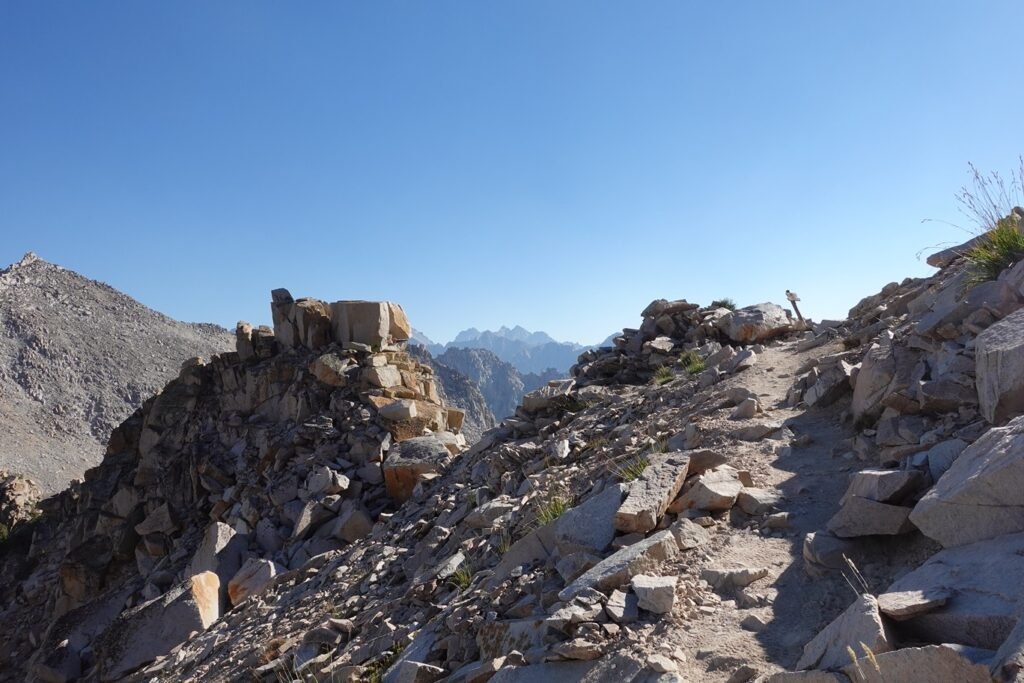
After reaching Onion Valley, I started up the horrible switchbacks around noon. It wasn’t that hot, so it was only a matter of time and willpower to climb up those switchbacks.
As long and annoying as the descent down from Kearsarge Pass was in July, going up was just as horrible and mind numbing as I remembered from 2017 when I first climbed this trail. Then I had made it all the way to the JMT/PCT and camped in upper Vidette Meadow. With the late start this day, I knew I couldn’t reach the PCT. I’m not sure if that thought slowed me down or if the climb was that bad.
Probably a little of both.
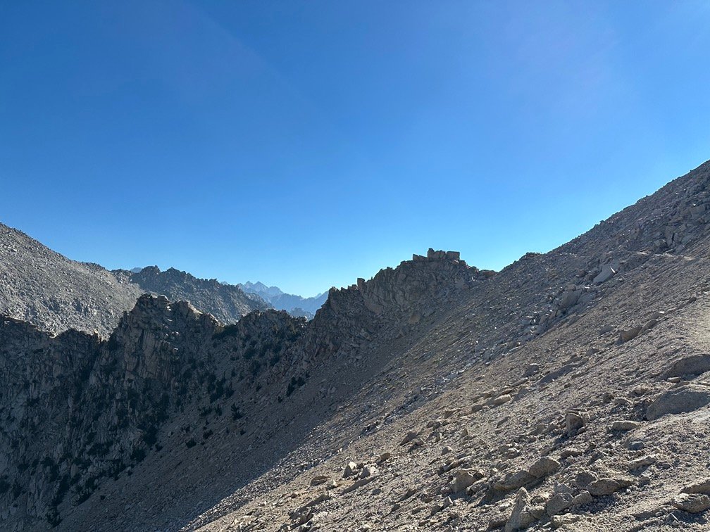
Again, it seemed that the switchbacks went out way further than they had to to get hikers up the steep terrain. But I slowly made my way up the trail towards Kearsarge Pass.
As I approached the top of the pass, it seemed like déjà vu all over. While going up was harder, going down this trail a month earlier still seemed horrible.
Time does not make passes any easier to climb or descend. 😀

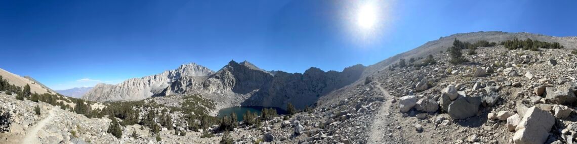
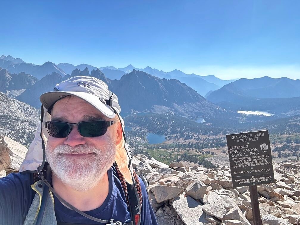
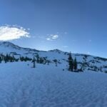
Reaching the top of Kearsarge Pass, I took the mandatory photos and selfie even though they looked a lot like the photos I had taken in July. Maybe a little sunnier.

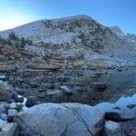
Unfortunately, it was almost 5pm when I reached the pass and with 3 more miles to go until I reached the PCT, I decided to focus on camping at Kearsarge Lakes since it was only about a mile away. While I may have been able to reach the PCT before sunset, the campsites around the trail junction were all in the trees. So, I decided to stop at Kearsarge Lakes in hopes of a good view from somewhere around the lakes.
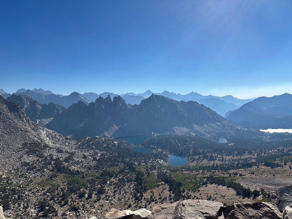

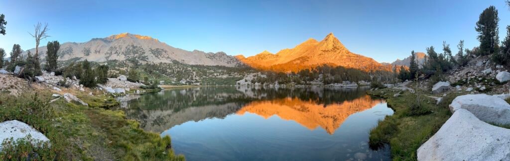
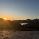
It was an easy descent down the trail to the lakes and I followed the use trail along the West shore of the nearest lake. I ended up at a campsite with a great view of the lake and the mountains to the East and maybe a short hike to see the Sunset in the West as a bonus.
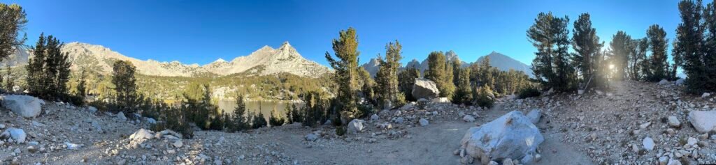
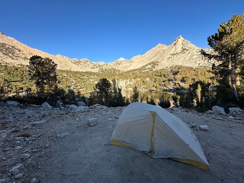
But I didn’t need to see the Sun to have some great light from the Sunset. I had chosen my campsite well.

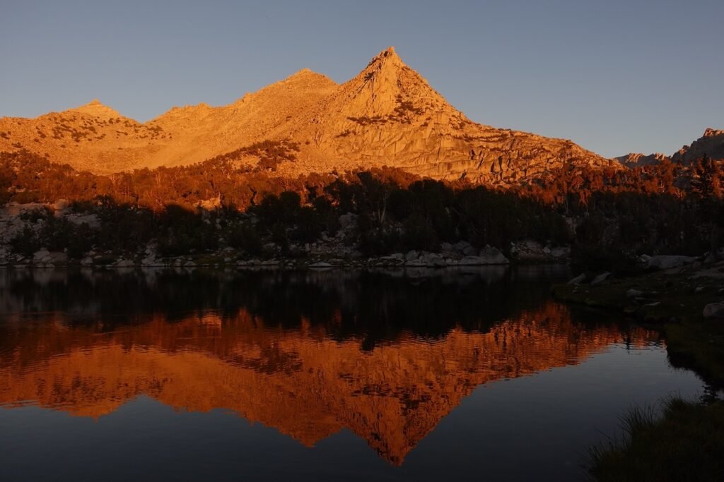
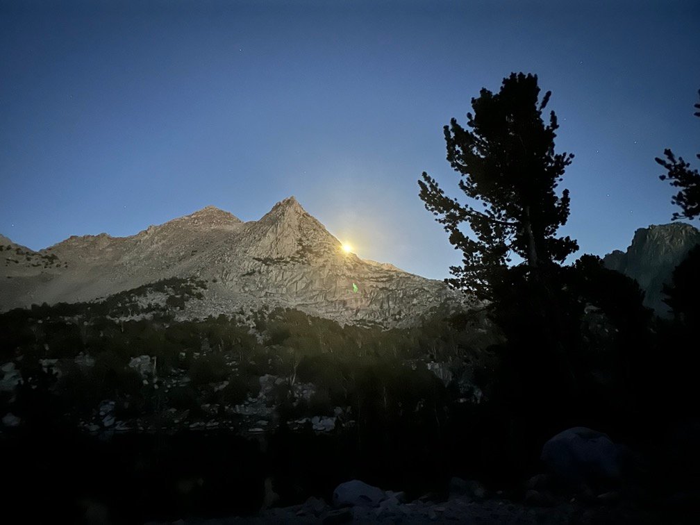
Oddly, a little after Sunset, the Sun started to rise from behind the mountains to the East.
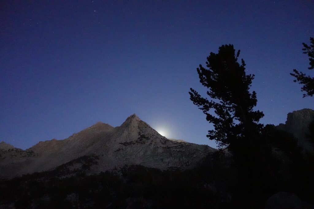
Light from the big sports complex in Lone Pine that didn’t exist?
Had I fallen asleep and forgotten falling asleep?
Altitude sickness (I hadn’t had much time to acclimatize for my return to the trail)?
Brain hemorrhage?
Or was I just crazy?
Tuned out to be the Full Moon rising, naturally. It was so bright it briefly had me wondering. After a late start to the day, I drifted off to sleep with good hopes for the next day.
I went back and forth about if I should call this day’s report PCT 2024 Section H Day 4, call it a side trail hike, or call it a Zero Month.
Zero Month was accurate way to describe the month it took me to recover from the last hike and be drawn back to the trail. Some people need an occasional Zero day or two to rest and resupply before returning to the trail. It just took me a little longer this time. 😀
In the end, it’s the start of my return to the PCT trail section that I had spent 3 days hiking in July, so marking it as day 4 of my PCT Section H hike made the most sense.
Scorecard for Kearsarge Pass (11,760 feet) after 3 times to top of pass:
| Climbing East side of pass | Very hard (2x) |
| Descending East side of pass | Hard (1x) |
| Climbing West side of pass | Not too bad (1x) |
| Descending West side of pass | Easy (2x) |
Goal for the day: Made it over Kearsarge Pass, but failed to reach the PCT.
Day 4 – 6.9 miles – 6 hours 40 minutes
(PCT section H – 21.5 trail miles out of 175.5 total miles (no change from July)
(mileage and time approximate and based on GPS tracks which may not be exact and include diversions from the trail)


1 Pingback