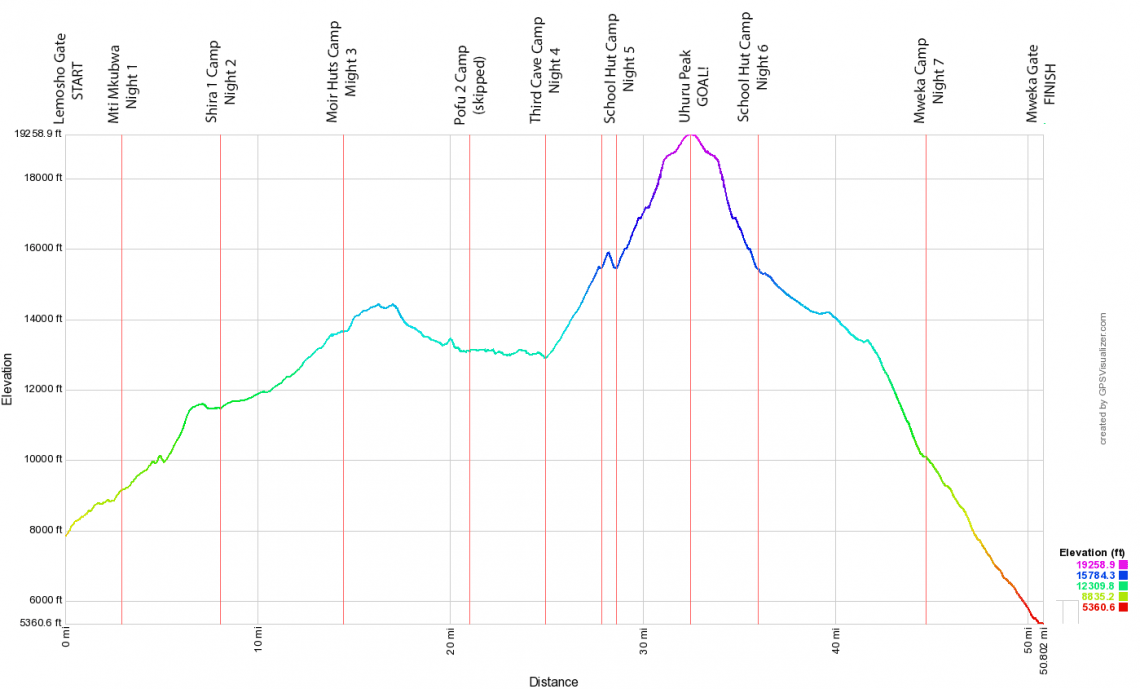
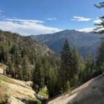
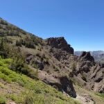
I finally went over my GPS tracks and came up with some elevation profiles and data on elevation climbed and descended during my Mt Meru and Mt Kilimanjaro climbs. Data is approximate based on my own GPS tracks, some fixes I had to do to make up for lost data/forgotten recording of tracks, and elevation looked up when creating the profile.
Most surprising was that (if the calculated data is accurate) I almost climbed 19,000 feet going up Kilimanjaro due to the gains and losses along that long trail. Which means that I did climb the equivalent of the height of Kilimanjaro’s Uhuru Peak’s elevation above sea level. 🙂
Mt Meru’s total elevation climbed is also close to the actual height of Mt Meru’s elevation above sea level.
Suddenly, I feel even more tired than I was. 🙂

MT MERU TRACK STATISTICS
(approximate mileage, elevation data, and times)
Gate to Miriakamba Huts
distance: 6.871 mi
time: 4:34
min/max elev.: 5201’/8176′
elev. gain/loss: 3455’/-512′
Miriakamba Huts to Saddle Huts
distance: 4.125 mi
time: 4:29
min/max elev.: 8157’/11706′
elev. gain/loss: 4362’/-842′
Saddle Huts to Little Meru UP
distance: 1.477 mi
time: 1:22
min/max elev.: 11619’/12399′
elev. gain/loss: 1006’/-281′
Little Meru to Saddle Huts DOWN
distance: 1.477 mi
time: 1:02
min/max elev.: 11619’/12399′
elev. gain/loss: 281’/-1006′
Saddle Huts to Mt Meru Summit UP
distance: 4.188 mi
time: 7:04
min/max elev.: 11665’/14934′
elev. gain/loss: 4065’/-805′
Mount Meru to Saddle Huts DOWN
distance: 4.045 mi
time: 5:01
min/max elev.: 11666’/14964′
elev. gain/loss: 643’/-3891′
Saddle Huts to Miriakamba Huts
distance: 4.125 mi
time: 2:29
min/max elev.: 8157’/11706′
elev. gain/loss: 842’/-4362′
Miriakamba Huts to Gate
distance: 4.090 mi
time: 2:40
min/max elev.: 5181’/8095′
elev. gain/loss: 76’/-2963′
TOTAL
distance: 30.40 mi
time: 28:45
min/max elev.: 5181’/14964′
elev. gain/loss: 14731’/-14664′

KILIMANJARO TRACK STATISTICS
(approximate mileage, elevation data, and times)
Lemosho Gate to Mti Mkubwa
distance: 2.940 mi
time: 1:36
min/max elev.: 7851’/9140′
elev. gain/loss: 1531’/-243′
Mti Mkubwa to Shira 1 Camp
distance: 5.133 mi
time: 5:07
min/max elev.: 9138’/11597′
elev. gain/loss: 2965’/-628′
Shira 1 Camp to Moir Huts
distance: 6.371 mi
time: 4:58
min/max elev.: 11476’/13663′
elev. gain/loss: 2431’/-256′
Moir Huts to Pofo 2 Camp
distance: 6.597 mi
time: 6:02
min/max elev.: 13074’/14422′
elev. gain/loss: 1547’/-2109′
Pofo 2 Camp to Third Cave Camp
distance: 3.935 mi
time: 3:11
min/max elev.: 12894’/13148′
elev. gain/loss: 817’/-1011′
Third Cave Camp to School Hut Camp
distance: 2.901 mi
time: 3:20
min/max elev.: 12898’/15485′
elev. gain/loss: 2639’/-81′
School Hut acclimatization hike
distance: 0.7493 mi
time: 1:11
min/max elev.: 15447’/15905′
elev. gain/loss: 504’/-510′
School Hut Camp to Uhuru Peak UP
distance: 3.874 mi
time: 7:14
min/max elev.: 15446’/19259′
elev. gain/loss: 5419’/-1621′
Uhuru Peak to School Hut Camp DOWN
distance: 3.490 mi
time: 4:09
min/max elev.: 15449’/19258′
elev. gain/loss: 684’/-4484′
School Hut Camp to Mweka Camp
distance: 8.746 mi
time: 5:09
min/max elev.: 10088’/15448′
elev. gain/loss: 258’/-5612′
Mweka Camp to Mweka Gate
distance: 6.065 mi
time: 3:19
min/max elev.: 5361’/10102′
elev. gain/loss: 154’/-4896′
TOTAL
distance: 50.80 mi
time: 45:21
min/max elev.: 5361’/19259′
elev. gain/loss: 18948’/-21453′


1 Pingback