Goal for the day: Hetch Hetchy Dam
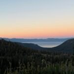
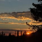
Without a direct view of the sunrise I had breakfast, packed my gear, and headed down to Tiltill Valley from the rock outcropping that I had slept on.

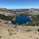
I had once hiked through Tiltill Valley from Lake Vernon and remembered it as a grassy bog that was hard to get through. My memory was right. Fortunately, being so late in the year made it easy to navigate through the tall grass without sinking into muddy water up to my thighs.
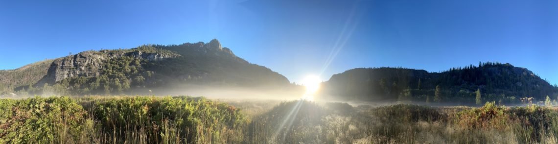
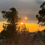
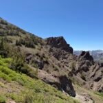
Some morning mist still hung over the marshy ground and I even got a nice angle on the rising sun. I then made my way through the narrow crack in the ridge that would lead to Hetch Hetchy.


Although I was mostly focused on reaching civilization, I took a short walk off the trail to see Rancheria Falls. It was still running fairly strong.
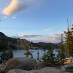
I added a liter of water to my supply (which I had almost ran out of since I didn’t get any water in Tiltill Valley) and then headed back to the shore of the reservoir.


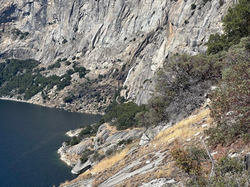
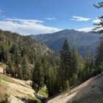
While mostly downhill, there was some unfortunate climbs up and down along the trail that had been built into the side of the ridge. An unfortunate result of the decision to fill the nice flat valley with water in the early 20th Century.


I also had the chance to see Wapama Falls along the hike. It was a good chance to take a break, get another liter of water to allow me to reach the Dam, and cool off by dunking my t-shirt and hat in the cold water.
Ah…
Being at 4,000 feet without much shade meant that it was getting quite hot as the day progressed. Soaking my t-shirt and hat in cold water was a old trick I had learned years ago in Yosemite to help cool off.

It was still over 2 miles to pavement, but overall it went quickly without too much drama.
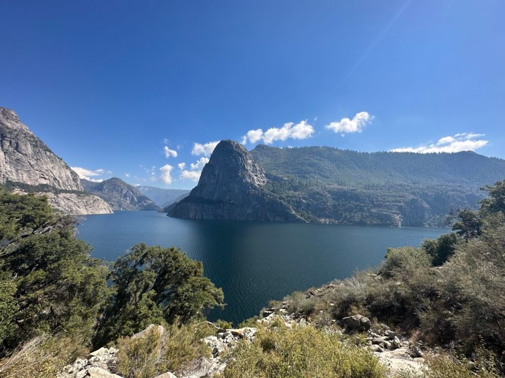
Unlike the previous year when I aborted through Hetch Hetchy when smoke from nearby fires were filling the air with smoke, the skies were crystal clear this day. That allowed me to enjoy those final miles with some great views.


As I stepped onto the road right past the dam, I exhaled and smiled at finishing my hike out of the wilderness. While the 20 miles from the PCT to the dam wasn’t really part of my goal, it did add those miles to the 32 miles I hiked on the PCT to give me 52 miles total for this hike. Not a bad end to my big hikes for this year.
Now to get back to my Jeep…
Total miles hiked: 10.5
Miles hiked one-way on PCT section I: 0
Goal: Successful!
After throwing away garbage and several things I didn’t need any more (I resisted the urge to get rid of my leaking air mattress and tent that I planned to replace next year), I settled in to a spot on the road that cars leaving the area would have to pass and stuck out my thumb whenever a car drove past me. There was only one road out from Hetch Hetchy and it was 17 miles to highway 120. I knew I couldn’t walk that after doing 52 miles over the past 5 days.
So, I took my chance with hitchhiking. I’ve had occasional success using my thumb in Yosemite, so it wasn’t completely impossible. I had worried that there wouldn’t be enough people visiting Hetch Hetchy on a Tuesday a couple weeks after Labor Day, but I had passed at least a couple dozen people after passing Wapama Falls. That gave me some hope that someone would at least get me to Hwy 120.
If I got there early enough, I could catch a YARTS bus to Sonora which was 2/3rd of the distance back to my Jeep.
I watched a half dozen cars go by before a kind young couple gave me a lift to Hwy 120. And as luck was have it, I made it there 15 minutes before the YARTS bus. I had worried they had switched from their summer schedule after Labor Day and I had only the summer schedule on my iPhone since I had planned to do this hike in August.
So, I had a long ride on the bus to think about my next step after reaching Sonora.
It would be half past seven by the time I got to Sonora, so getting a Diet Coke, dinner, shower, and a hotel room would be the best choice.
But I had already missed 2 days of work that week and I also had to interview two people for a technician job the next day. I thought I could make it back to the Bay area or at least closer to it if I got a taxi or Uber to Sonora Pass to pickup my Jeep that evening.
The only taxi service in Sonora blew me off saying they’d call me back if they could get a driver. By some miracle, I managed to get a Uber ride that wasn’t that expensive. I even managed to get a couple bottles of Diet Coke and some snacks before I left Sonora on highway 108.
It doesn’t look far on the map, but the road to Sonora Pass gets narrow and winds up the mountains to reach the pass. So, it takes time.
When I reached my Jeep I was happy to see it was there, wasn’t ransacked by a bear, and the engine started. So, I then had to retrace my path back down that dark highway. I had only driven this highway in the daylight, so I was starting to have second thoughts about going further than Sonora that night.
I should have just stayed at a hotel in Sonora and taken the Uber back to my Jeep in the morning…
I was almost back to Sonora when that proved to have been the decision that I SHOULD have made. Although most of the highway had been a single lane in each direction up until then so I had been trying to keep my speed low enough to catch the curves and avoid any opposing traffic, the road did become 2 lanes in each direction as I got near Sonora. So, I ended up speeding up a bit.
That was when… something came out of the darkness in the road ahead and I swerved to miss it. My front tire missed it.
My rear passenger tire wasn’t so lucky.
Fortunately, I managed to get my Jeep under control and slow to a halt. I looked back, but couldn’t see what I had hit. Then my low tire pressure warning started going off.
I drove my Jeep a little further ahead to an intersection with a street light illuminating the area. Where was that a minute earlier?
Anyway, I was right that my rear passenger tire was flat and I had to put my spare tire onto my Jeep. After that, I knew there was no way I was going to get home that night.
In Sonora, I got gas and a Big Mac and looked for hotel rooms. I was less than an hour from Oakdale, so at least I could get further home before crashing at a cheap hotel along the way.
It wasn’t a great end to a otherwise successful trek, but I did get home the next day.
Unfortunately, the damage turned out to be more than a simple flat once I got back the the SF Bay Area. Bent rim, shredded tire, broken axle, bad fuel injector… My insurance would cover some of that, but not nearly enough.
I doubt I’ll do any further big backpacking treks this year, so I’ll have to be satisfied with going 2 and 3 for treks this year.
Finishing both section K and I this year at least gave me some closure from having coming up short on those sections last year.
It also means that I had hiked every mile of the Pacific Crest trail from Thousand Island Lake to Donner Summit. That’s a little over 234.5 miles for that long continuous stretch.
South of Devils Postpile, I had covered 122 miles from the part of the PCT that rejoins the JMT at Reds Meadow to Crabtree Meadows. Crabtree Meadows is where where the JMT separates from the PCT to go up to the summit of Mt Whitney.
Sadly, I have only three short parts of section G hiked. 11.5 miles altogether.
That’s a grand total of 357.1 miles hiked by me on the Pacific Crest Trail out of 2655.2 miles. Most of those hiked in the last four years.
So, I went from 11.4% to 13.45% of the PCT hiked.
The numbers seem small and large depending on how you look at them.


1 Pingback