With winter storms continuing to sweep through California, my usual winter hibernation is still in full effect.
When the weather allows, I’m still taking my bike to and from BART for my commute, but the weekends are hit or miss if the weather will allow me to do any big hikes.
First two weekends were washouts and couldn’t do any long hikes, but I did get enough clear skies long enough to do some short neighborhood hikes and even a 17 mile bike ride.
A clear Saturday led to a routine climb of Mt Diablo via the Summit Trail.
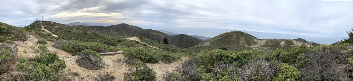
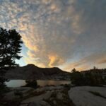
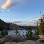
The next Saturday I went to the Pacific Coast and climbed from Gray Whale Cove to Montara Mountain. I went up the North Peak and two other sub peaks, but decided not to go over to the South Peak since it was a bit of a hike down and then back up.
It wasn’t raining, but the sky was overcast. At least there was no low lying clouds or fog, so I got some views of the whole area (all the way to Mt Tamalpias and Mt Diablo). There was a pretty strong and cold wind blowing across the ridge lines, so it was a challenge to keep warm. I even sat in a cave to have a break from the wind and have some lunch.
I normally wouldn’t have done this hike at the coast on such a blah day, but I had another reason to go to the coast:
Crab!
Dungeness Crab season had just opened, so I wanted to go down to Pillar Point Harbor to get some fresh crab right of the boats. And I hadn’t been hiking in this part of the Bay Area for a few years, it was nice to get some hiking in along the coast.
The end of 2019 nears. It was a year of epic successes and of unfortunate failures.
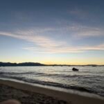
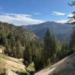
To celebrate, I decided on a long hike from Stinson Beach to the top of Mt Tamalpais in Marin County. I’ve done it maybe a half dozen times before, but it is always a fun-but exhausting-hike. It’s basically sea level to 2,572 feet in about 4 hours. It was a great clear day on the coast (but a bit cold).
Start at Stinson Beach, go up the Matt Davis Trail, up over the ridge to Rock Spring, and onto the Mountain Top Trail.
From there I hit the first peak of Mt Tam, the “former” West Peak. Former, since the US Air Force bulldozed it and built a radar base there.
After that, I reached the “current” West Peak (or as close to it as I can get until I’m stopped by a fence around the smaller radar station that now sits there).
Fortunately, the Middle Peak is still open to hikers despite there being more buildings and a radio station (that always reminds me of a Buddhist temple when see from the East Peak).
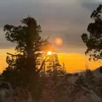
And finally, I set foot upon the East Peak, the main summit of Mt Tam. Once upon a time reaching this 2,572 foot main summit of Mt Tam was a great achievement. Now, while it pales in comparisons to the other peaks I’ve hiked, it’s still a fun hike and a great way to end this momentous year.
I did have to get down again, of course. Instead of retracing my steps, I went down the Fern Trail to the Old Stage Road and West Point Inn. From there, it’s a nice hike down to the Pantoll Junction.
Then it’s a bit harder as I returned to Stinson Beach via the Steep Ravine Trail. The thing about this trail is that it’s… like… steep. Who would have guessed? 🙂
And then an easy finish along the famous Dipsea Trail, which reminded me that I had only done that entire trail once before from Mill Valley to Stinson Beach and that I keep meaning to try to hike it in both directions in a single day. Well, there’s always next year. 🙂
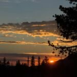
So, 15 miles total in around 7 hours. I saw the sunrise on the drive to Stinson Beach and the sunset on the way back. A nice way to end the year.


Comments by WanderingJim
PCT DAY 85 – CA Section H
"No cell service in many parts of the PCT. Not dead yet."
PCT or BUST!
"Yes, I’ll be going through there by early August"
JMT 2020 Day 3
"I'm afraid I have no idea. Not really a fisherman, so don't..."
JMT 2020 Trek Day by Day
"Yeah, but with 9,000 pictures, it's hard to label each one..."
Kilimanjaro – October 2019
"Everest Base camp is on my list too. Mostly since I know..."