
Goal for the day: McClure Meadow
This was not going to be a short day and it was all UP, but hopefully after my zero day at MTR I should be able to tackle it. It’s basically two days to get to Muir Pass (11,975 feet) with McClure Meadow the first night’s stop.
Since I had ‘goofed off’ the day before, I made a point to get up, have breakfast, and pack my tent and gear early. So, I was on the trail pretty early (around 6:30am).

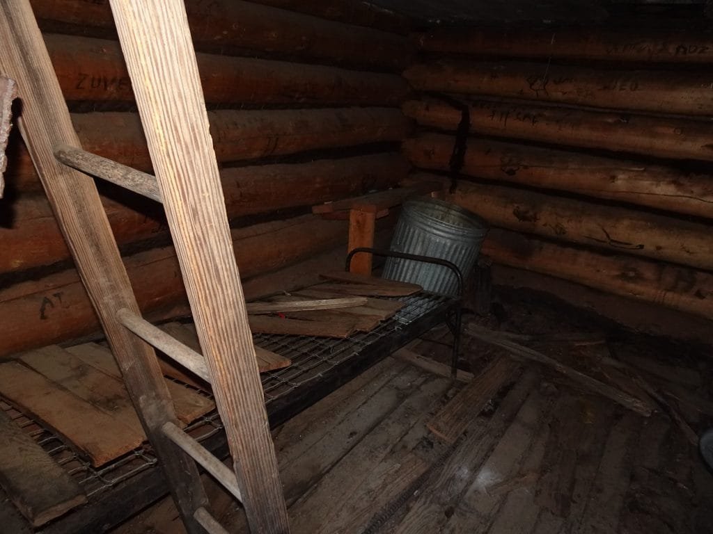
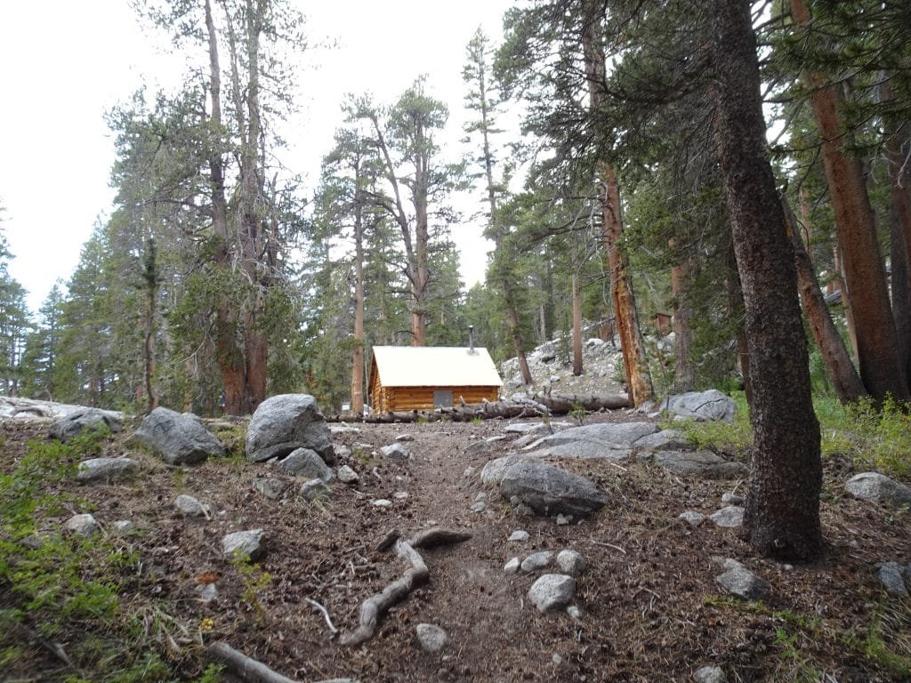
The first part of the trail was a nice gentle slope upwards. Along the way, I stopped to look at the Muir Trail Cabin. It was used during construction of the trail and was dedicated to John Muir Memory.
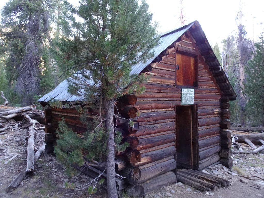
Looks like some people may occasionally sleep in it, but since the door doesn’t seem to want to close animals also seemed to spent some time doing various bodily functions in it. Doubt I’d spend the night inside unless it was an emergency.
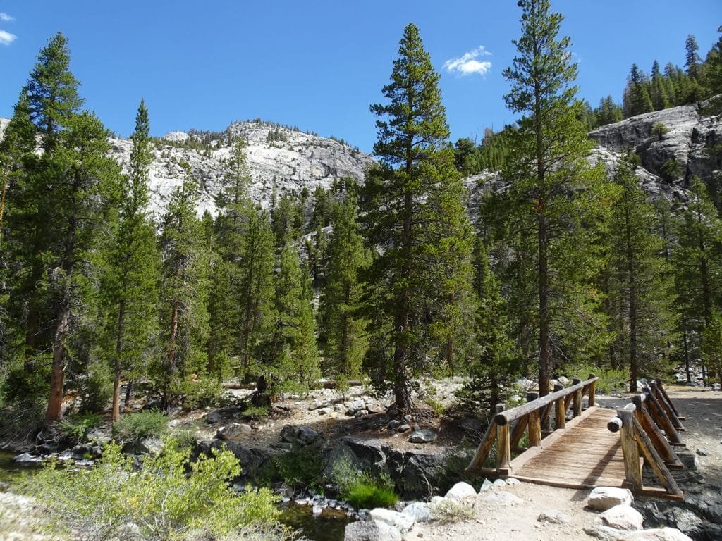
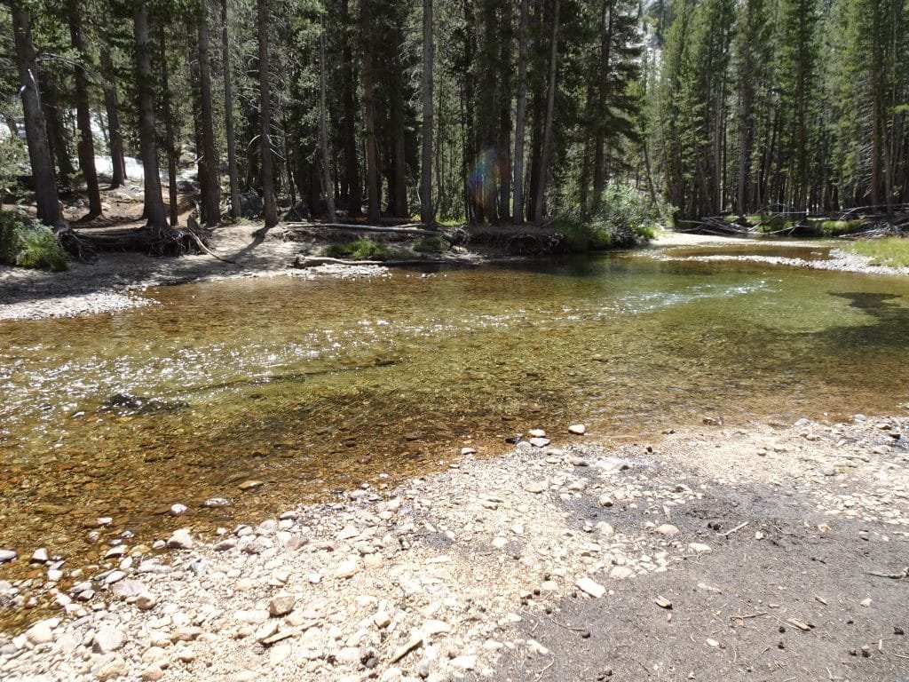
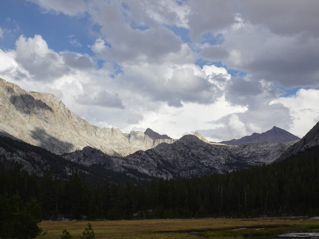
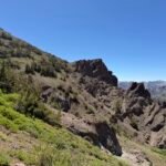
After that, I reached the bridge that crossed over into Kings Canyon National Park. I was a little surprised at how sudden the terrain changed at the border. From a gentle trail through a meadow to a rough trail snaking along the river as the rocky cliffs rose dramatically around me.


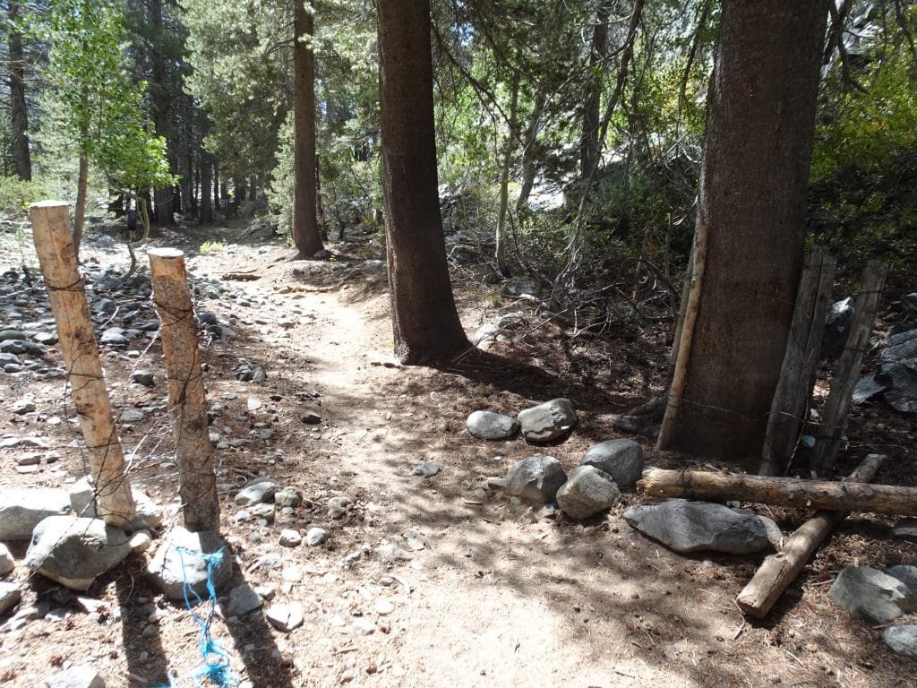
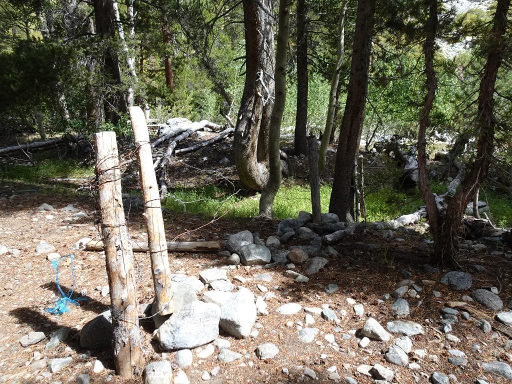
After entering Kings Canyon, one thing I found along the trail was there were occasionally wire fences stretched across the trail with rough wooden gates made to allow people to get through. It kind of reminded me of the cattle grazing fences I often encounter in the SF Bay Area (although these wire fences didn’t have barbs in the wire), but I didn’t think they would have cattle grazing in the National Park.
I saw these types of fences occasionally along the trail for many days to come. I eventually learned from a ranger that they were indeed to keep grazing animals in certain parts of the park. She didn’t go into what animals were grazing, but I doubted they were cattle.
The next thing that I was on the lookout for was Muir Trail Rock. Apparently, people have a tendency to miss it as they pass by on the trail so I had it pinpointed on my GPS map and made sure to keep an eye out for it.
And I almost missed it anyway. 🙂
But after going past the rock, I realized I had passed it on the GPS map and looked back. Eureka!
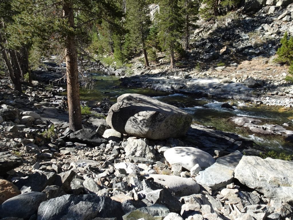
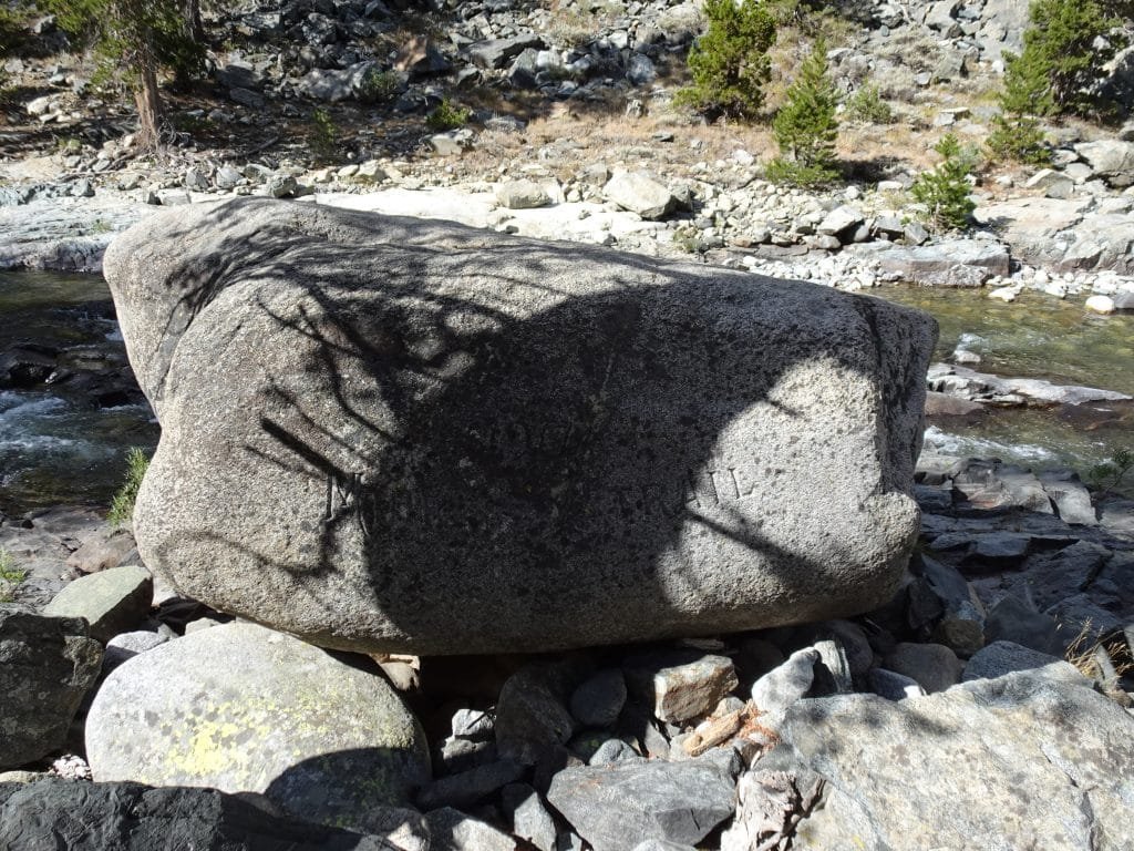
It was just one of many large rocks (more like a boulder, really) along the river, but it had ‘1917 Muir Trail’ chiseled on it and was a landmark for the trail. I assume it was done sometime during the trail construction.
I took a lot of photos, although the shade from a tree made the ‘Muir’ part hard to read. Then I climbed on top and took some more photos. I had to wait a few minutes, but another hiker came by and I asked him to take a photo of me on top for prosperity. Thanks.

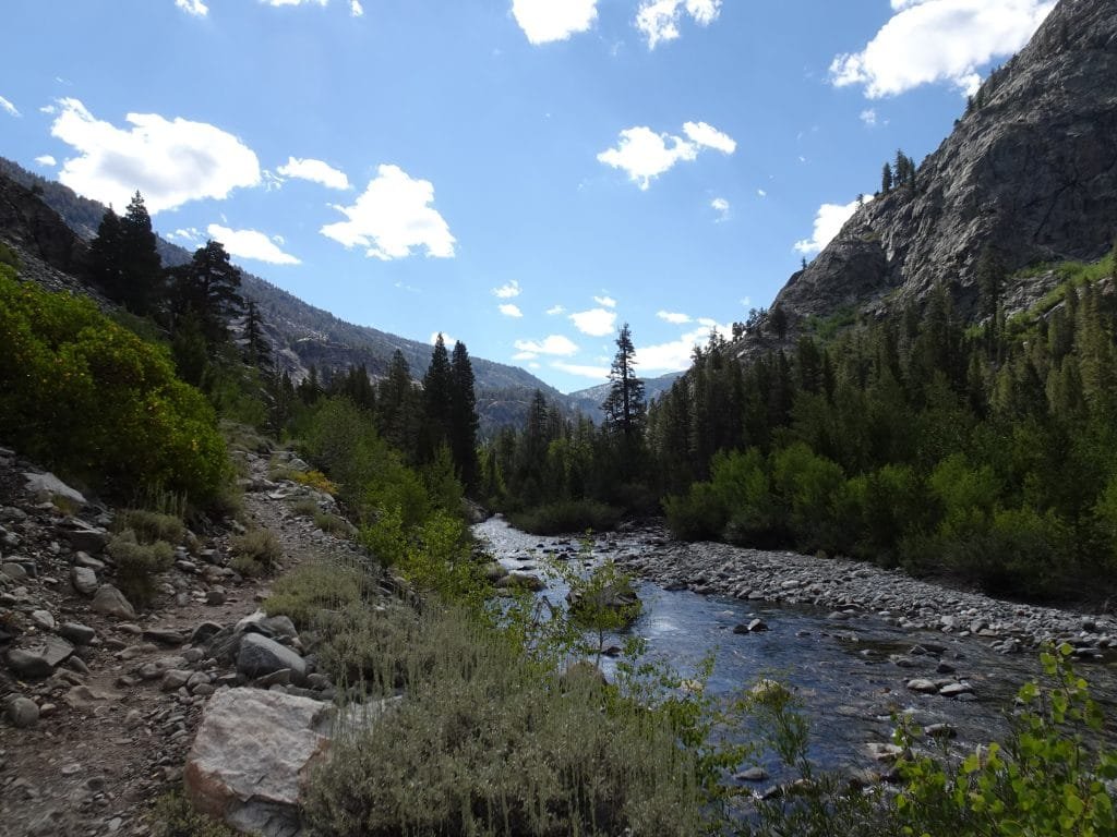

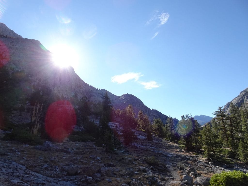
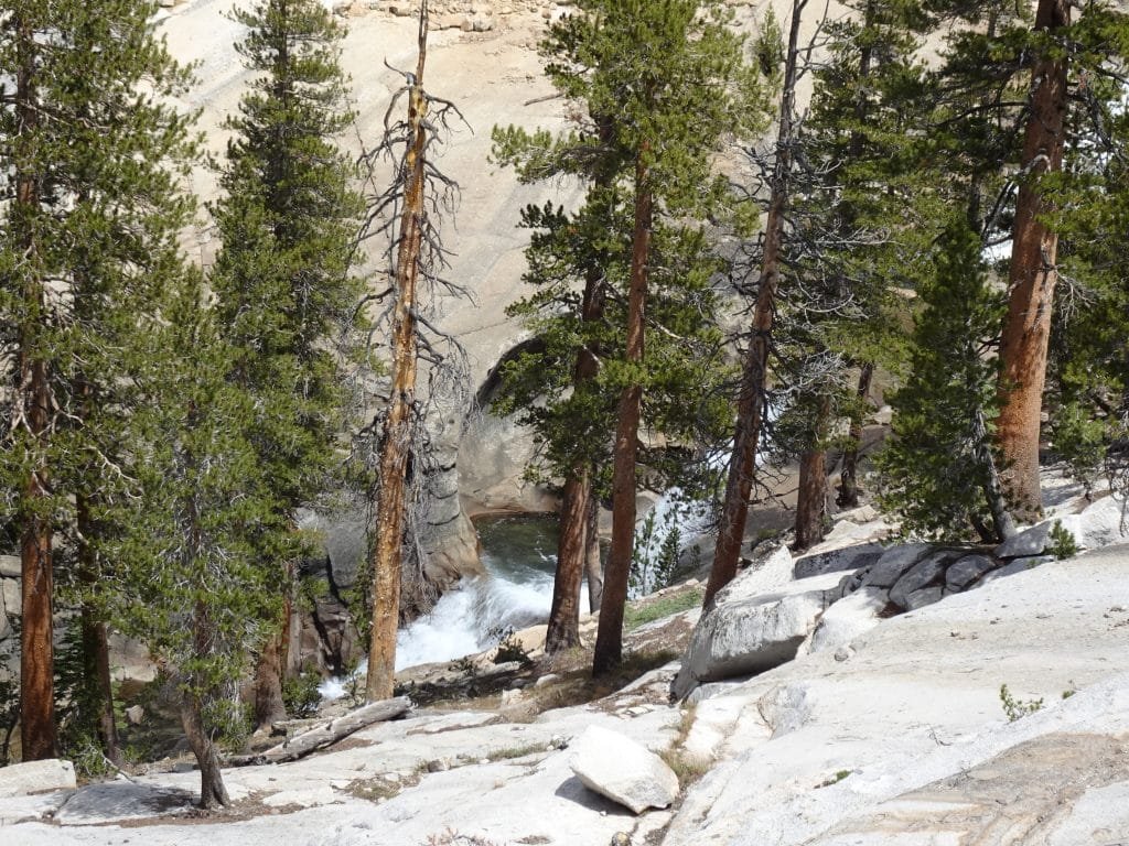
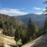
Continuing up the gorge, I reached the start of Evolution Valley. Unfortunately, it started with some switchbacks, so I took a quick break to prepare my self physically and mentally to climb them.

They were one of the worst set of switchbacks that far on the trek (they did have some nice views along the way up, though). They were all different lengths and either were too flat so you didn’t seem to gain any elevation or too steep that you labored to climb them.
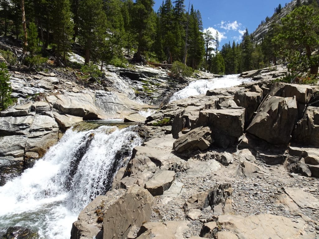
Evolution Creek did run along side them and had occasional cascades or falls that you got a brief peek at along the way, so it wasn’t all grunt work.
This was when I started having pretty bad pain in my right hip. Not just soreness, there was a sharp pain with most steps. Even more so when I was climbing a steep part of the trail. Considering this was the point where my pack was at its heaviest, I grew concerned that the weight had caused some damage or the extra weight was straining my body beyond its limits.
I did my best to hike through it and shifted my weight around to see if it would help.
I smiled as I reached the top of the switchbacks and took a break to enjoy the creek and refill my water. Then I got my shoes and feet wet.
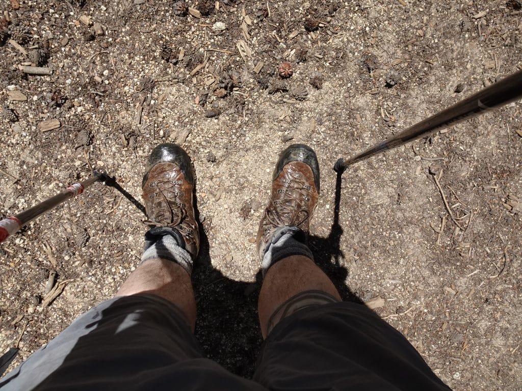
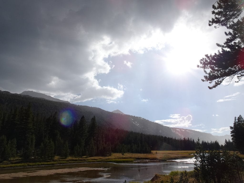
There was a wide part of the creek that you had to ford. It wasn’t deep (not even as deep as the river down near the hot springs were), but there were no stones or logs to get across (at least that I could see). With the day already pretty warm, I decided to do what I did the day before: Just walk through the creek and let my boots dry out afterwards. This would turn out to the be the only situation where I had to ford any water on the JMT itself.
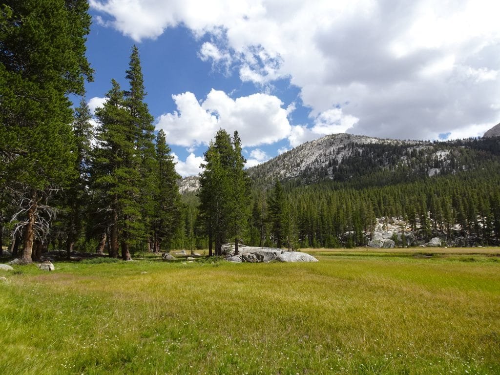
After the switchbacks took a lot out of me, I had considered stopping short and setting up camp. But according to the map it should be a pretty nice gentle climb up through Evolution Meadow, so I kept going.
I did feel a few rain drops along the way, but nothing beyond that. I don’t think I even took the time to throw my rain cover on my backpack.
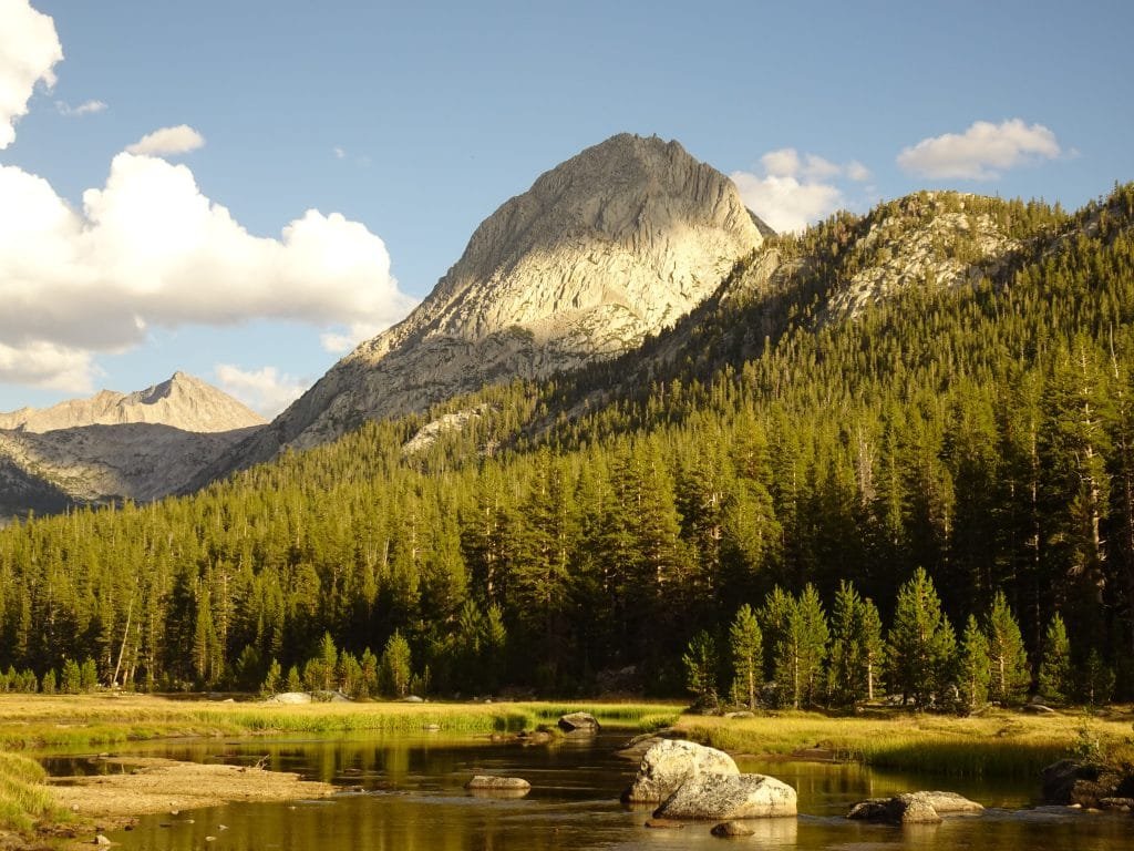
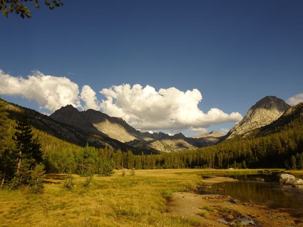
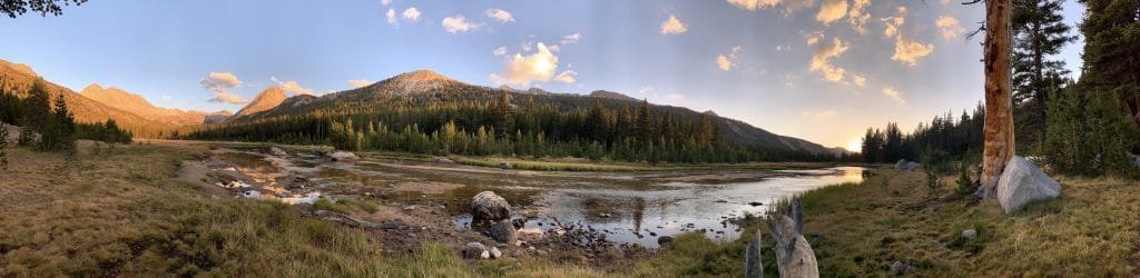
There were some campsites along the trial as I went, but I pushed to reach McClure Meadow. The campsite info I had listed several sites with great views around the meadow, so I was motivated to see for myself how great they were.
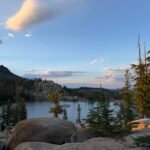
Entering McClure Meadow I found one of the campsites right away, but it was occupied by a big group. Moving on, I passed the Ranger Station and then found paradise.
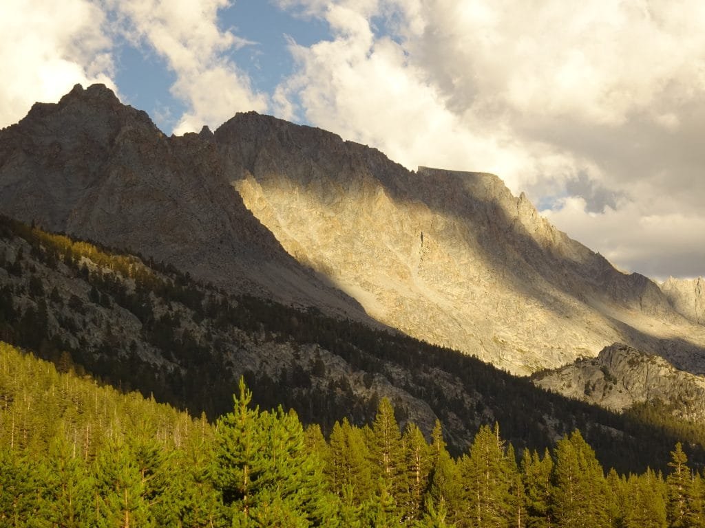
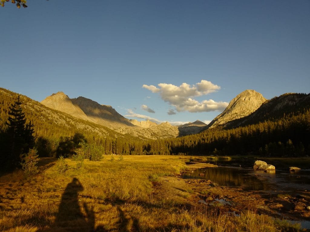
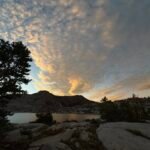
From the trail, the campsite area didn’t look like much. Looking at the areas nearest the trails they didn’t look that great to me, so I moved further in. There was a group with 3 tents on the far southern side of the area, but I found a little single tent space separated from them by a ridge of boulders. Then I saw a group of people standing near the creek looking at… a row of mountains already lit up by the sun (it was only mid-afternoon). Breaks in clouds were causing the sunlight to be cast over the mountains in great patterns.
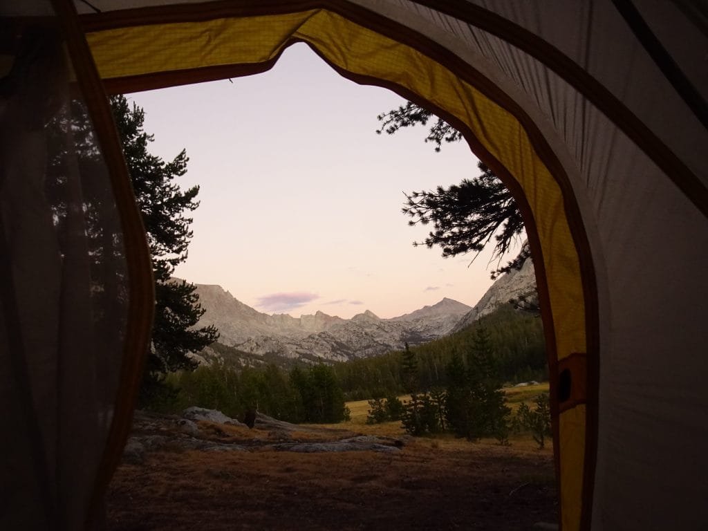
That sold me on setting up my tent there. It wasn’t just because it was getting late and my body was aching all over from the over 12 miles of climbing. Honest. 🙂
What more could I ask for? Privacy due to the boulders separating me from the other group, a great view from where my tent would be put, an even greater view if I went out to the creek, easy access to water, and the sunset and sunrise should be spectacular due to the long unobstructed view caused by the wide open meadow around the creek itself.

I took a lot of pictures before even setting up my tent, but eventually got to work. I even brought some water from the creek in my 3 gallon Ziplock bag and washed my hair and hiking shirts and underwear again. Trust me, I’d wash them with soap every day if it was practical on the trail (sometimes I’m too tired, don’t have easy access to water, or get distracted).
It then decided to rain on my clothes as they tried to dry in the sun.
Scrambling, I put them on a tree branch that was shielded from the rain and I got inside my tent to wait out the rain. Again, it did not last long and started about an hour after I setup my tent.
That makes 4 days in a row when I had some form of decent rainfall. I was starting to think my decision to throw out my rain pants at Reds Meadow might have been a mistake. Granted, nothing so far would have required me to use them, but it’s nice to have them just in case.
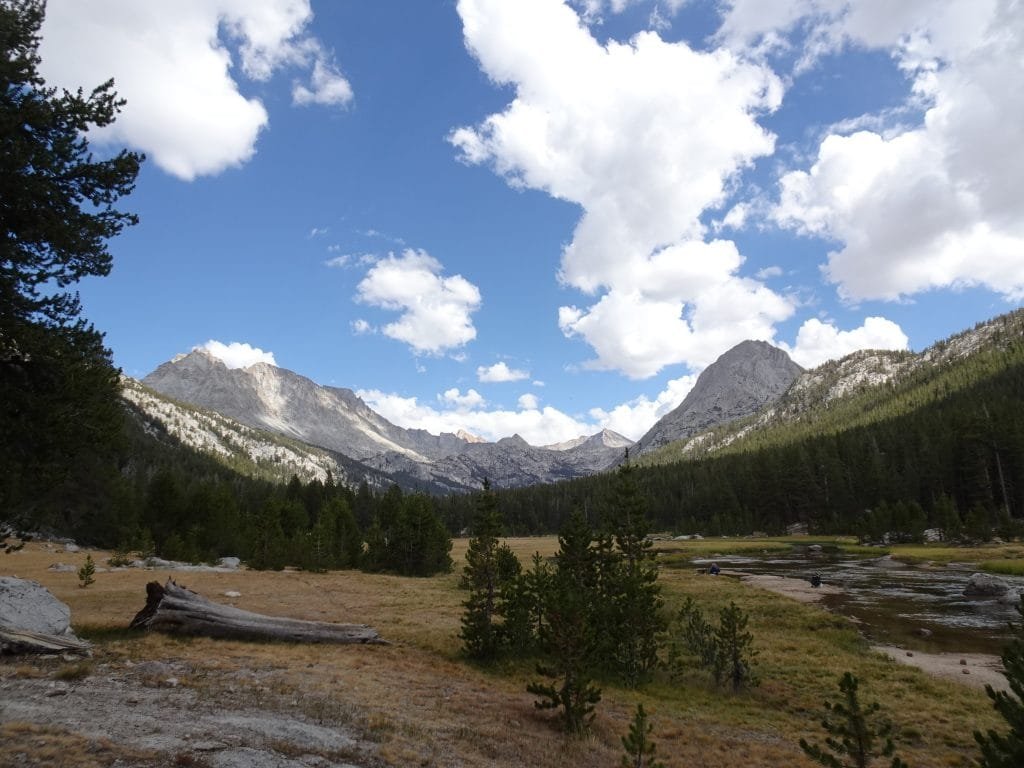
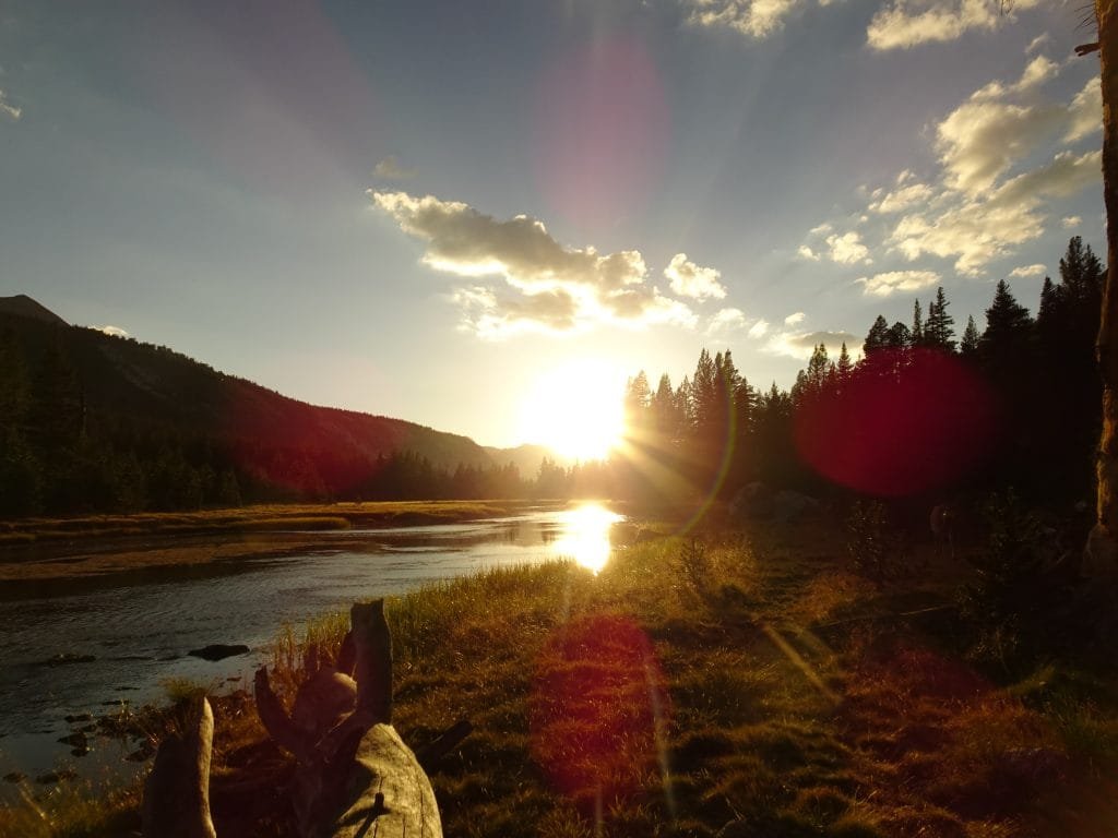
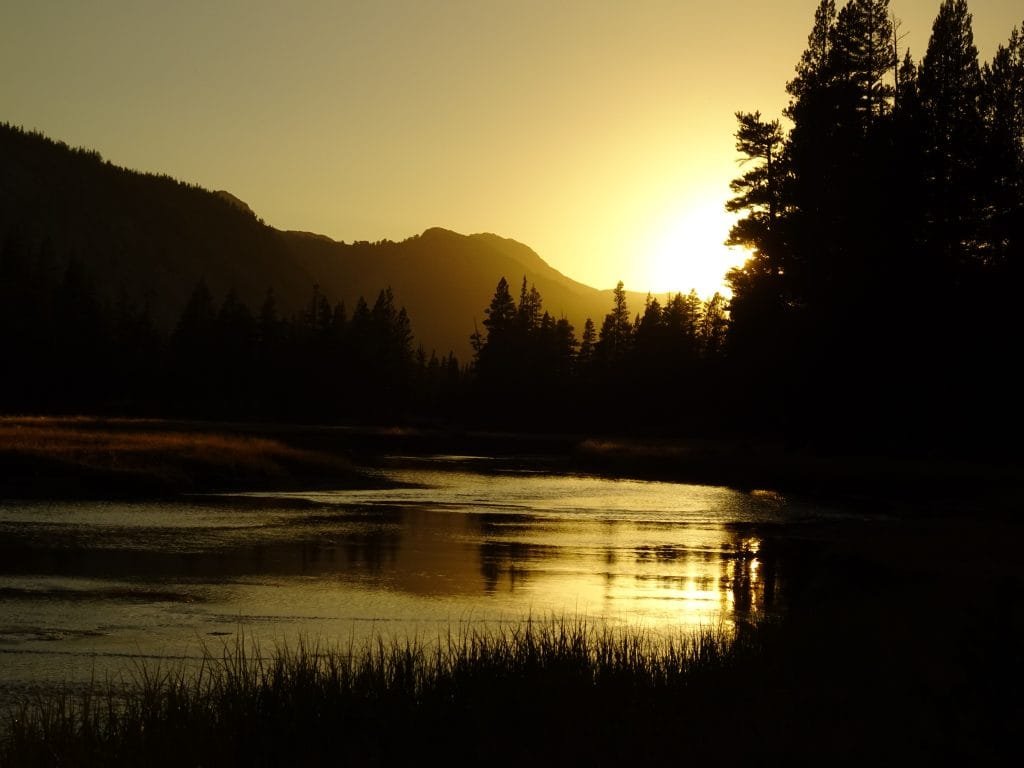
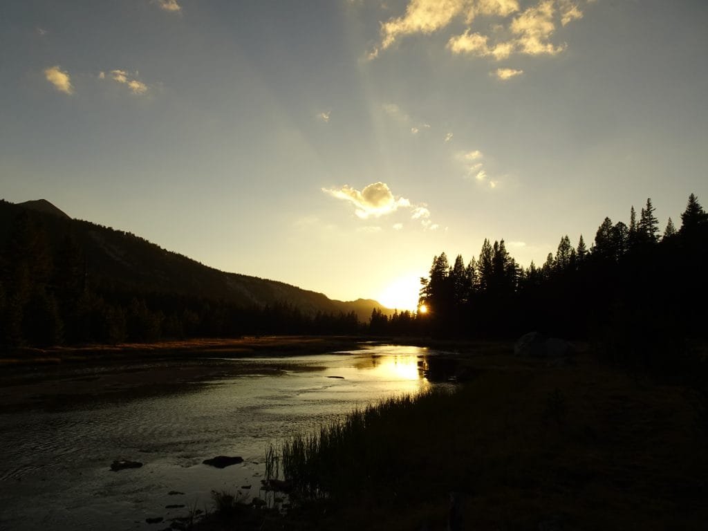
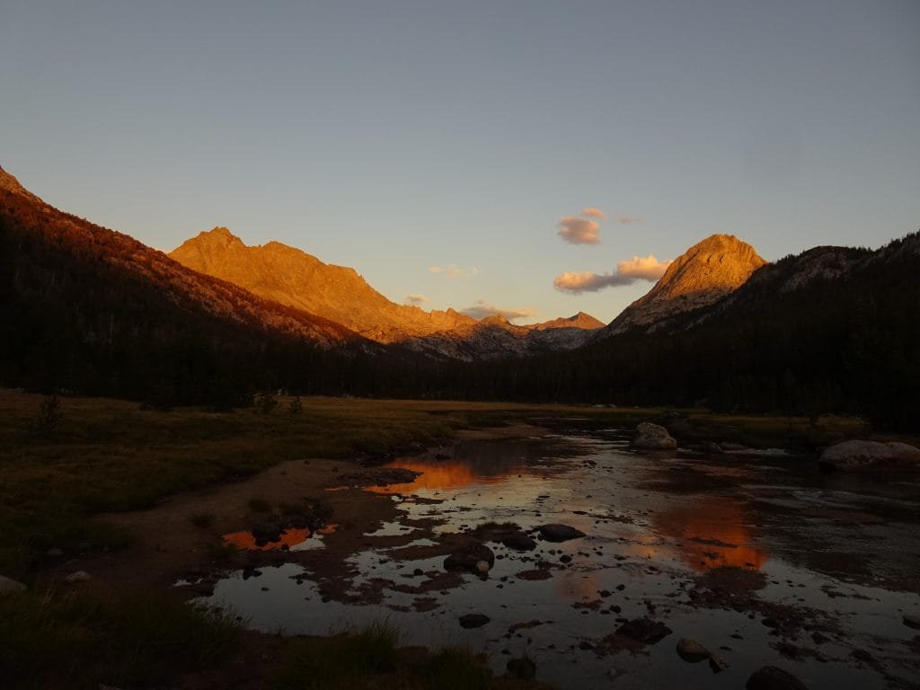
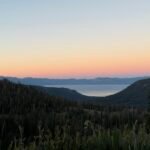
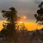
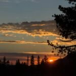
The rain stopped well before sunset, although some of the clouds stuck around. But they only added to the beyond spectacular light from the sunset! On the north side of the meadow the sun was setting almost directly in line with the creek, causing some nice reflections. On the south side, the golden light was splashing across the mountains that I’d be seeing a lot the following day as I climbed up to Muir Pass.

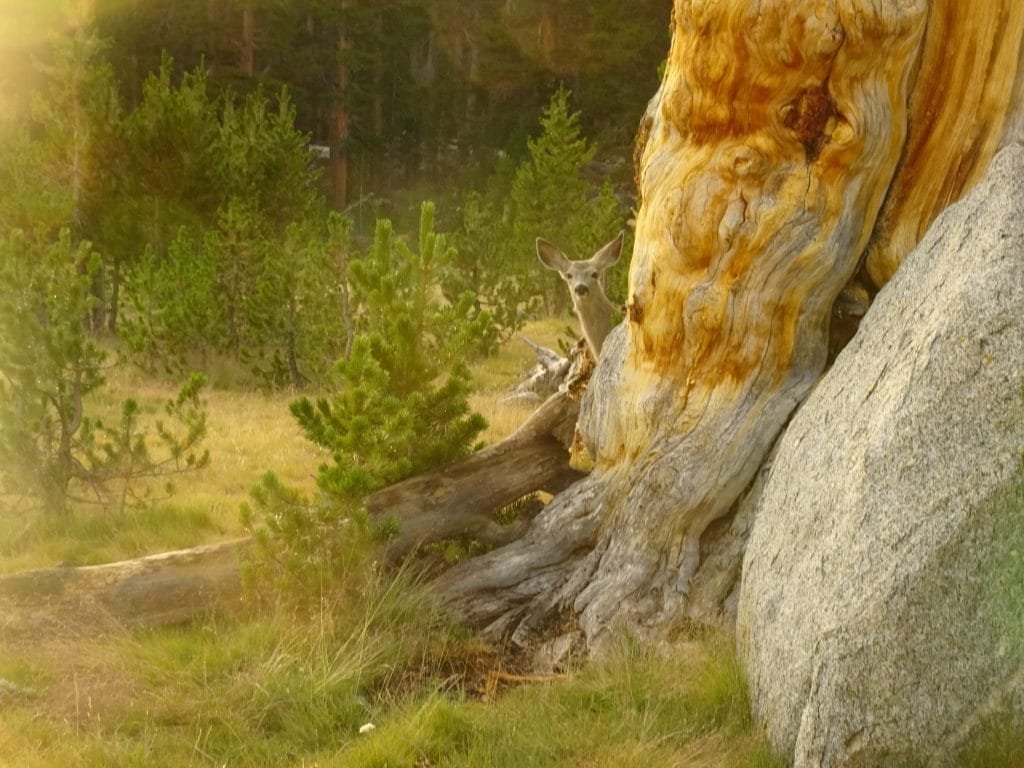
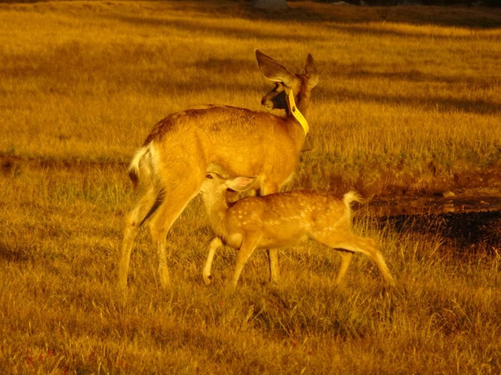
But there were also many deer roaming around that I got some nice pictures of. Some got very close and one faun was nursing on its mother. In fact, I was distracted taking pictures of one group of deer that I missed seeing a mother and her two fawns coming up behind me. One of the other campers motioned to me to look around and then I saw them. Like the coyote a week earlier, they were as startled as I was. I did get pictures of them this time. 🙂
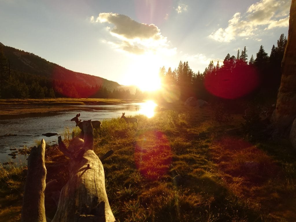
As the evening wore on, the colors changed and awed me and everyone else around. I eventually retired to my tent, but since I set it up with a view of the mountains I could see any remaining light that might splash across the mountains before I fell asleep.

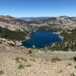
Next up was the first of the four 12k passes I’d have to go over in the next 4-5 days: Muir Pass!
12.5 miles hiked, 8:45 hours, 3,350 feet climbed
119 total miles hiked on the JMT
Highlights:
• Climbing up to Evolution Meadow on possibly the WORST switchbacks of the trek (up to that point, at least)
• Sunset at McClure Meadow!
• Deer at McClure Meadow


Comments by WanderingJim
PCT DAY 85 – CA Section H
"No cell service in many parts of the PCT. Not dead yet."
PCT or BUST!
"Yes, I’ll be going through there by early August"
JMT 2020 Day 3
"I'm afraid I have no idea. Not really a fisherman, so don't..."
JMT 2020 Trek Day by Day
"Yeah, but with 9,000 pictures, it's hard to label each one..."
Kilimanjaro – October 2019
"Everest Base camp is on my list too. Mostly since I know..."