
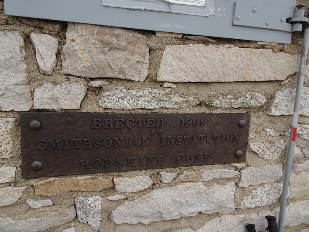
Goal for the day: After 211 Miles, the END of the John Muir Trail – Mt Whitney Summit (14,505 feet)
I had decided against attempting a overnight stay at the summit, so I had organized my equipment in what I’d need to take to the summit and what I could leave at the JMT/Whitney Trail junction. The lighter the pack the better. Really, just water, a few trail snacks, a backup battery, a few warmer layers of clothing, and a few emergency items (including, of course, my Inreach mini). I also had to guard the equipment left at the junction against rain (garbage bags to the rescue) and marmots (bear canister to the rescue).
One major change I made to my gear was that I didn’t fill up my Camelbak with filtered water. Well, I did, but then I added my Gatorade powder to it. So, I’d have plenty of Gatorade for my summit attempt. Just to be safe, I filled my 20oz Gatorade bottle with plain filtered water. Once I started up the switchbacks, there was no water on Mt Whitney until the bottom of the 99 switchbacks on the other side.
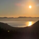
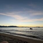
Waking up around 5am (my normal trail wake up time), I enjoyed the stars over Mt Whitney. Odd… some of the stars were moving. Shooting stars? Nope, they seemed to be moving upwards in a zig-zagging pattern. Alien spaceships?
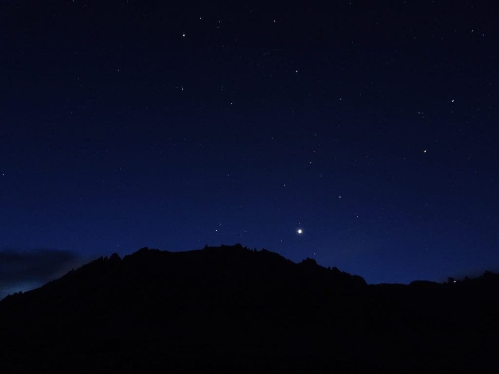

Naturally, they were the hikers who had a started up the switchbacks hours earlier.

I finished packing my gear as I watched the light from the sunrise dance around the mountains and scattered clouds.
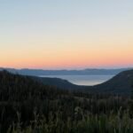
One of the people camping nearby mentioned that there had been several very light rain showers overnight, but the clouds in the sky were not dark and scary. My tent hadn’t been wet, so at least it wasn’t a lot of rain.
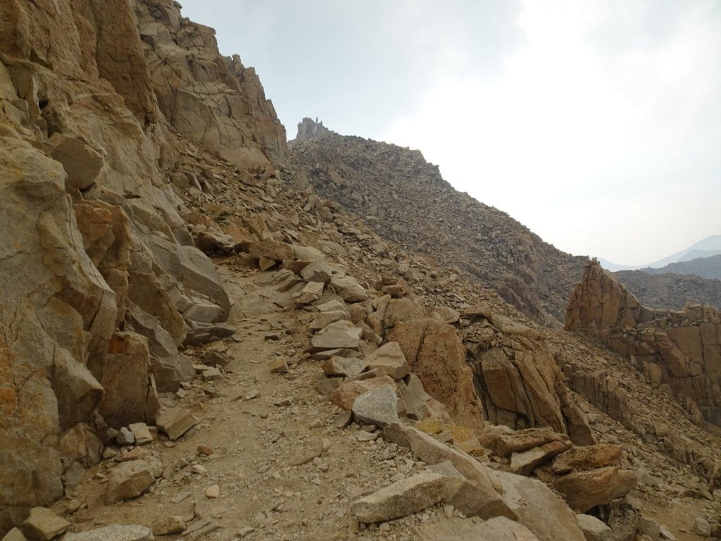
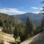
I started up towards the switchbacks that would take me to the junction of the John Muir Trail and the Mt Whitney Trail, where the two trails combined for the final 2 miles and 1,650 feet of my ultimate goal.


On the way up, I did spot a small set of dark clouds way to the west that seemed to be raining, but they were moving northward. Hopefully the otherwise clear sky would hold.


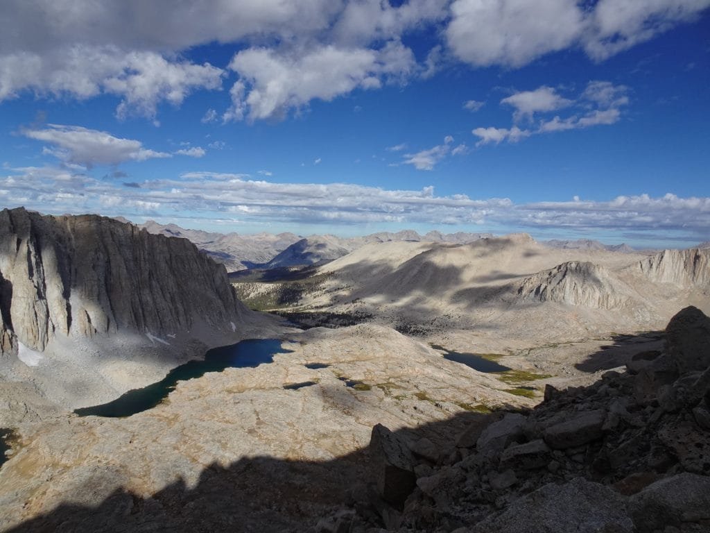
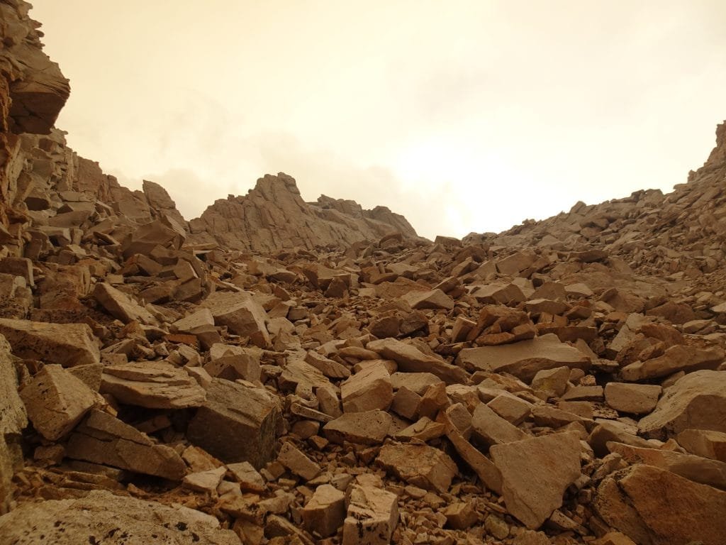
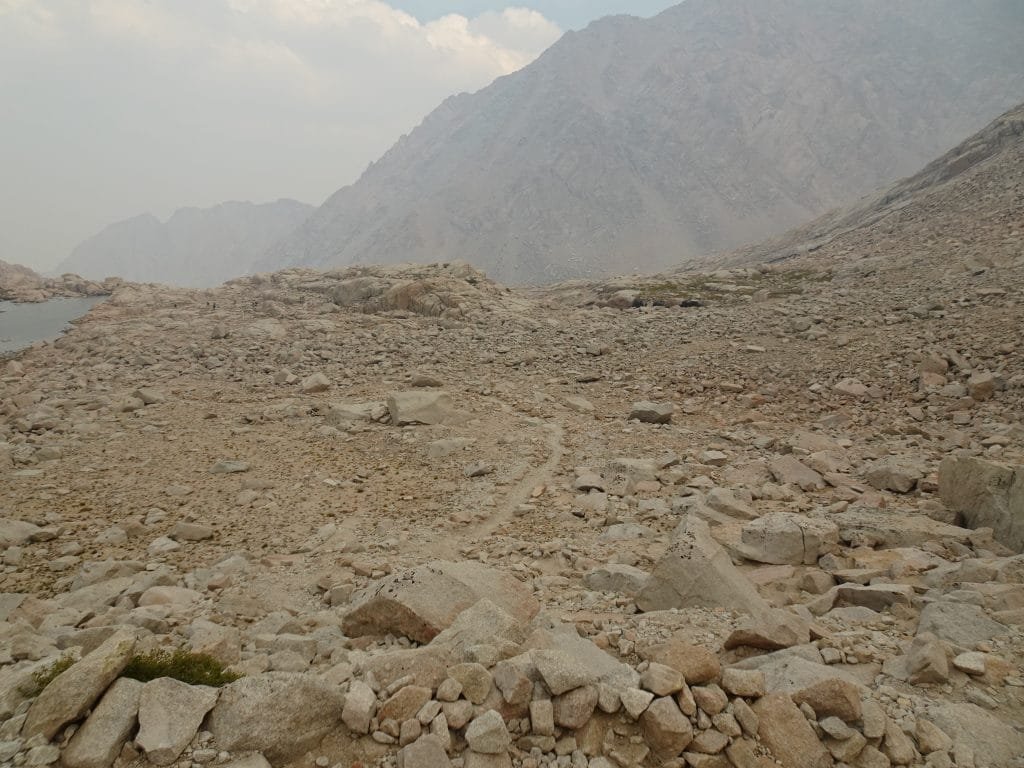
After climbing up the first thousand feet or so from Guitar Lake over a trail that was not that steep and only had a few small switchbacks to negotiate, I hit the large switchbacks for the final climb up to the junction.
Only ten of them on this side, but they were long and climbed steeply up the west side of the mountain. I made the mistake of counting them as I reached the corner of each one. Not looking at my GPS all the time was one of the tricks I use to keep from knowing how much further (usually a LOT) I had to my destination. By counting the switchbacks, it pretty much negated trying to take my mind off how far I still had to climb with my full pack. 🙂


On switchback 9, I saw the little tiny bivvy site at the corner of the switchback and chuckled. It was so small that I’d be scared of rolling off the edge in my sleep, pulling my tent with me. The other bivvy sites were much more traditional and the chances of falling off a ledge weren’t as high. Not zero, mind you. 🙂
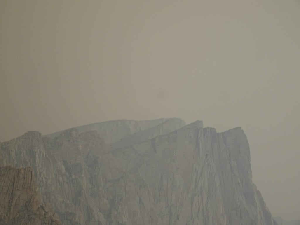
Unfortunately, that’s when I saw a haze of smoke hanging over the mountains to the southwest of me. I’d keep an eye on that and also for any sign of a storm hitting the summit.

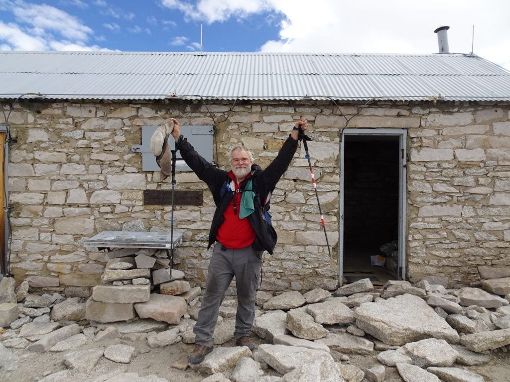
As I finished the last switchback and reached the JMT/Whitney Trail junction, I celebrated that achievement. I took a break and emptied out my backpack. Everything with a smell was already in my bear canister, so all I had to do was collect all the other items (tent, sleeping back, air mattress, clothing dry pack) into a garbage bag and weighed it down with a large rock.
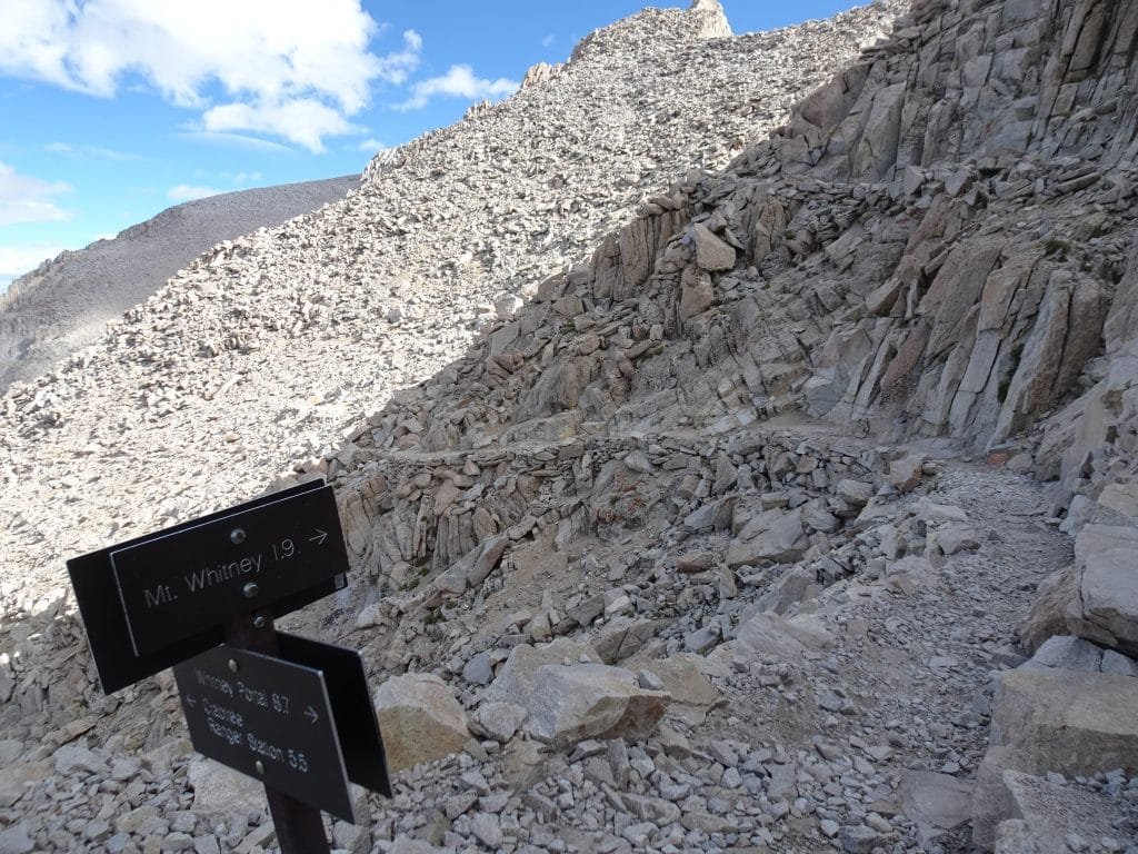
The summit wasn’t getting any closer by resting there. So I got to my feet, pointed myself north, and started up the trail to the summit. 2 miles to hike and 1,650 feet to climb. Based on my prior two trips to the summit, I expected it to take two to two and a half hours to reach the summit.


As I passed the class 1 trail (more of a class 2 scramble, than a trail actually) up to the summit block of Mt Muir, I kept going. I planned to climb it, but not until after reaching the summit of Mt Whitney. I didn’t want to take the time at that point to climb it and I REALLY didn’t want to chance getting hurt and not be able to finish the JMT.
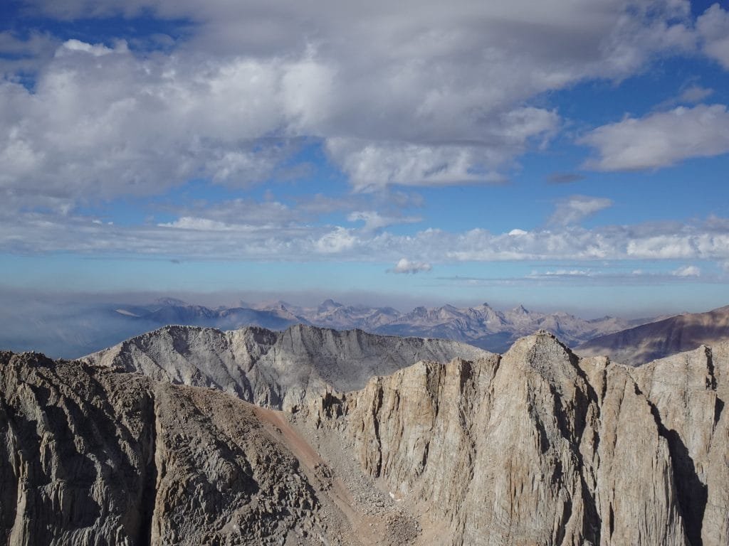
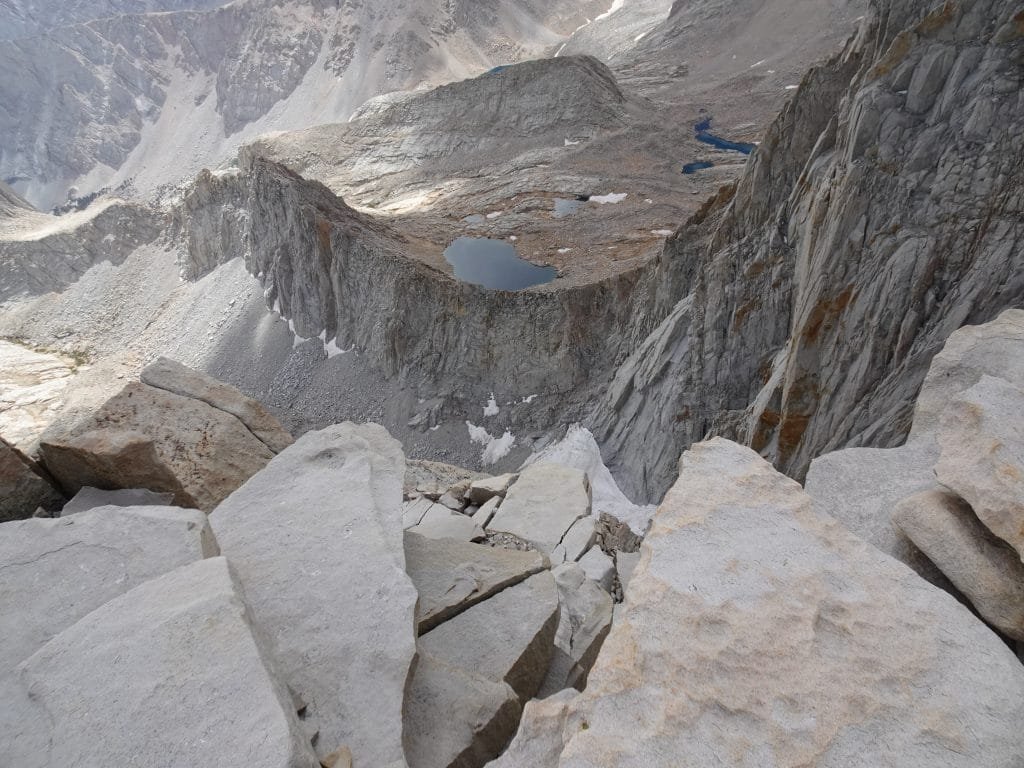
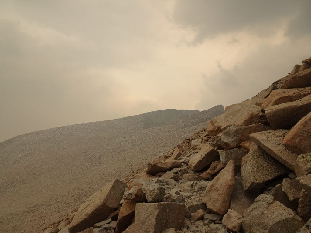
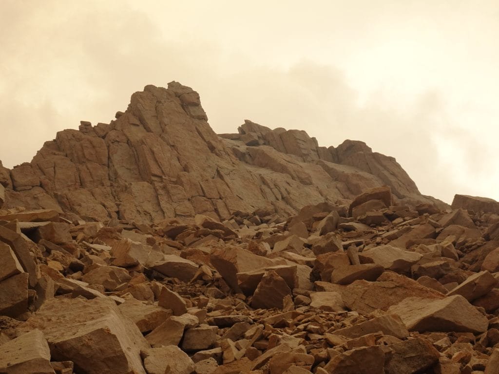
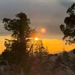
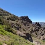
The trail from the junction to the summit snaked it’s way across the west side of the ridge that made up of Mt Whitney, Mt Muir, and the various needles and crags that separated me from my final goal.
Since it was morning, the ridge blocked the sun as I climbed the switchbacks and it was quite cold as a result. Now that I was on the ridge, the sun peaked through the gaps in the ridge (known as windows) and warmed me up considerably.


But it cooled down once I got back in the shadows. I never had to switch to my down jacket that I had brought with me to the summit, so it never got that cold.
Unfortunately, looking behind me I noticed a band of darkness flowing northward. I took some solace that it didn’t seem to be headed towards the summit and seemed to be smoke from a fire somewhere. That was better than a thunderstorm, but not by much.

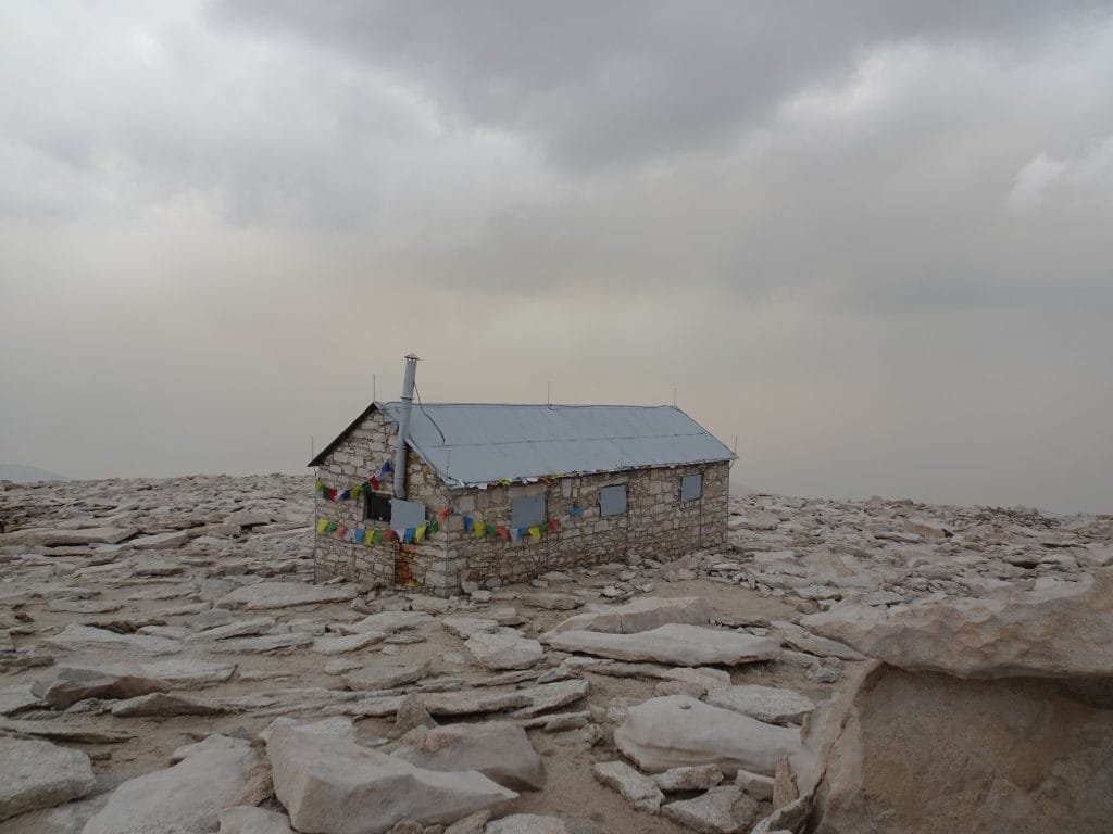
As I neared the main summit, I spied the Survey Hut and knew the goal was very close.

Unfortunately, near the very end of it the JMT/Mt Whitney Trail took a long detour to the north side of the crown of Mt Whitney before turning east towards the actual summit. I always thought that was a stupid route for the trail to take, since it went out so far before heading to the summit. Even my maps disagreed on if that was the actual JMT trail or if a shorter trail going up and over the ridge was correct.


I decided to follow the longer trail since it was a bit more used and was the route I used on my first summit of Whitney in 2015. I used the shorter route in 2017 when a large snowfield blocked the longer trail.
I figured I’d use the shorter trail on the way down just to make sure I covered all of the JMT. 🙂
After making the turn to the east, I eventually saw the Survey Hut. I was giddy with joy about being so close to finishing the JMT, but that could be the lack of oxygen. 🙂

Nope… I was giddy, elated, overjoyed, smiling from ear to ear, amazed, and beside myself with joy as I stopped in front of the Survey Hut and I officially completed the John Muir Trail:
![]() 211 miles
211 miles
![]() 24 days
24 days
![]() The entire John Muir Trail in a single trek
The entire John Muir Trail in a single trek
![]() From Yosemite Valley to the top of Mt Whitney
From Yosemite Valley to the top of Mt Whitney
I doubted I could do it from the start of planning, in the days and weeks before I started the trek, during the long hike from Yosemite, and right up until I saw the hut.
But if I didn’t try to do it, I failed before even starting.
As I basked in the satisfaction of completing this major trek, I had some things to do before resting and enjoying the summit for a while.
![]() Take a lot of pictures
Take a lot of pictures
![]() Take a lot of panoramas
Take a lot of panoramas
![]() Locate all the summit benchmarks that I could
Locate all the summit benchmarks that I could
![]() Take pictures of my feet on the summit. In this case, over each of the benchmarks just to make sure I covered all possible summit markers. 🙂
Take pictures of my feet on the summit. In this case, over each of the benchmarks just to make sure I covered all possible summit markers. 🙂
![]() Take some selfies and have some of the other hikers take my picture in front of the Survey Hut, the summit sign on the bolder, over each benchmark, and in front of the 360 degree views all around me.
Take some selfies and have some of the other hikers take my picture in front of the Survey Hut, the summit sign on the bolder, over each benchmark, and in front of the 360 degree views all around me.
Why do that first?
![]() It’s a habit that I’ve gotten into to make sure I get them out of the way in case something chases me down from a summit. Like a huge thunderstorm with lightning.
It’s a habit that I’ve gotten into to make sure I get them out of the way in case something chases me down from a summit. Like a huge thunderstorm with lightning.
![]() Or if I fall off the edge of the boulders making up the summit. At least, I may leave behind a record that I made it. 🙂
Or if I fall off the edge of the boulders making up the summit. At least, I may leave behind a record that I made it. 🙂
![]() Or a fighter jet crashes into the summit. I didn’t see any this time, but definitely heard fighter jets during my trek. I’ve seen and heard them on previous treks in this area and believe they are training flights from the Naval Air Weapons Station at China Lake.
Or a fighter jet crashes into the summit. I didn’t see any this time, but definitely heard fighter jets during my trek. I’ve seen and heard them on previous treks in this area and believe they are training flights from the Naval Air Weapons Station at China Lake.
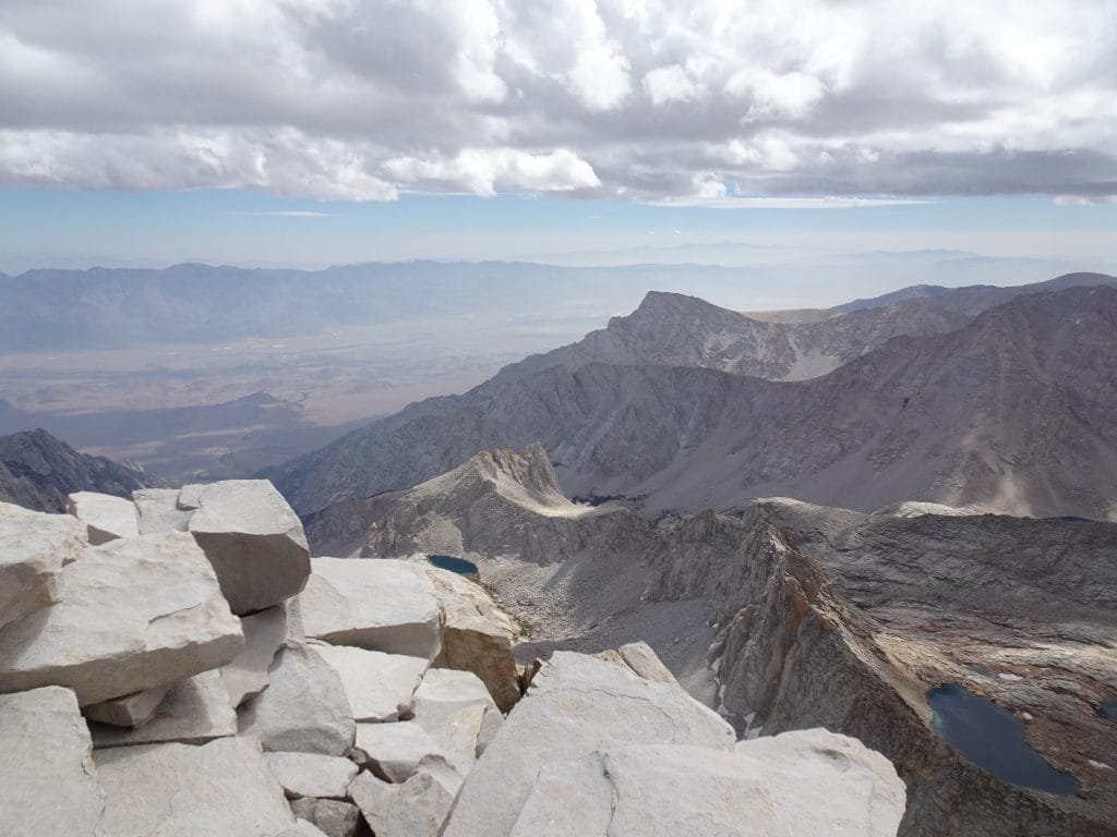
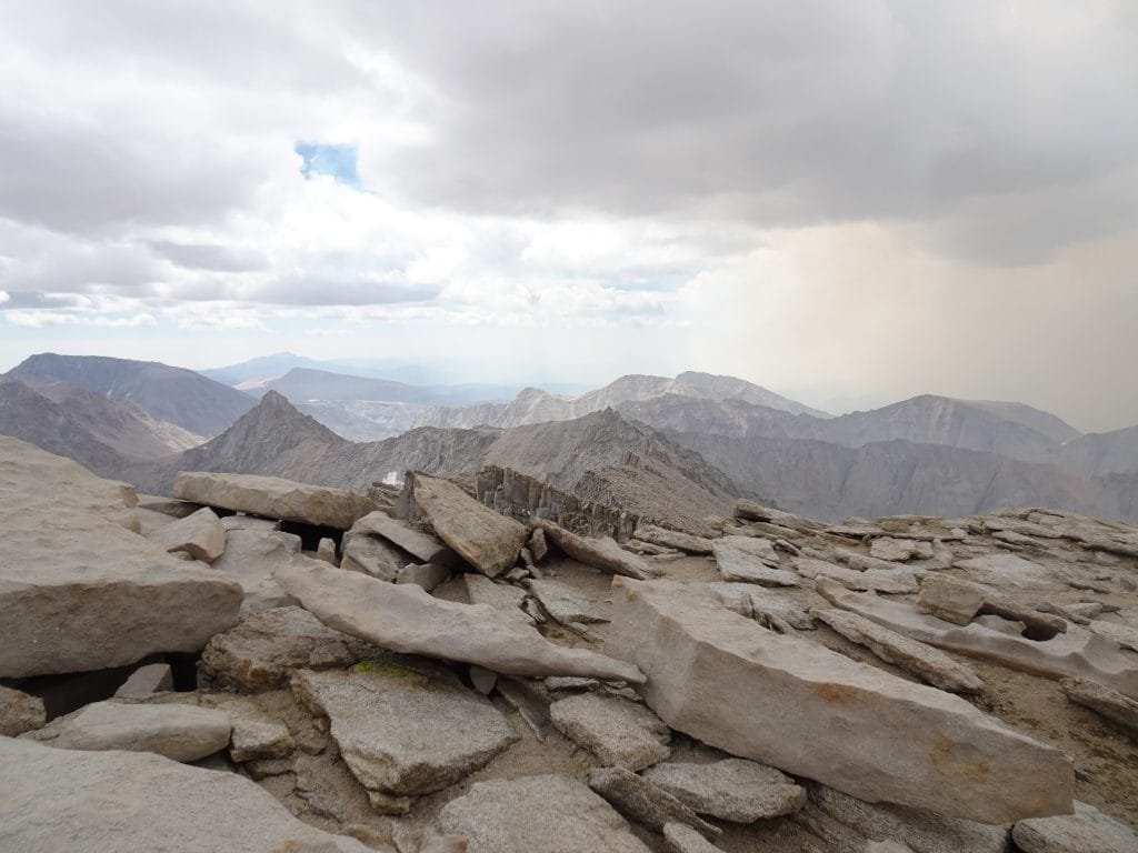
Morbid and unlikely worries aside, I enjoyed every minute I was at the summit. The views were great and the feeling of accomplishment I felt made the previous 24 days all worth it.


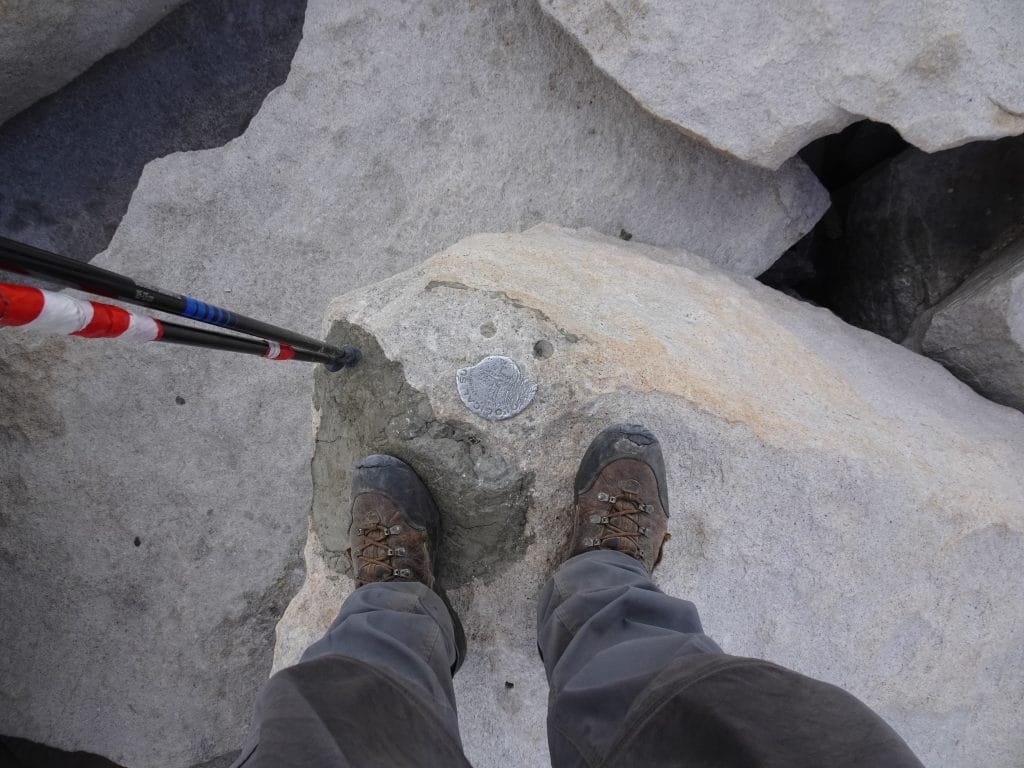

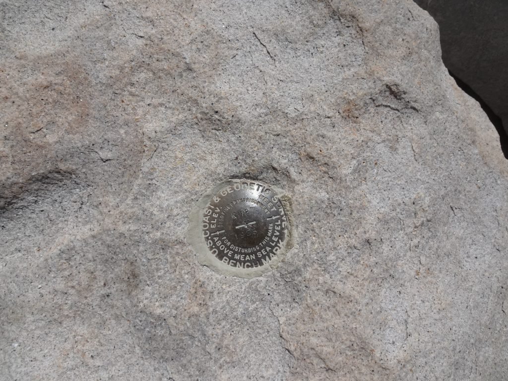

For the benchmarks, I had seen them during my previous two summits. There were six of them altogether, including one that had seen better days.
Hopefully I didn’t miss any, but those are the same six benchmarks I’d seen on my previous summits.

There were also some patched mounts that may have held old benchmarks or some other form of indicator.

One other summit tradition I took care of was to photograph two rocks that I had carried from the JMT trailhead 211 miles back in Yosemite to the summit. One would be added to my rock collection and the other left at the top of Mt Whitney.

Considering they keep changing the height of Mt Whitney, it’s no wonder there’s a lot of benchmarks and patches up there.
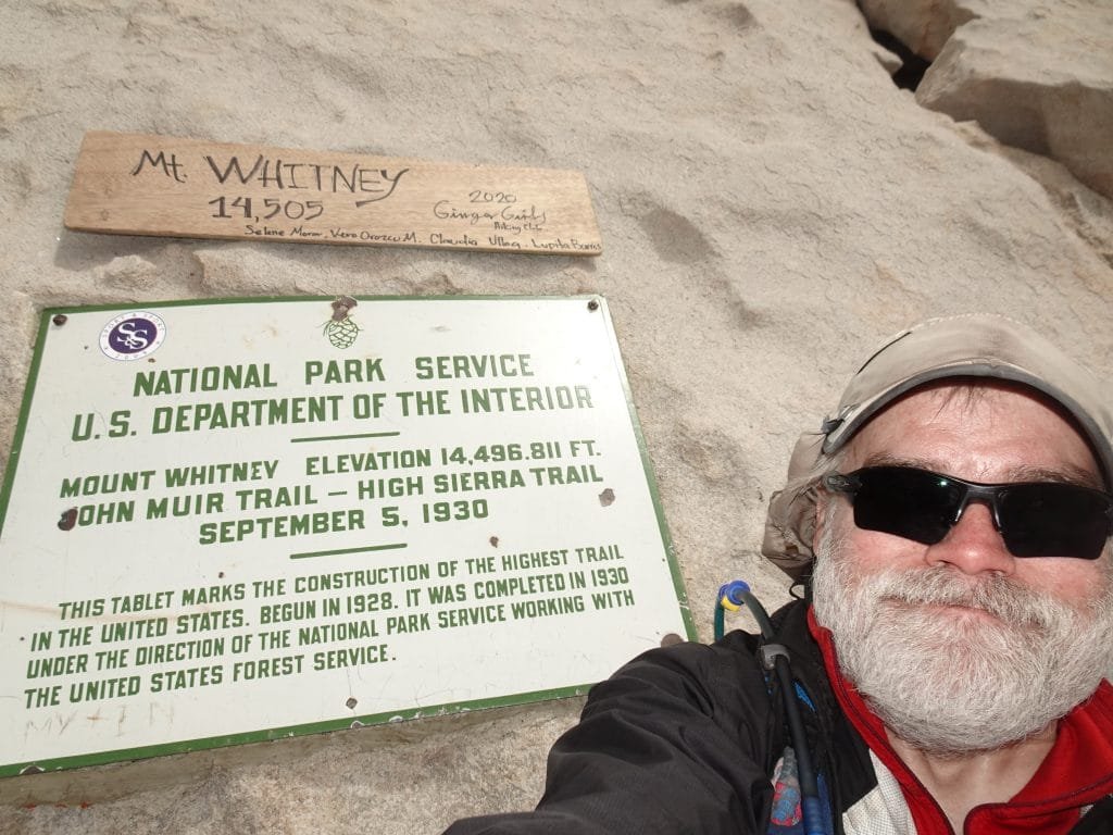
14,505 feet is the latest ‘official’ height, but I heard they may revise a lot of mountain heights in the near future using more exact measuring methods.
That’s not going to change the fact that Mt Whitney is the highest peak in the lower 48 states.
Or the fact that I’ve summited it three times now.

I tried to sign the summit register, but all of the pens within the register case were out of ink. Fortunately, I had brought a sharpie with me and could sign the register to celebrate and record my accomplishment. It was a little thick, but was better than nothing.


Since I could see the others who came before me had tried to use the almost empty pink pen to barely write their names in the register, I left the sharpie behind and also told everyone currently on the summit that the pen was there.
The door on the hut was also still missing over 3 years after being damaged in the Winter of 2017. Maybe they decided not to bother replacing it.
That made my decision not to spend the night at the summit a good one. The last time it was VERY cold without the door there.


As I enjoyed a rest at the summit, I did do one more task: Check my email for the first time in 14 days.
The summit of Mt Whitney enjoyed a cell signal courtesy of a direct line of sight down to Lone Pine. As I did a quick check for any emergencies, I also checked the weather, news (the World was still there), and sent some emails to my friends, family, and co workers.
When else would I get to give a live update of such a major accomplishment?
The first time I reached Mt Whitney’s summit, I spent about an hour and a half at the top. I descended back to Trail Camp after I started to get a headache (one of the symptoms of altitude sickness).
As previously mentioned in these JMT reports, the second time I spent the night (at least 16 hours).
I could have spent the whole afternoon at the summit the way I felt, but there were some concerns.
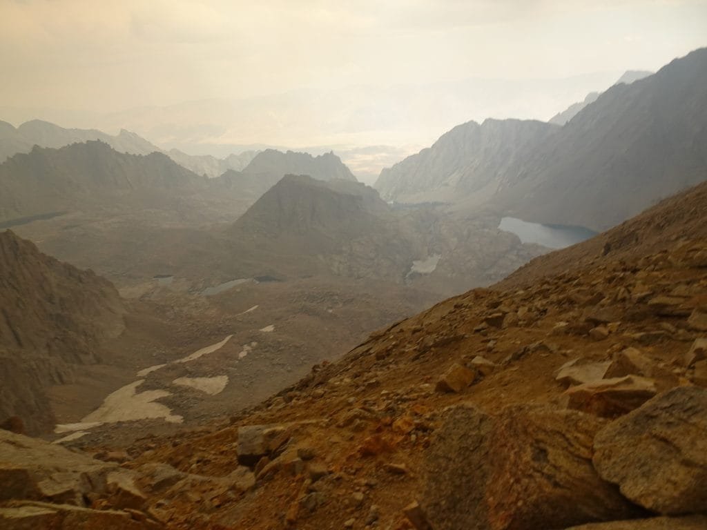
The weather for the last half of this trek had been very unstable, unpredictable, and even if the weather report from my Inreach and my cell phone didn’t indicate any storms were likely that afternoon, weather in the mountains was ever changing. For example: My Inreach forecast didn’t indicate any bad weather was expected the day before and I ended up with a big late afternoon storm casing me up to Guitar Lake.
Fortunately, I didn’t see any bad weather or dark clouds heading towards the summit.
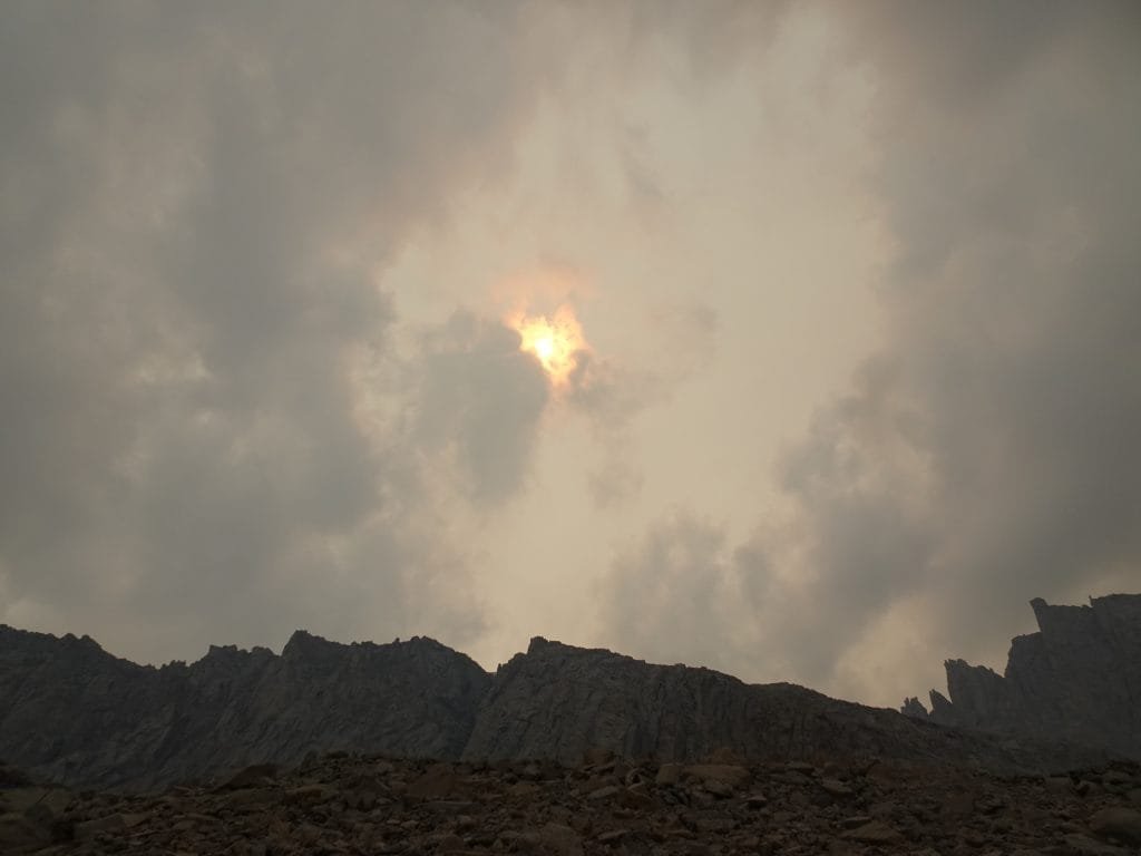
But unfortunately, the dark band of smoke from the southwest had started to move towards Mt Whitney. At first, it was angled to pass by the west side of Whitney and was headed north. It slowly started to block the view to the northwest as I had approached the summit, but didn’t stop me from my goal.
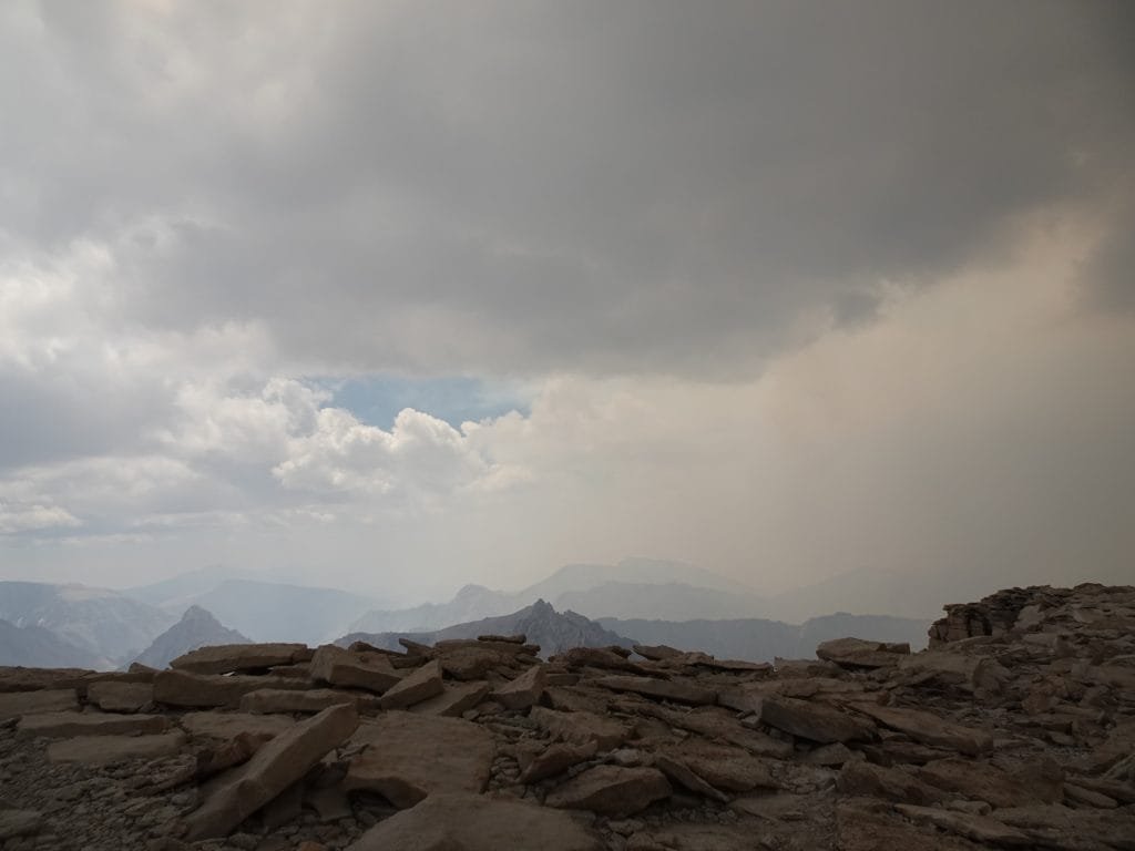


But as I enjoyed the summit, it had started to slide in over the top of the summit. Before long, I expected it would block all of the views from the top. The smell of smoke in the air was getting stronger as well.
So after only about an hour, I reluctantly bid the summit a fond farewell and started down.
Since I took the long trail up I decided to go down the shorter trail to make sure I hiked the correct JMT trail, whichever one it was.
While it was easy to follow, there were a couple spots that were unclear or had multiple routes down. Rejoining the other trail, I headed down towards the junction of the JMT and Mt Whitney Trails.


It was an uneventful descent, although I did feel some light sprinkles a few times along the way and the smoke had pretty much covered the whole area by the point I neared Mt Muir.

As I looked up at the summit block of Mt Muir, I had to make a decision. The rain drops I had felt earlier worried me as well as the smoke now blocking the views.
Even if I did scale the summit block without falling and injuring myself (or worse), there wasn’t going to be much to see.
Since I had already climbed Mt Muir before, there wasn’t any great need to add it to my list of 14ers that I had conquered. It was already there on the list.
And if it started raining while I was up on top, it could make getting down the slick granite rocks hard without risking a fall. A fall off the north or west side may only break some bones, but a fall off the other sides would be deadly.
So I decided finishing the JMT was more than enough for this trek and continued down to the junction to retrieve my gear.


It wasn’t long after that when a loud rumbling sound rolled across the mountain.
Thunder.
It repeated itself as I realized I made the right decision to skip Mt Muir. Rain was one thing, but being on top of the summit block of Mt Muir in a thunder storm was asking for a quick exit from this World.
To my dismay, several people then passed me heading towards Mt Whitney’s summit. I warned them that the smoke pretty much eliminated the view and the thunder meant that the smoke was hiding some storm clouds.
The summit wouldn’t be safe if lightning started to strike the high point. And Mt Whitney was the ultimate high point in the lower 48 states.


Even being on the crest was dangerous, so I quickly repacked my gear into my backpack (being a bit sloppy).
In retrospect, I should have started up to the summit at least an hour earlier. But 20/20 hindsight would have made this a much different trek and maybe even an unsuccessful trek. Where’s a TARDIS when you need one?

At that point, I did have a wild option pop into my mind: Setup my tent at one of the bivvy sites and ride out any storm that comes that afternoon. Water would be tight for an overnight stay, but I probably could manage (I had put just plain water in my Gatorade bottle just in case I needed it for cooking).
I could even use that as an excuse to climb to the summit the next morning for the sunrise if I wanted to (which I did, if I was in position to do it).
But after more thunderclaps and after the past 24 days started to weigh heavily on me, I knew I had to start down to the Whitney Portal.
It was time to finish this trek in victory.
To begin my downward hike, I had to climb up a bit to reach Trail Crest. There, I looked around and saw that the smoke had moved down to cover Trail Camp as well. Things were starting to look like dusk in the middle of the afternoon. There was an occasional sprinkle of rain, but nothing heavy or that made me think of putting my rain cover on.
Trail Crest was the 11th pass I had to cross over during this trek, although it’s not on the JMT itself (it’s part of the Mt Whitney Trail).

I started down the 99 switchbacks, making a point NOT to count them this time.
Even downward, it could become an eternity if I actually kept track of them.


One of the switchback trails near the top had an eroded section that required me to climb up over some slick rocks to get around it. Maybe it was the occasional rain drizzles that passed over making them slicker or just bad luck, but I slipped and almost slid down the side of the ridge. Carefully pulling myself up and stepping past the bad section, I continued on.
<HIKER RANT ON>
The eroded section was obviously the result of many people cutting the switchback at that point to save 0.0005 seconds of time.
<SARCASM ON>I’m glad you got down the switchbacks a little faster<SARCASM OFF>, but next time think of who may seriously injure themselves due to your “shortcut”.
As much as I complain about switchbacks, they are there for a reason: To prevent erosion and make it easier for people to climb and descend the steep side of the mountains.
Please think of others and don’t cut the switchbacks.
<HIKER RANT OFF>
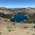
There were some snowfields along the east side of the ridge, but they didn’t cover any of the switchbacks. So that made it official: I did not have to cross any snow fields during this long trek. I passed a few patches by some of the trails (several near Helen Lake, if I remember correctly), but never had to traverse any of them to hike the JMT.

I made it past the cables, a part of the switchbacks so precarious they had to put up a railing and cables to keep people from falling off the trail.

When I got to switchback 25, I was surprised at what I saw. I still wasn’t counting, but I knew it was switchback 25 because it had a spring flowing from it.

The spring being there wasn’t surprising (it was a well known water source), the fact that the water was gushing out of it was. Considering how little snow we got the previous Winter and that it was late August, the amount of water pumping out of that spring was amazing. The other times I had passed this spring it had been a slow flow spilling slowly over the rocks (July 2015) or barely a trickle (August 2017-a very high snow year).
I passed the spring again and again as I descended the final switchbacks, since was falling and flooding across almost all of the remaining switchbacks.

As I finished the last switchback and hit the level trail that snaked through Trail Camp, I surveyed the area and conditions.


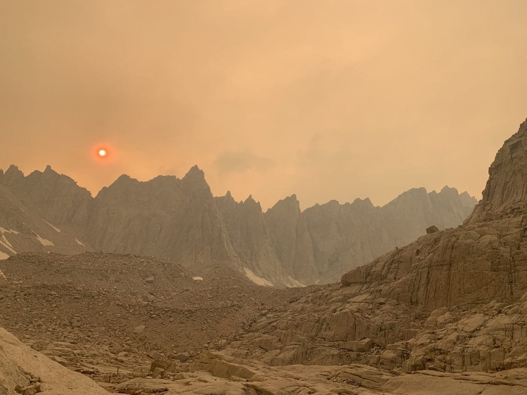
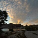
There hadn’t been any thunder for a while, but the sky was a dark mix of orange and red. It wasn’t even 4pm and it seemed the sun was setting and casting a red glow over the area. But it was just the smoke making everything look like a sunset or at least a nightmare version of a sunset.


I could stop and camp at Trail Camp or maybe Consultation Lake. It wasn’t that crowded and my legs and feet were all for stopping.
I had been thinking of trying to get down to Outpost Camp to make the next morning hike a hop, skip, and a jump down to French Toast at the Portal Store. The wind that was blowing across the area also made me think Outpost Camp would be better protected from the wind since it was just bellow the tree line.
I could also try to get all the way down to the Whitney Portal, but based on my prior descent times from the summit that would get me there around 8 or 9pm. The Portal Store would be closed and the ability to get a ride down to Lone Pine that night would be a lot harder. Plus my body was unlikely to want to keep going that long or far.
I knew the trail below Trail Camp was pretty tricky and hard to navigate when rested. Trying to go any further down in my current condition could really be hard and dangerous.
But in the end, the beautiful view of the entire ridge of Mt Whitney from Trail Crest to the summit that was spread out in front of me convinced me to stop when I added that to the votes from my legs and feet.
With the smoke filling the skies I didn’t know how much I would see at sunset or sunrise, but my previous stay at Trail Camp on my first Mt Whitney climb made me very aware that they both could be spectacular. The chance of a nice sunset or sunrise made me choose to spend the night at Trail Camp.
I decided on a campsite that was up along a rock dome separating the Whitney Trail from Consultation Lake. It gave a nice wide view of the area and Mt Whitney.
I looked at the red Sun burning through the thick smoke and started to think I was on Mars. The colors made everything look like the photos the various rovers sent back from the surface of the real Mars.
I wished I had time to check for the location of the forest fire(s) causing the smoke when I was at the summit, but at least I was above the tree line should any fires be below me. None of the hikers coming up from below mentioned anything, so I put that worry aside.
After setting up my tent and having dinner, I started to worry about the strong wind that continued to blow through Trail Camp. That wind obviously is what blew the smoke in over the whole area. It also blew ash over the area that occasionally sprinkled down around me.
The smoke precluded any major color (except red) at sunset, so I went to sleep early with the wind still blowing. I only had happy thoughts of my successful JMT trek flowing through my head. Nothing could take my accomplishments from this trek away.
A job well done.
8.8 miles hiked, 6:00 hours, 3,250 feet climbed
221 total miles hiked on the JMT (plus 4 miles to descend to Trail Camp)
Highlights:
• Finished John Muir Trail!
• 211 Miles from Yosemite Valley!
• Mt Whitney Summit! (14,505 feet)
• Views!
• Smoke from fire 🙁
• Camping on Mars


Comments by WanderingJim
PCT DAY 85 – CA Section H
"No cell service in many parts of the PCT. Not dead yet."
PCT or BUST!
"Yes, I’ll be going through there by early August"
JMT 2020 Day 3
"I'm afraid I have no idea. Not really a fisherman, so don't..."
JMT 2020 Trek Day by Day
"Yeah, but with 9,000 pictures, it's hard to label each one..."
Kilimanjaro – October 2019
"Everest Base camp is on my list too. Mostly since I know..."