I wasn’t that active in October and early November, but did get a decent number of bike rides in as well as some short weekend hikes.
I did climb Mt Diablo via the Summit Trail near the end of October and then did a short loop at Las Trampas Regional Park in early November.
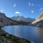
In anticipation of having to burn off a lot of turkey, I decided to head to Mt Tamalpais the weekend before Thanksgiving. I had wanted to head out to the coast for the past several weekends, but always found a reason not to do the hour-long drive to get there.
I had breakfast, then was able to get motivated enough to get into my Jeep and drive to the West. I started to get worried almost immediately since there was a thick fog covering the freeway and it grew thicker as I headed over the Bay on the Richmond Bridge. The weather report said it would be sunny, so hopefully it would burn off quickly.
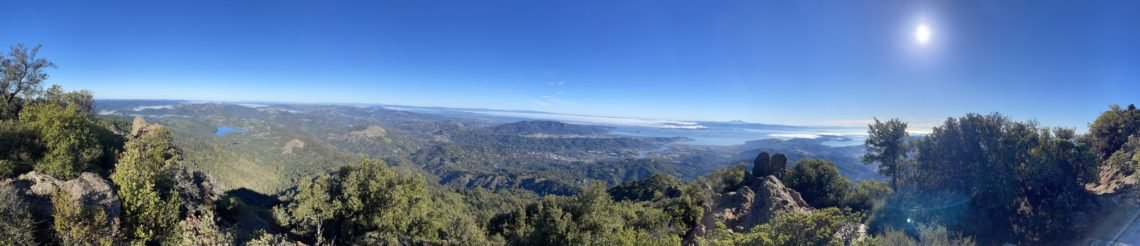
But once I got up to ridge that the Panoramic Highway snaked across, the fog cleared and I could see the entire coastline and Mt Tamalpais clearly. Normally, the fog would come in from the Pacific Ocean and funnel over the coastal mountains and into the Bay.
But the weather has been a bit odd and instead of fog from the ocean, there has been a lot of tule fog coming from the Central Valley. You can’t always be sure where the fog is coming from when you’re inland, so I was happy to see the sunny skies. I also had some views of the rising Sun to the East. I should have gotten out of my home at least a half hour earlier to get even better views of the Sun.
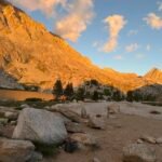
I decided to start my hike from Mountain Home instead of starting down near the coast at Stinson Beach. Going across Gravity Car Fire Road, there were some very nice breaks in the trees when I could see the rising Sun and get some nice pictures. It would have been even better if I had gotten there a bit earlier, but I’ll take what I got.
After that, I climbed up the Vic Haun and Temelpa Trails. After the gentle climb of the first 300 feet along the fire road, these trails covered the last 1,700 feet up to the East Peak of Mt Tamalpais. Not the worse climb, but definitely a steeper climb than the route up from the coast. You do save climbing an extra 900 feet by using this route, of course.
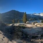
Due to the shorter hike, I reached the East Peak pretty early and took a nice break at the summit and saw the extent of the blanket of fog covering most of the water of the Bay. It was starting to thin out, but I verified that it wasn’t coastal fog. The entire coast that I could see was clear of fog.
After enjoying the view for a bit, I had to decide how to return to my Jeep. A direct return hike the way I came would be a very quick hike as would be going down the Upper Fern Creek Trail and take Hogback Trail back.
Wanting to make the most of the long drive to get there, I decided to head West taking in the Middle and West Peaks (or as close you could get to the West Peak) as I headed towards the ruins of the old Air Force base. Normally, the foundations of this old base were deserted, but they were using the area for a SAR training exercise. I went by the group and the helicopter and made my way down to Pantoll.
This was one of the routes I may have taken if I came up from Stinson Beach and I could still descend all the way down to the coast if I felt like it. I could even take a bus back up to Mountain Home if I went all the way to the beach to save myself a reclimb. After thinking about it, I decided I’d just hike back along the Troop 80 trail. Mostly downhill and a nice stroll in the woods.
It was a great day hike and I’m glad I was finally able to get to Mt Tam.


Comments by WanderingJim
PCT or BUST!
"Yes, I’ll be going through there by early August"
JMT 2020 Day 3
"I'm afraid I have no idea. Not really a fisherman, so don't..."
JMT 2020 Trek Day by Day
"Yeah, but with 9,000 pictures, it's hard to label each one..."
Kilimanjaro – October 2019
"Everest Base camp is on my list too. Mostly since I know..."
Kilimanjaro
"You started hiking with Kilimanjaro first? Even I worked my..."