Goal for the day: The Summit of Mt Whitney – 14.505 feet – Highest point in the lower 48 states
I awoke around 3am to a sense of déjà vu. From my 2020 JMT Day 24 description of waking up before climbing to the Summit of Mt Whitney:
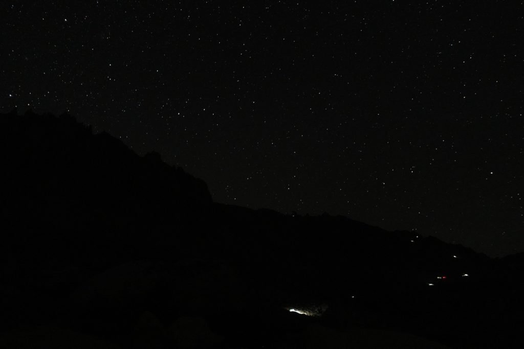
I enjoyed the stars over Mt Whitney. Odd… some of the stars were moving. Shooting stars? Nope, they seemed to be moving upwards in a zig-zagging pattern. Alien spaceships?
Yet again, the moving headlamps of the hikers going up to the Summit looked surreal against the black backdrop of the dark mountain.
Four years prior, I had left shortly after sunrise. This time I was going to join the trail of hikers heading up in the dark. Since I was going to go up and return to Guitar Lake that same day, an earlier start was a better choice for two reasons. One, I had to do a full round trip back to Guitar Lake and, two, late afternoon thunderstorms are easier to avoid if you get up to the Summit as early as possible.
I had a quick breakfast of granola, strapped on my headlamp, and headed AWAY from the Summit by heading southeast. Why away? See the prior day’s description about why the 10 switchbacks up the west side of Mt Whitney are 2 miles south of the Summit.
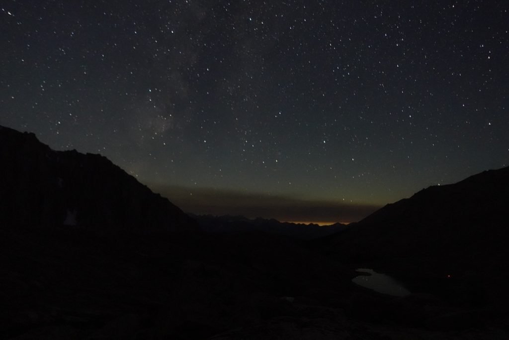
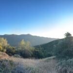
I did get to see some beautiful views of the stars as I began my trek.

Climbing up in the dark tends to be slower than in the light of day. The headlamp illuminated the trail in front of you, so you have to be careful to follow the trail closely to avoid any trip hazards or stepping off the side of the trail and falling to your death.
The lower part of the trail didn’t have many steep drop offs that could lead to serious injuries, but there were some.
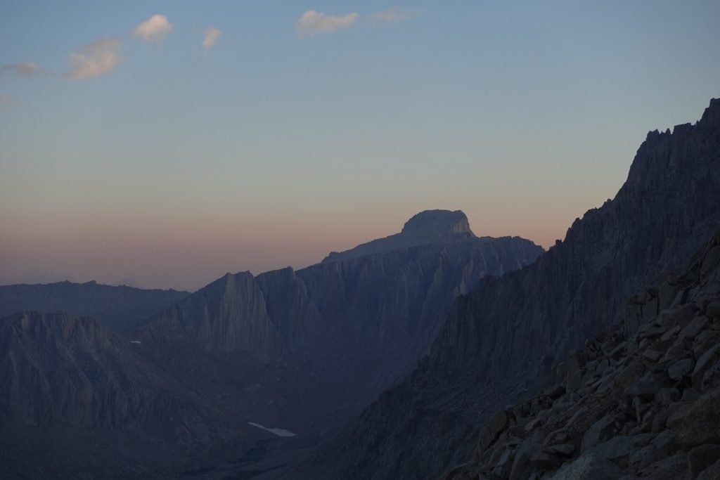
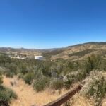
Fortunately, I was only in total darkness for the first hour or so of the climb. Then the light from the Sun rising on the other side of the ridge started to give enough light that you could see the scenery around you and also the trail right in front of you.
While you couldn’t see the actual sunrise from this side, the light did make for a pretty climb.
Step by step, I climbed ever higher along the switchbacks. While the 10 switchbacks on the west side were a lot easier to climb than the 99 switchbacks on the east side, they were longer to keep them from being too steep. So, I did my best not to count them and just kept going and going, and just making sure to turn at each corner.
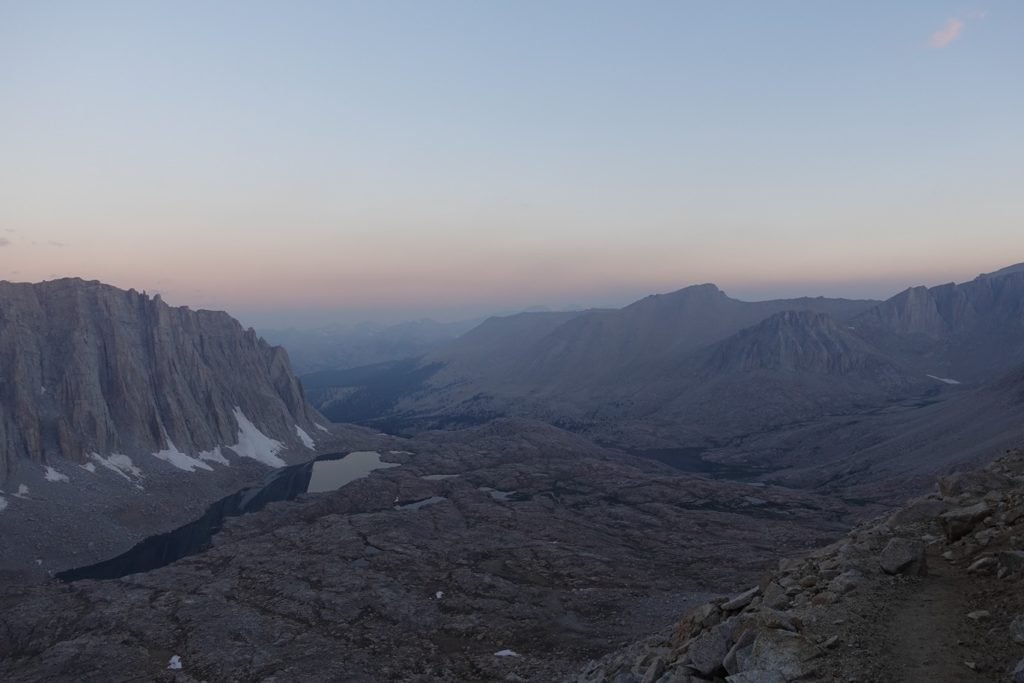
And taking a lot of pictures, of course. I’m glad I choose to start pre-dawn as the light from the rising sun gave me some great views as I climbed ever higher.

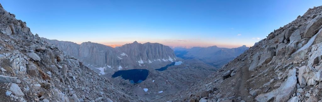
And then when direct rays from the Sun started to hit the mountains to the west, an whole new kind of spectacular view entertained me on the way up,


After reaching the trail junction where the JMT joined the Mt Whitney Trail for the final 2 mile slow climb towards the Summit, I took a rest and chatted with the other hikers who paused there. Here, I ran into some of the people who were part of the pack train group. It was somewhat nice that there were some people on the mountain that weren’t always racing ahead of me.
After an all too brief rest, I turned north and headed towards the Summit.
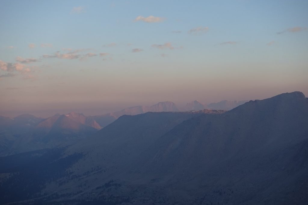
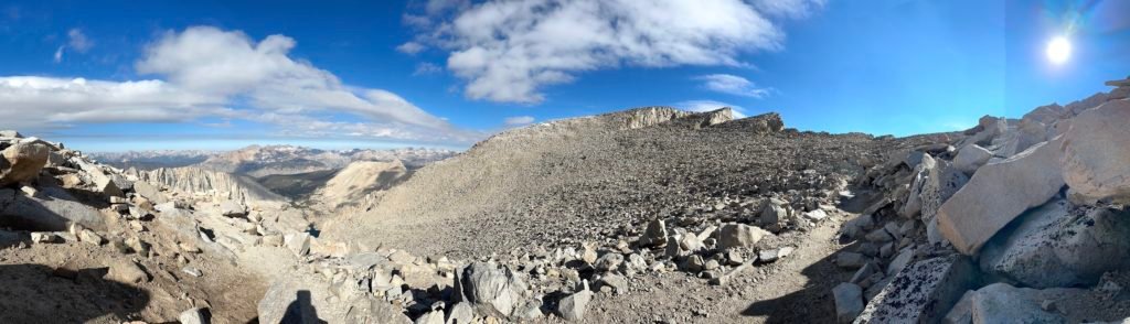
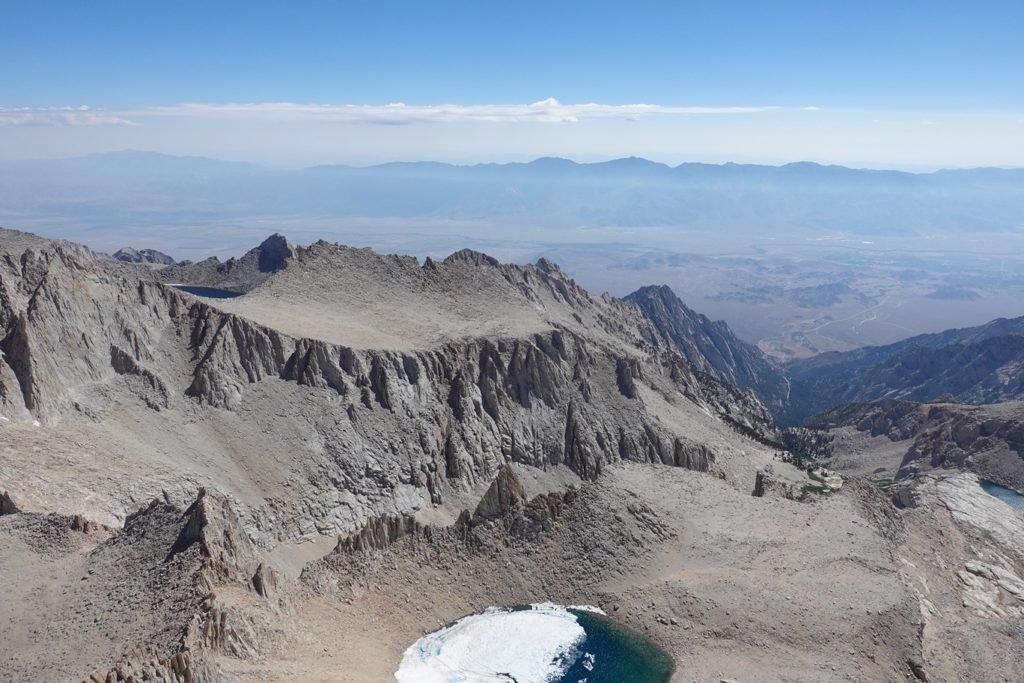
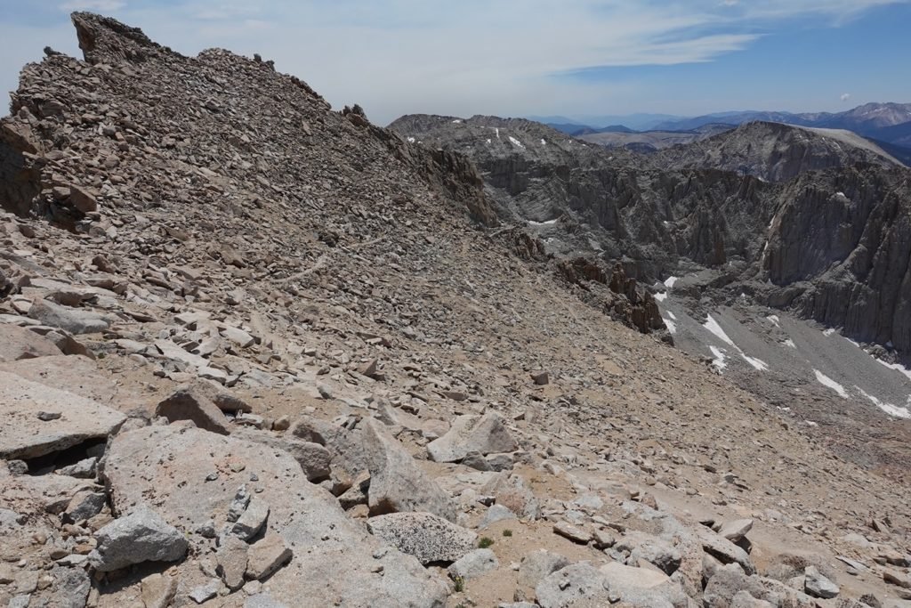
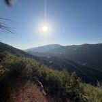
After a few more small switchbacks, the trail generally moved along the ridge in a northward direction, slowly climbing in altitude as the ridge slowly got higher. The occasional peek at the crest holding the Summit pulling you forwards.
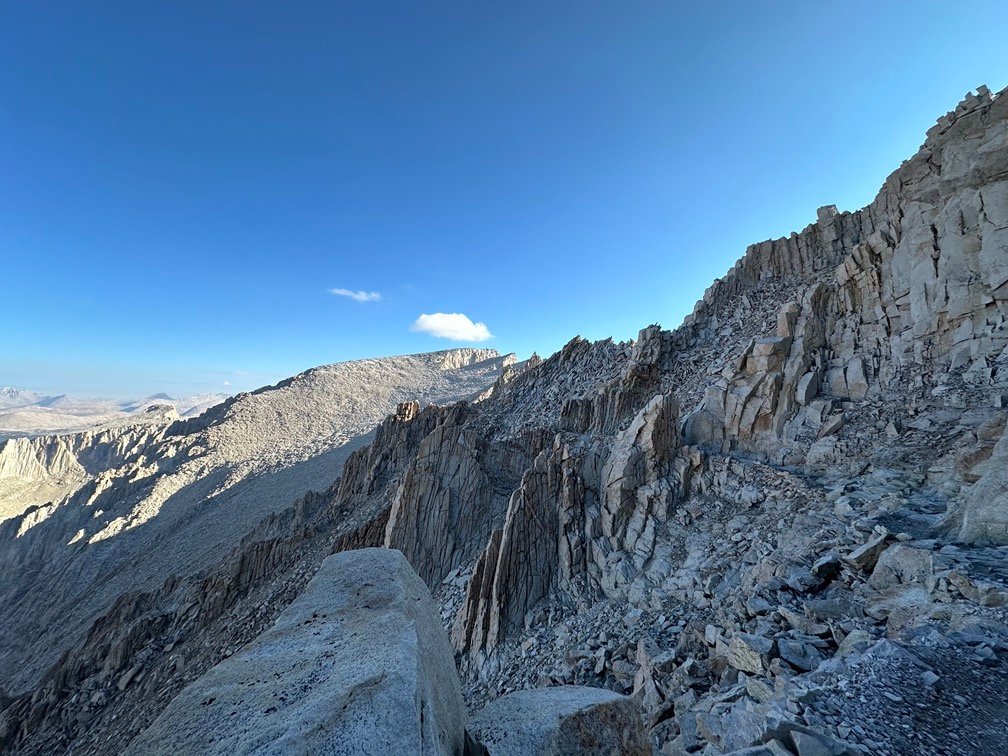

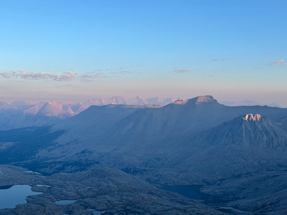
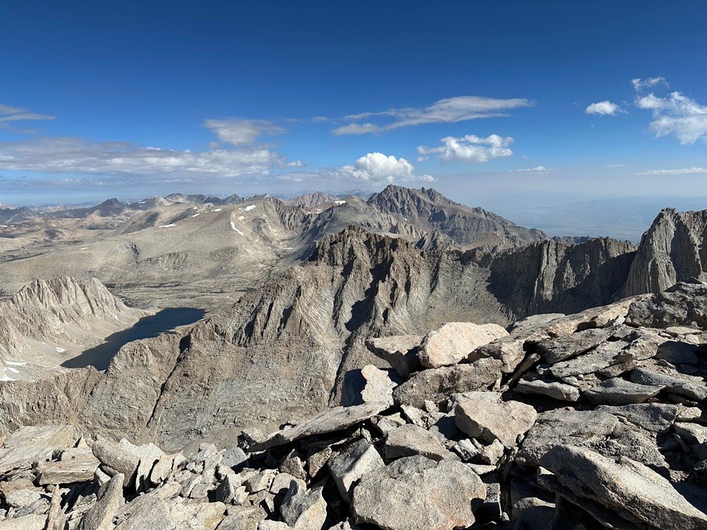
An occasional glance behind me gave me a peek of Mt Langley in the distance between the cracks in the ridge. The cracks also gave me a chance to warm up as the Sun could finally be felt on my skin. While I remember being very cold on previous hikes along this ridge due to the sun being blocked by the ridge most of the time, this time there wasn’t as much of a difference between shade and time in the Sun on this trek. Maybe that was due to the heat wave that was still boiling California for anyone unfortunate to be below 8,000 feet. And at 13,500 plus feet, it was almost pleasantly warm… sort of.

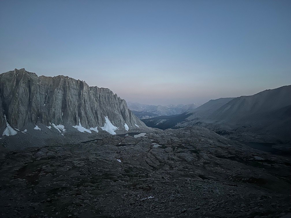
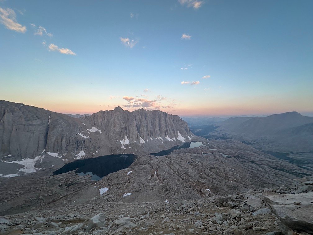
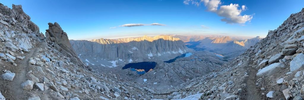
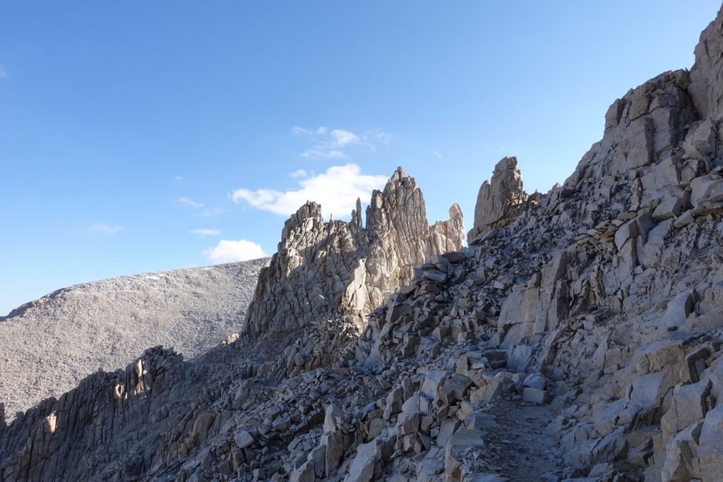
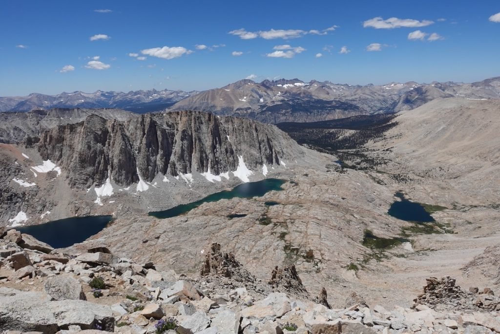
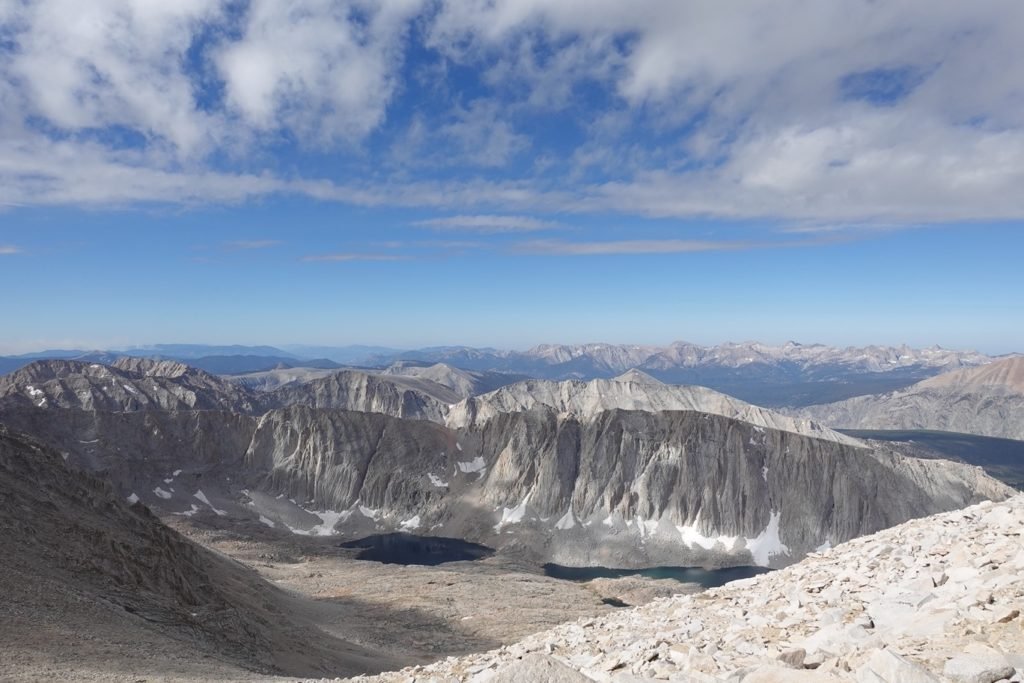
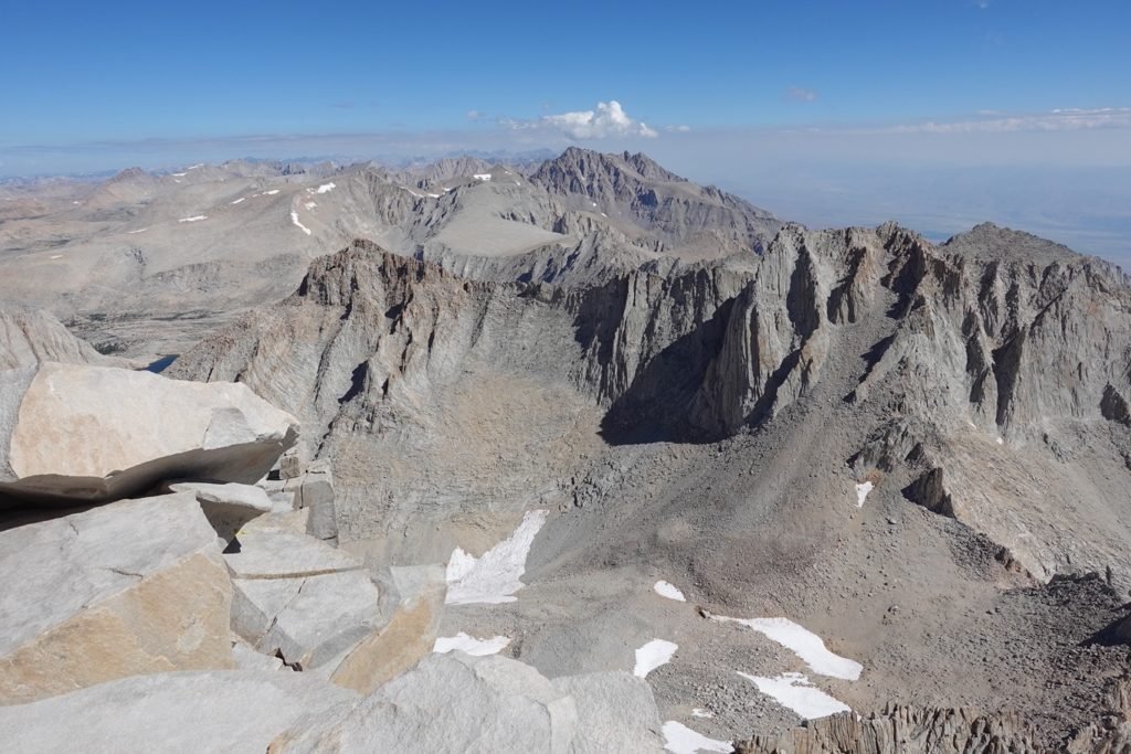
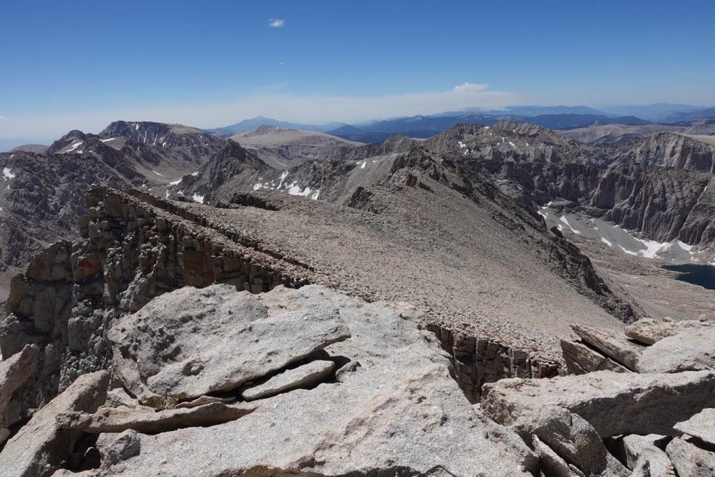
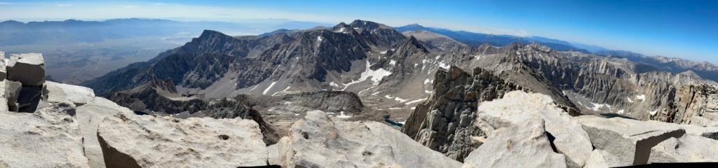
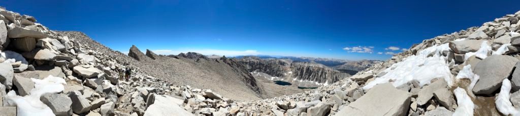
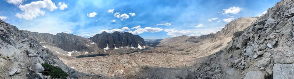
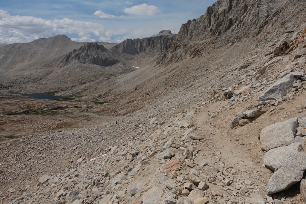
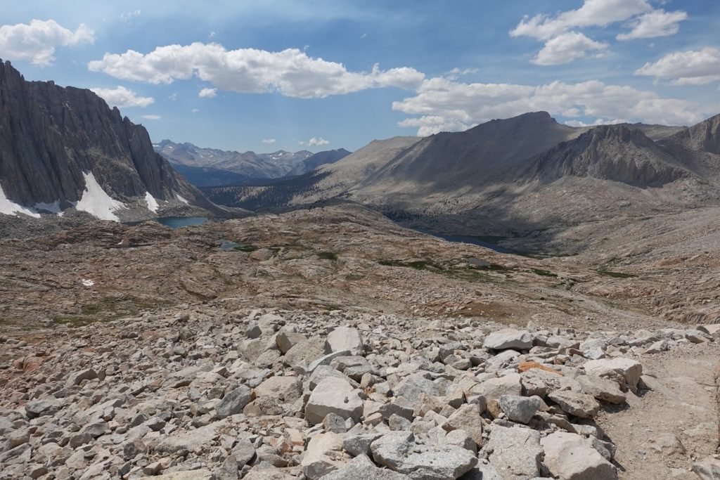
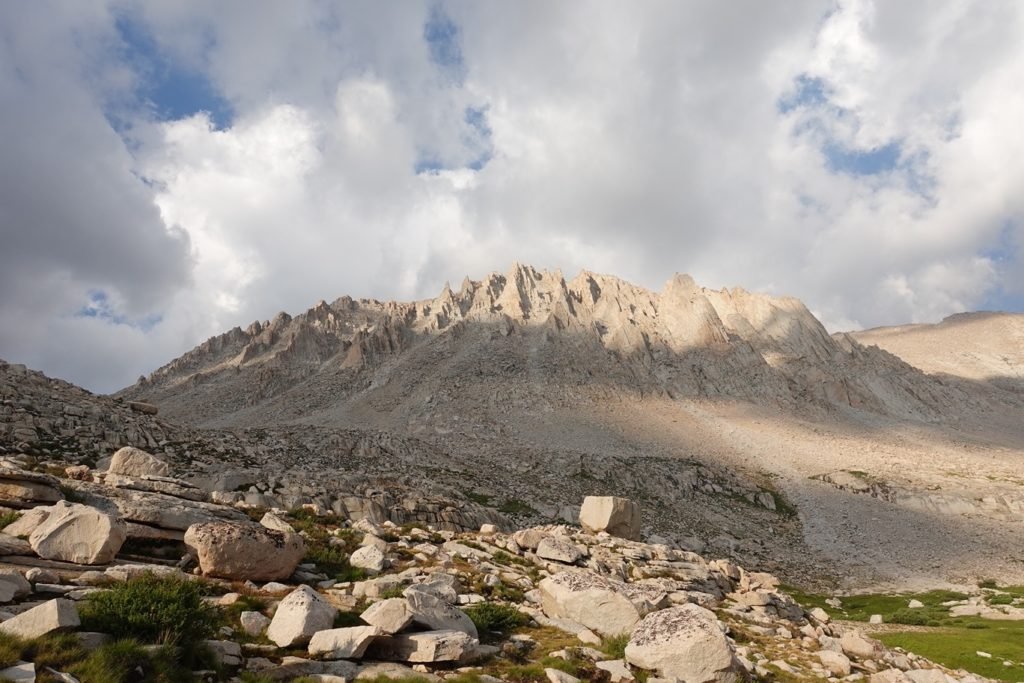
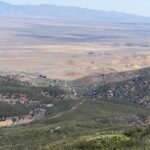
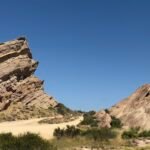
The hike curved around a lot of rock formations, S’brutal Tower being one of the landmarks along the ridge that getting around eventually gave you a great view of your goal.

And the entire area.


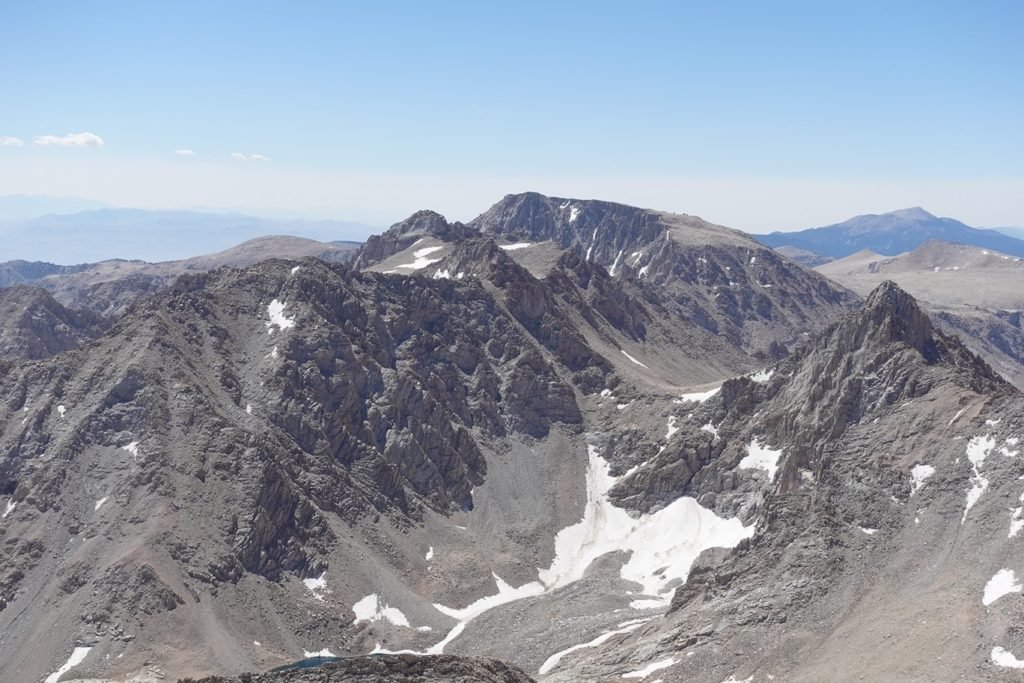
So many peaks all around and no way to tell which peaks are what (except for the ones I know on sight).
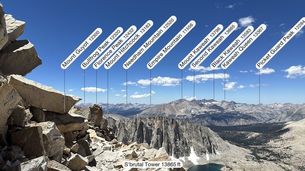
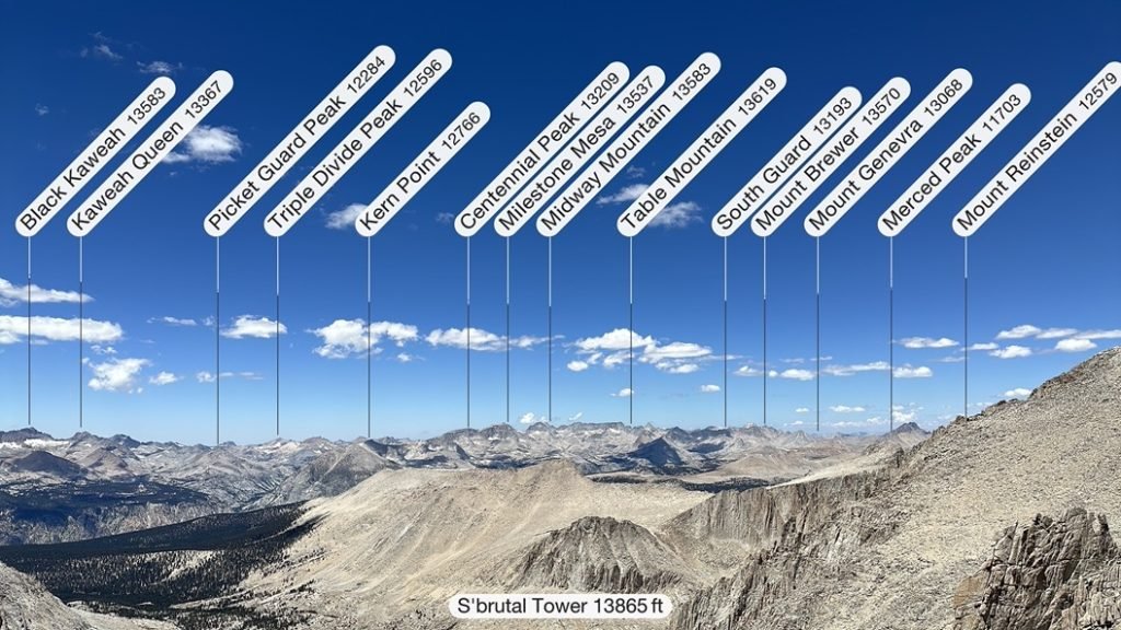
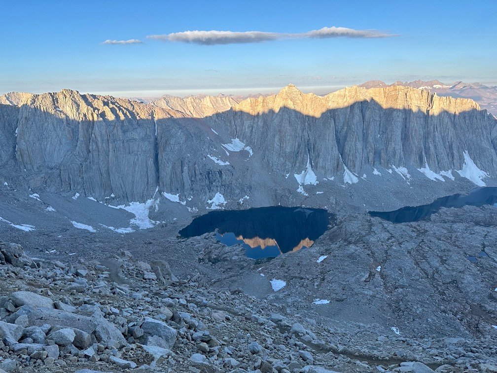
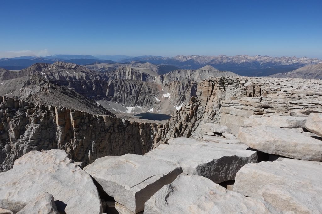
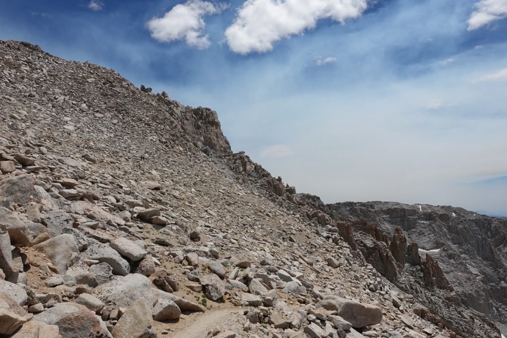
Once around S’brutal Tower, you can see the goal almost all the time as you hike along the remaining trail towards the Summit.
That might seem to be a good thing, but it was still 1.25 miles to go at that point.
It’s like the Summit was taunting you by being so in your face, but still seeming to be so far away. Of course, the altitude starts to affect you as well, so it makes the last mile all that harder.

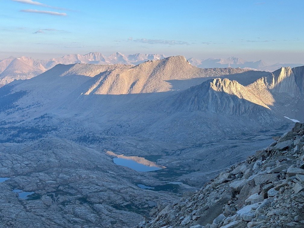
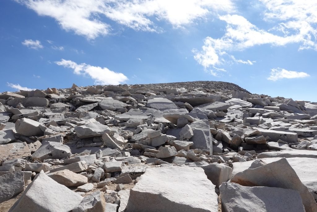
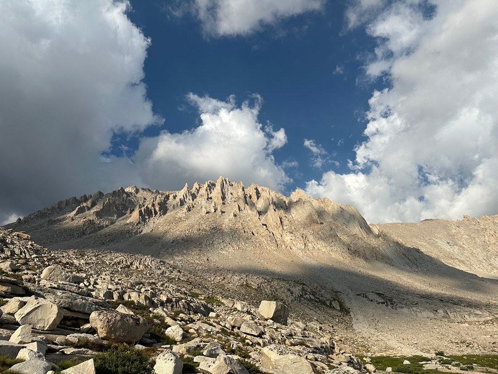
As I finally neared the Summit, I had to go through my first snow field of this trek. Fortunately, it was a very small bit of snow. The prior year, it would have been much bigger and probably impassible in July.

The JMT and Mt Whitney Trail takes a weird wide arc to the north before finally turning east towards the Summit. But no shortcuts for me, so I enjoyed the view before the final gentle climb to the Summit.

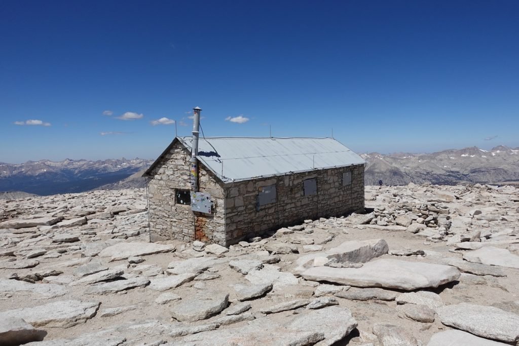
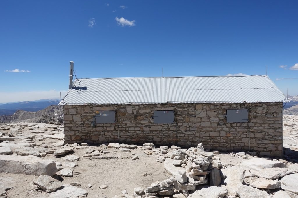
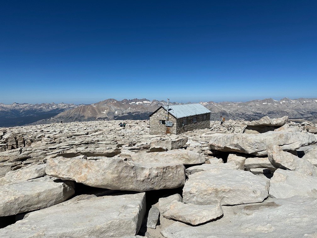
The familiar bump of the Summit appeared over the rocks. Shortly followed by the…
Summit survey hut.
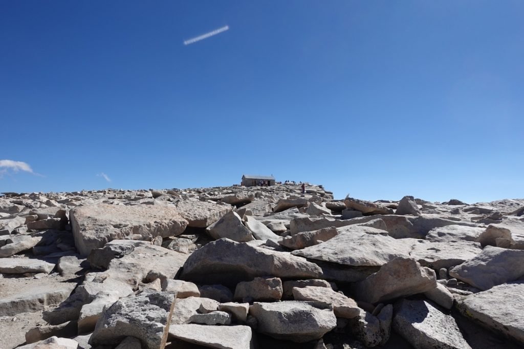
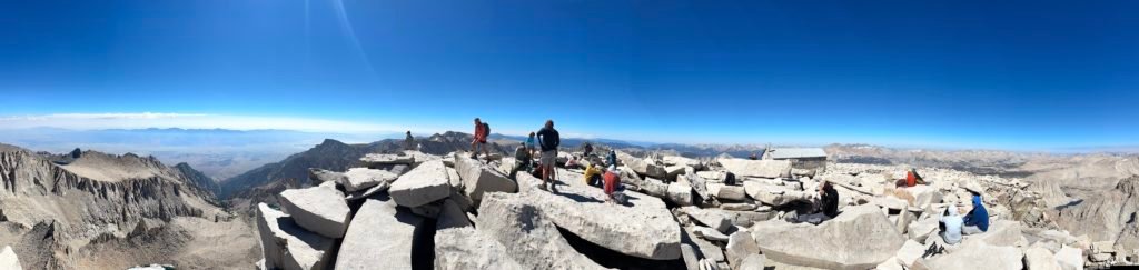
Once you saw the hut, you knew you had made it to the Summit and could soon celebrate!!
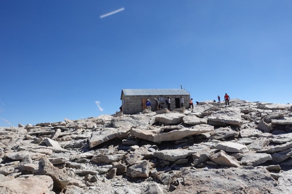
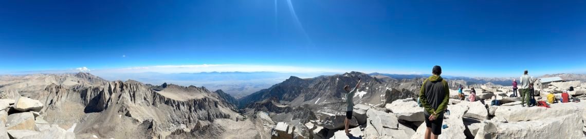
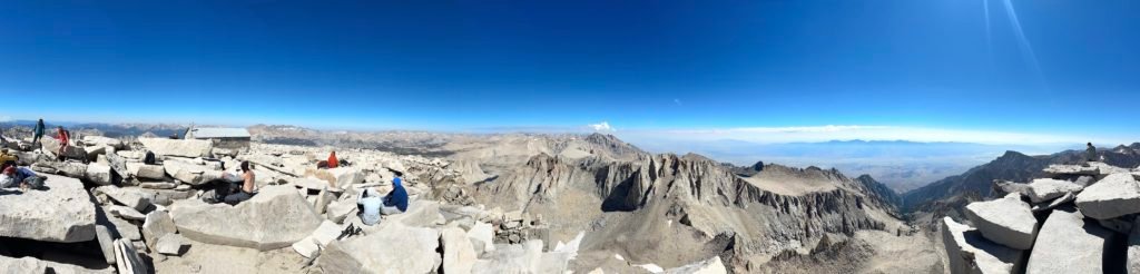
And look all around at the 360 degree view.


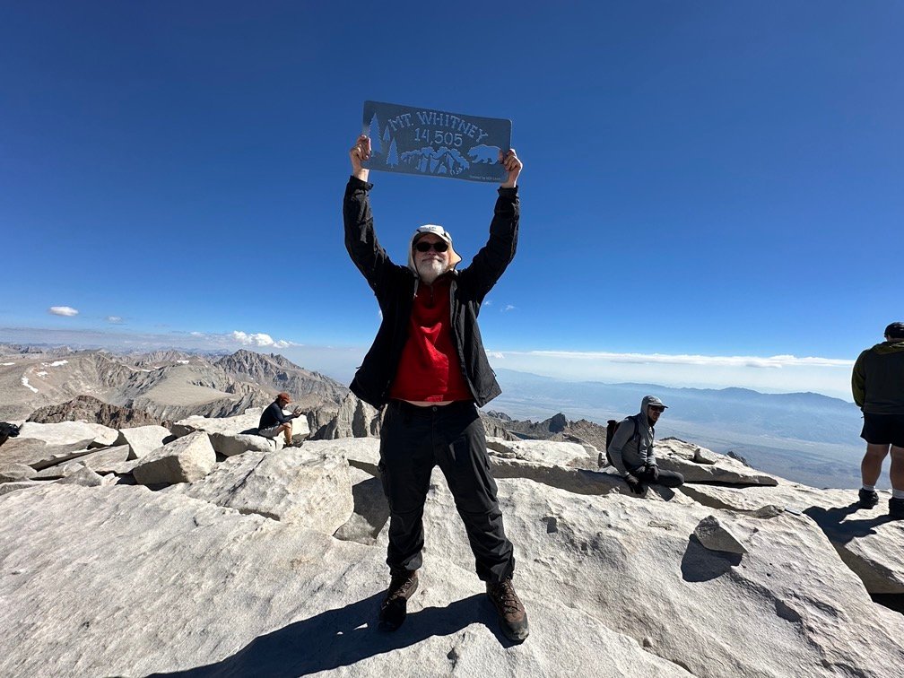
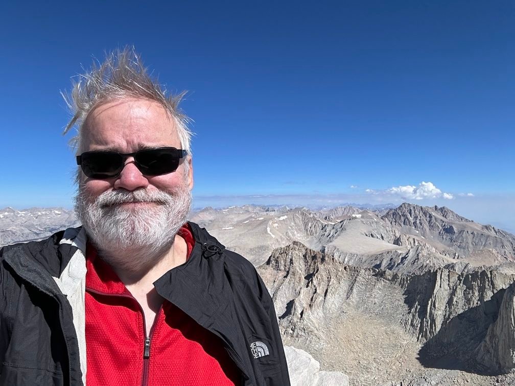
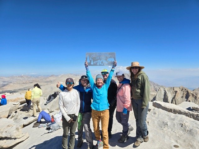
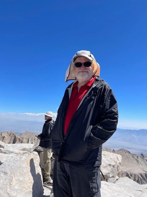
I had to document that I had actually made it myself to the Summit, of course.
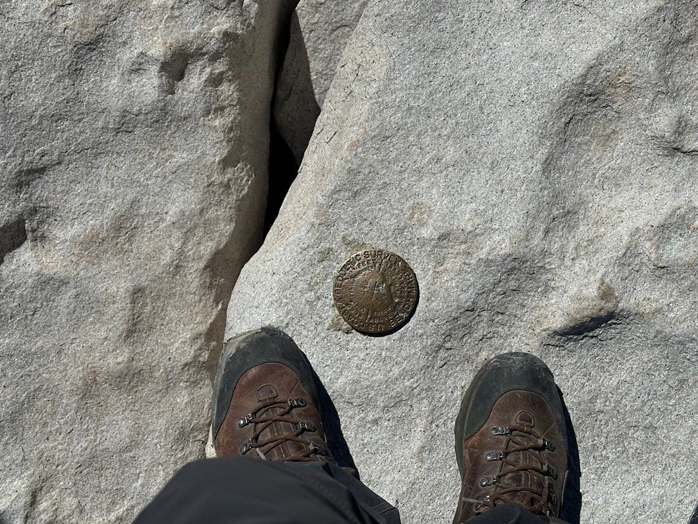
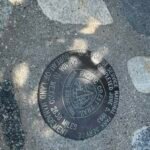
There are 6 benchmarks around the summit (plus some old pieces of other possible old markers). I’ve never been able to tell which is the most recent, but every time I reach Mt Whitney’s Summit, I’ve taken pictures of my feet at all 6.
And this plaque.
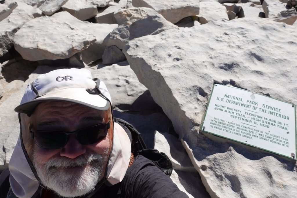
I’m not sure if any of them have the current ‘official’ height of Mt Whitney (14,505 feet), but in the end it doesn’t matter. I know I was there for the fourth time and could enjoy a job well done.

I celebrated by opening the second can of Diet Coke that I had brought with me from Lone Pine…
Or I would have if it hadn’t sprung a leak in my backpack the day before. Don’t know if it was the altitude change (although I had brought cans of Diet Coke to the top of Mt Whitney before) or the can just got punctured somehow, but that was the only disappointment of reaching the Summit.

Most of the pack train group did make it to the Summit eventually. Some ahead of me and some after. I guess their guide had gotten sick and one of the horse wranglers had led them all to the summit.
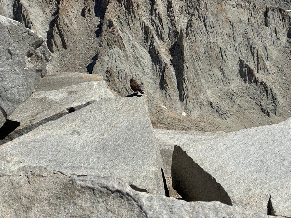
Even a bird made the trip up, but I assume it cheated by flying up instead of hiking along the trail with the rest of us.


The blue skies all around me reminded me of my choice to take a Zero Day down in Lone Pine to avoid some of the bad weather in the mountains. That turned out to be a great choice since the day before and this grand day had turned out to be perfect days to get to and climb Mt Whitney.
Sadly, I knew I had to eventually go down. My tent and most of my gear was still down at Guitar Lake and I didn’t have enough cold weather layers with me to survive overnight at the Summit without my gear.
Plus there was a glacier inside the Survey Hut.
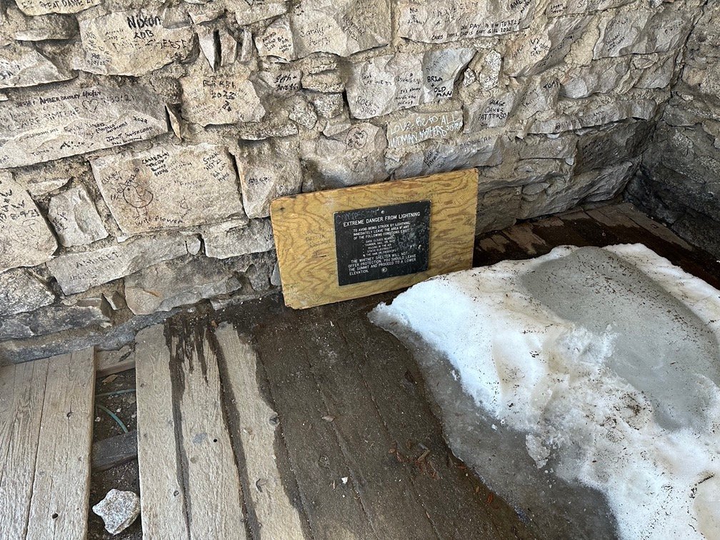
I had to wonder if that was left over after the huge snowfall from the winter of 2022-23 or just from the average snowfall we had in 2023-24. Without a door to the hut since the winter of 2017, I’m sure plenty of snow drifted into the hut each winter.
So, after signing the visitor log in front of the Survey Hut, I reluctantly started down from the Summit. Most of the scenery was similar, but seen in reverse order.

I did pause when I passed Mt Muir. It one of the prominent peaks along the ridge and one of the 12 official California 14ers. I had thought about climbing it on the way down, but just didn’t have the desire or energy to do it.
I had already climbed it many years ago (it was my third California 14er), so didn’t have a lot of motivation to climb it again.


At the trail junction, I saw a marmot as I pondered abandoning my gear at Guitar Lake and ‘aborting’ down to the Whitney Portal where I could get a burger and fries. While that was an option I had thought about during planning and some of more exhausting parts of this trek, I didn’t even think of it seriously at that point. If I had my gear with me and had camped at the Summit or junction, it would have been VERY tempting. But, I had at least 3 more days ahead of me and my gear was REALLY expensive. 😀

The descent down to the lake was pretty easy, but I was surprised to see a trail crew doing major repairs to the lower part of the switchbacks. Since it was still dark when I had gone through this section that morning, I hadn’t noticed anything amiss. I doubt the gaping holes that were there now had been left overnight.


I returned to my campsite a little after 4pm, meaning I had spent over 12 hours on the trail climbing (6 and a half hours), at the Summit (1 and a half hours), and descending (4 and a half hours). The climb up had taken me a little over an hour more than it did in 2020. Slowing down in my old age, I guess. Or the pre-dawn hike slowed me down a bit. Yeah, maybe I’ll just assume it was the later. 😀
I collapsed into my tent and just lay there resting for at least an hour.
I did get up enough energy to have some Ramen for dinner and wash my hiking shirts and underwear to make the next 3 days to Onion Valley less stinky.
Again, I decided not to jump in the lake to take a swim.
Still too cold for my tastes. I did soak my feet in the cold water that helped soothe the aches and pains.


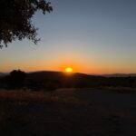
There was a point where I though I’d pack my tent and gear and try to get back to the PCT and get a couple miles up the trail.
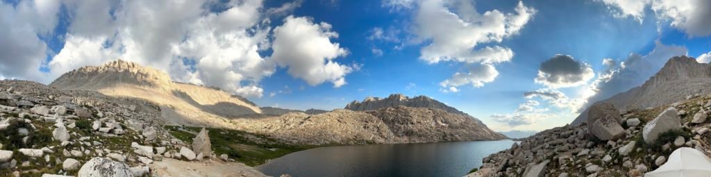
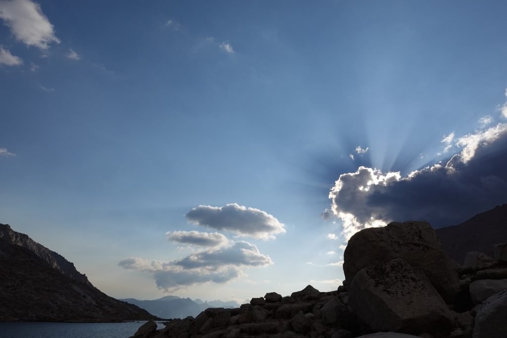
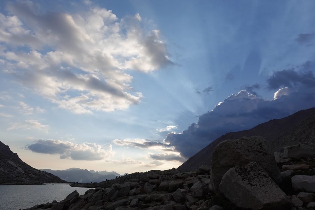
But I got back to camp too late and just enjoyed the sunset from Guitar Lake for a second night before drifting off to sleep. Spectacular, once again.
Second major goal of this trek successfully completed!!
You’d think I’d be bored of climbing Mt Whitney after four times, but there’s something special about it that never seems to get old to me.
Someday, maybe I’ll become a hermit and just live at the Summit. I’m sure backpackers would bring me water and food once word got out about the “Old wiseman of Mt Whitney”.
Old Wise-ass, more likely. 😀
Goal for the day: A spectacular success! Fourth time to the top!
Mt Whitney
4.8 miles UP – 6 hours 30 minutes
1 hour 30 minutes at the Summit
4.8 miles DOWN – 4 hours 30 minutes


(mileage and time approximate and based on GPS tracks which may not be exact and include diversions from the trail)


1 Pingback