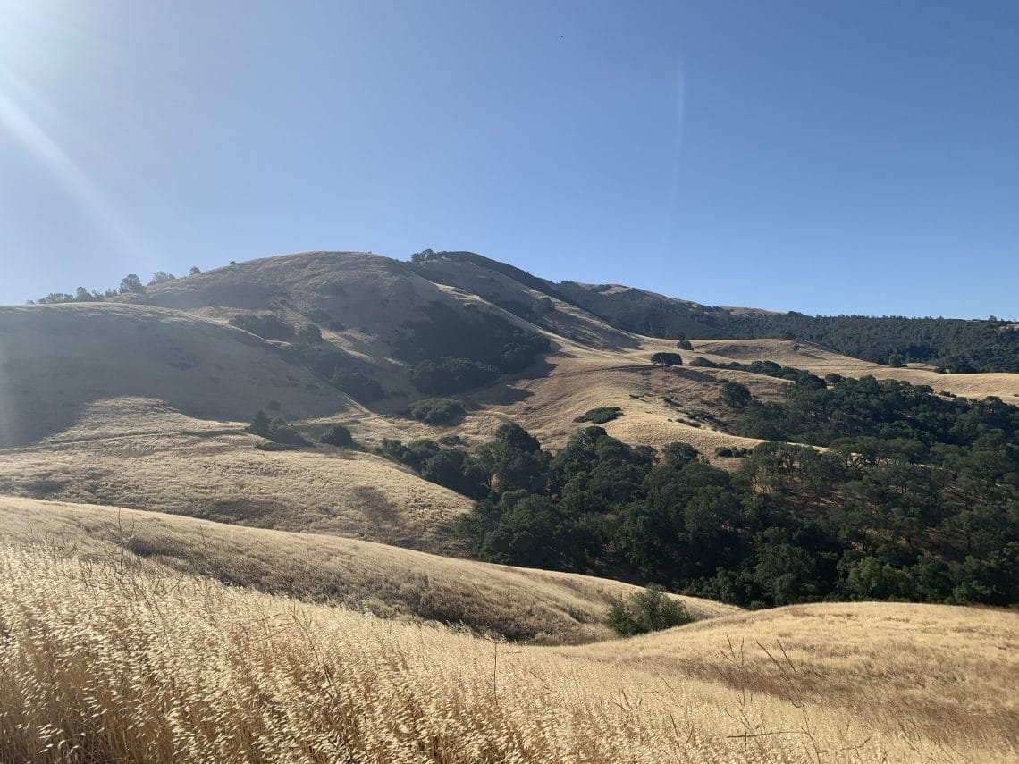
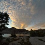
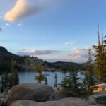
June started with a heatwave, but fortunately it cooled down by the first Saturday of the month. So, I decided to try to cross off some of the few remaining un-hiked trails at Mt Diablo State Park off of my list.
I decided to ride my bike to the Michell Canyon Staging Area. The gate is supposed to open at 8am, so taking my bike would allow me to get an earlier start. Imagine my surprise when I got there a bit before 7am and the gate to the parking lot was open. I could have driven my car. Ah well, it was a nice bike ride. (1)
After filling my Camelbak, I set off down Michell Canyon Road towards Red Road. I had not be able to do two trails beyond Black Point the previous time I was in this part of the park, so I headed down Olofson Ridge Road. It was a decent walk, but mostly downhill at that point.
When I hit the park boundary, I was happy that the gate did not have any ‘Private Property’ or ‘No Trespassing’ signs. That was a concern, since the trail that loops around to the other trail I wanted to finish (the rest of Red Road) was just outside the park boundary. I could have made my way along the fence, but it would have been a challenging hike to do that. Fortunately, I was able to stay on the ranch roads and start up Red Road. After a quick rest, I enjoyed the climb up. (2)
Again, the next gate did not have any signs, so I decided to head over to Burma Road. This approach would let me go to the main summit if I wanted to or go to the next set of trails I wanted to cross off my list (Meridian Ridge Road).
When I got to the junction with the Juniper Trail and Deer Flat Road, I had to make a decision. I could actually reach the Meridian Ridge Road trails by either route. One would just mean a LOT more climbing (the main summit route). Since I had been to the summit more times that I could count and with the roads in the park now open (probably leading to a lot more people at the summit), I decided to give my feet a break and go down Deer Flat Road. (3)
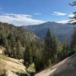
It had been a while since I had been in this part of the park, so it was a nice change of scenery. While not as much climbing to reach the main summit, there was a bit of climbing left to do to reach the Murchio Gap. (4)
Often, this junction was where I would head up and over Eagle Peak, but this time I continued along the Meridian Ridge Road onto the new part of the road that I had never bothered with. There really wasn’t any particular destination along the trails in this area, so that’s why I never got around to hiking them.
The trails were in a ‘H’ formation, so I did have to go down some of the spurs that connected to other trails and double-back on myself to reach the center part of the trail that ran down the ridge line. This, of course, added to my mileage for the day. (5)
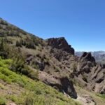
The main part of the trail went down a VERY steep ridge line, almost to the point that I have to wonder why they put a trail there. It was slow going to avoid slipping on all the loose dirt and stones. It actually seems a bit familiar, so it’s possible I had hiked it before after all and since it was so traumatic that I blanked it out of my memory. 🙂
Having survived that steep descent and after having to double back on another of the spurs, I reached the end of the un-hiked trail where it joined to the Back Creek Trail. Goal!
I did have two and half miles left to get back to where I started. but it was mostly downhill from that point. And not too steep. (6) I did run out of water at that point. Since I didn’t go to the summit I couldn’t refill my Camelbak without a detour to the Juniper Campgound.
Fortunately, it wasn’t that hot and the strong winds that blasted me all day helped keep the day cool enough to avoid the lack of water from being a problem.
As I rode my bike home (thankfully mostly downhill), I decided to try to go down Ygnacio Valley Road instead of taking Turtle Creek Road over to Treat Blvd. The problem was that this meant a bit of a climb before the road descended down Lime Ridge. And since the traffic was pretty bad that afternoon, I decided to take Cowell Road back to Treat Blvd. I decided that Ygnacio Valley Road was probably best avoided on my bike unless it was early in the morning when there wasn’t a lot of traffic.
So, with the trails I crossed off my list that day, there were only 3 main groups of trails I still have to hike to finish hiking every trail in Mt Diablo State Park. I think 3 or 4 day hikes would be enough to finish them all, so I should be able to finish them off this year with plenty of time to spare.
Which worries me a little bit since I had a bad thought that I may be able to actually hike ALL the Mt Diablo trails in this calendar year if I went back and re-hiked some of the trails I had already hiked in the previous 6-7 years. (7)
So a little under 16 miles on my bike and a little over 16 miles hiking. 32 miles in a single day. Did I mention my feet hate me? (8)
Footnotes:
1) My feet disagree with this comment.
2) My feet did not enjoy the climb.
3) My feet agree with this comment.
4) My feet thinks they were lied to when we chose not to go to the summit and take the ‘easier’ route.
5) My feet curse me.
6) My feet thanked me for the gentle descent.
7) My feet have officially gone on strike. 🙂
8) Yes, I have and they do. 🙂
On the second Saturday of the month, I decided to tackle another area of Mt Diablo State Park that still had trails that I hadn’t hiked.
In this case, it was an area along Morgan Territory Road. The trails don’t really go anywhere, so I’d only hiked a couple of the trails that crisscross this area. Fortunately, the trails were laid out so that I could do a pattern that didn’t require a lot of hiking over the same trails or had a lot of dead end trails that would require retracing my steps.
One surprise was a trail that wasn’t on the map, but had trail markers and a name: Perkins Trail. It was a little detour from the trails on the map that I had expected to hike, but had a surprise: An old stone dam.
It was a nice place to have a short break. After that, it was just one more major trail, unfortunately it was the steepest hike of the day. It was technically an utility road to the base of several power towers.
But it did have a great view of the area at the end of the road. Another short break and I made my way down and was able to cross the whole area off my list of trails to hike at Mt Diablo.
So there’s only one large area left with un-hiked trails for me to do, along with a small area. The large area should be doable in a single day. The small area has one obstacle: I haven’t figured out how to get to it. It doesn’t have trails that intersect with the other trails inside Mt Diablo State park and is surrounded by private property.
Wheres there’s a will, there’s a way.
The next day, I felt pretty good so decided to head to Mt Diablo again. And I choose to target the last big area I had left: Curry Canyon Road
Since the roads are now open, I drove to Curry Point to start. When I had descended from the summit via Frog Pond Road many weeks earlier, I had run out of steam and failed to take the side trails to Chase Pond and Sheepherder Spring.
Sheepherder was a short, but pleasant hike (of course, I was starting with fresh legs this time). Chase Pond Road was more challenging, but a nice hike on non-tired legs. The ‘pond’ was dry, so I looked at the grassy indentation while I had a nice break. In retrospect I may have been able to do this side trail the last time I was in this part of the park, but regardless I can now cross it off my list.
Then I had the harder part of the day ahead of me. At the end of Curry Canyon Road, there are several trails that climb out of the canyon and end at the state park’s boundary. This meant a good deal of climbing up and then turning around and descending back, only to repeat it four times.
Curry Cave Rd, Grizzly Bear Rd, and Knobcone Point Road were these demanding climbs. After completing those, I had had a nice break and lunch at the gate that unfortunately led to private property and forced me to turn around.
The two and a half miles back up Curry Canyon Rd wasn’t steep, but at the end of the day the slow ascent seemed to taunt me. By the time I reached my Jeep, I was glad for a nice cold Coke.
There was one more trail inside the park that I intended to do that day since it would be a easy stop along the road on the way back home, but I decided to skip it for now. It would be a quick stop to hike it someday soon. Diablo Ranch Trail would have to wait.
So, only three trails in two parts of the park to finish before I can say I did all of the trails at Mt Diablo!
One more down… one to go.
I decided to start another day by driving into Mt Diablo State Park to hike Diablo Ranch Trail to cross one more trial off my list.
It was a straight forward climb up and then back down the 1 mile long trail. Somewhat anti-climatic.
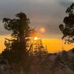
I had thought about going over and trying to do the last area with un-hiked trails, but decided as long as I was inside the park, I’d drive up to Juniper Overlook and then hike up Juniper Trail to the main summit.
The drive reminded me why I didn’t like driving into the park: Lots of slow moving traffic and bicycles. Regardless, I made it to the Juniper Overlook and started up towards the summit.
This trail wasn’t that busy until I hit the lower summit parking lot, but the actual summit wasn’t as busy as the last two times I had been up there during the COVID-19 closures.
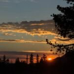
On the way down, I decided to go across Moses Ridge and loop around back to Juniper Campground. This may be because I hadn’t hiked that trail for a while and subconsciously was thinking that I may try to hike ALL the trails in Mt Diablo State Park by the end of the year instead of just settling for hiking all of the trails over the past 7 years or so.
Always nice to have another goal as you’re nearing finishing a goal. 🙂
And… GOAL!
Just finished doing the last un-hiked trails at Mt Diablo State Park: Pheasant Run and Quail Run Roads. Like a lot of the last few groups of trails, this required some careful planning to reach the trails and a lot of hiking back and forth on dead end trails. While the hike wasn’t hard, the views were nice and that last step when I finished that last piece of trail was a nice feeling.
What started as a errant thought earlier this year, led to me attempting to hike all those little out of the way trails and roads that I had never hiked before.
Feels good.

Comments by WanderingJim
PCT DAY 85 – CA Section H
"No cell service in many parts of the PCT. Not dead yet."
PCT or BUST!
"Yes, I’ll be going through there by early August"
JMT 2020 Day 3
"I'm afraid I have no idea. Not really a fisherman, so don't..."
JMT 2020 Trek Day by Day
"Yeah, but with 9,000 pictures, it's hard to label each one..."
Kilimanjaro – October 2019
"Everest Base camp is on my list too. Mostly since I know..."