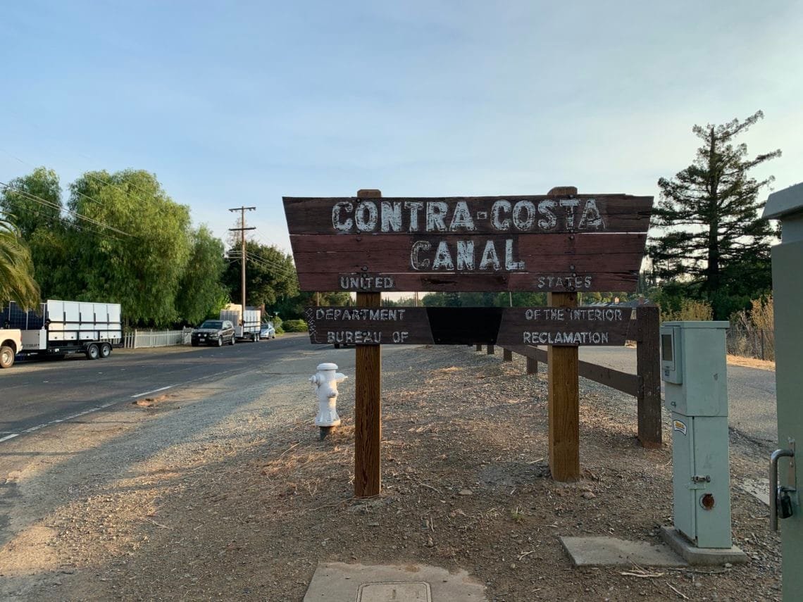
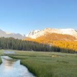
The first weekend in October started with a morning bike ride to the eastern side of the Contra Costa Canal Trail. Since this trail runs right near my home, it’s a easy trail to get to and do.
I have been wanting to try to bike the entire trail in one ride, so took a bottle of Gatorade with me and biked to the north-eastern end of the canal trail. 5 miles there and 5 miles back to my neighborhood.
I still felt pretty good at that point so continued west after having a sip of my Gatorade. I passed through the tunnel under the BART tracks and under the freeway, before entering Pleasant Hill and crossing several streets.
After passing over Gregory Lane, I knew I might as well go all the way to the end since it was only 3 and a half miles left. A couple of miles later, I finished my Gatorade and ate one of my snack sticks.
The trail from this point has some ups and downs that always make me wonder why they didn’t level out some of the hills along the canal (which naturally was pretty level overall to allow the water to flow).
Fortunately, a lot of them had a downward slope that led right into a upward climb, so if I timed my descent right to pickup enough speed, the uphill part usually was pretty easy.
As I hit Muir Rd, I smiled at reaching the north-western end of the canal trail. Since I still had to get home, I turned around and headed right back.
I stopped at a Seven-Eleven and got an new bottle of Gatorade to quench my thirst for the ride home. The ride back was uneventful and I didn’t even think about calling for an Uber. 🙂
So, I finished biking the entire Contra Costa Canal trail in both directions! 29 miles. It was a bit tiring to do that long of a bike ride, but the weather was fairly mild that day.
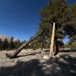
The next day, I decided to attack one of the three remaining areas of Mt Diablo with some trails that I had not hiked in 2020 yet.
Starting from where the Burma Road trail crossed the North Gate Road, I headed down towards Barbecue Terrace Road via Buckeye Trail and the remaining part of Stage Road that I hadn’t hiked the previous weekend.
Barbecue Terrace Road wasn’t hard, but did have some elevation gain until it hit Wildcat Trail and the South Gate Road. I took a break at the closed Wildcat Group Camp for lunch and then decided to head over to finish off the last part of Burma Road that I still had to do in 2020.
That meant hiking up to the Junction of the North Gate South Gate, and Summit roads. I could have gone up the Summit Trail, but since that would add a little mileage so I just walked along the road and then headed north on North Gate Road.
Heading up Angel Kerley Road, I could have gone down and hiked the last segment of Burma Road and then retraced my steps back to my Jeep, but there was another trail that went from Mothers Trail to the northern corner of Burma Road. It wasn’t an official trail and wasn’t on the official maps, but I’ve seen it as I passed by. Since it would avoid having to retrace my steps on Burma Road and was mostly level, I took it to get to the other side of the section of Burma Road I hadn’t yet hiked in 2020.
I did have a little bit of burrs attach to my socks along the way since the trail was pretty narrow. Unfortunately, this area was mostly in direct sunlight with very little shade. AND it was warmer than the weather forecast had said it would be. This led to a fairly hot finish to my day.
After having to climb a little to reach Burma Road, I headed down and around the elbow back to the Angel Kerley Trail junction. The heat was making me remember why I always made a point of hiking this area of Mt Diablo in the morning: The afternoon heat was killer without shade.
I reached the point of the Burma Road I had hiked earlier in the year, but didn’t celebrate finishing this area of trails.
Why? Because the descent from this point to the North Gate Road was the steepest trail in Mt Diablo State Park. It was always a pain to climb up and a pain to descend on. The loose dirt and rocks made the descent slow and tricky to find a good route that wouldn’t see me slipping and crashing down the steep hillside.
I also ran out of water and Gatorade along the way, so I was both parched and exhausted by the time I (safely) reached my Jeep,
I grabbed a can of luke-warm Diet Coke and drove home, having cleared this area of unhiked trails. Just under 10 miles in 5 and half hours.
That only leaves Michael Canyon Road, Falls Trail, Old Prospectors Road, and a few connector trails around them to finish in 2020.
I could do them in one long day hike, but more than likely I’ll do them in 2 day hikes. So that could mean that I finish by the end of October, but I have been thinking of waiting to hike the Falls Trail until we get a significant amount of rain so the waterfalls are flowing.
But there shouldn’t be any problem finishing the remaining trails by the end of the year.
The next weekend started with a 22 mile bike ride. Since it was the weekend, I decided to go all the way to the north end of the Iron Horse Trail.
But instead of just turning around and going back to my home, I decided to head east along the streets of Concord to the north-eastern end of the Contra Costa Canal Trail and take that trail home.
It was a very minor change of pace.
The next day I took aim at the Mitchell Canyon area trails at Mt Diablo that I needed to cross of my list this year. Since it had been a while since I climbed to the top of Mt Diablo’s main summit, I decided to incorporate that into my planned hike.
So, I started at the Mitchell Canyon staging area and headed down the canyon to Red Road to get to a little tiny segment of trail that I hadn’t hiked this year yet.
Then it was up past Juniper Campground and to the summit. Not a lot of people on the trails until I neared the summit.
To descend, I went down Bald Ridge and then finished by completing the rest of the Mitchell Canyon Road. 16 miles altogether.
That only leaves the Falls Trail loop and Old Prospectors Gap Road to finish (plus a tiny part of the Old Finley Road that I can’t do until they finish construction on an old culvert).
Unfortunately, Old Prospectors Gap Road dead-ends at private property, so it’s a 1 mile hike down about 900 feet and then 1 mile climb back up to the North Peak Trail junction.
But I should be able to do that in one day and with over two months left in the year, it’s a sure bet I’ll finish hiking ALL the trails in Mt Diablo State Park this year.
It may be hard waiting to hike the Falls Trail until we get some good rain storms through the area so the waterfalls are overflowing with water.
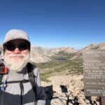
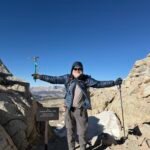
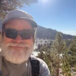
I was fortunate that my sore ankle from the previous weekend climb of White Mountain Peak turned out to be nothing major and it felt good enough to go out to hike in Las Trampas Regional Park.
Starting from the Ringtalled Cat Trailhead, I decided to try a trail labeled Dewies/Birthday on my map. I kind of regretted is soon after. It got very steep, very quickly. Much steeper than the Madrone Trial that I had used in the past from this trailhead.
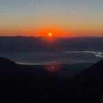
The good thing about the steepness was that it got me up above the trees to see the sun rise above the low clouds to the east.
I got several different views of the sunrise and Mt Diablo as I climbed up higher. It was a nice start to the day.
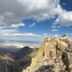
Once I reached the Las Trampas Ridge Trail, it unfortunately was covered in a low hanging cloud. The views along this ridge were always great and it was a bit disappointing to not get the full view.
I did pop up to Las Trampas Peak, even though I couldn’t see anything from up top. It was a short detour, so nothing lost.
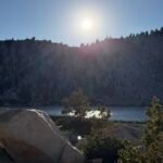
Then I reached Vail Peak and had to decide if I would take the short route (6 miles for the whole loop) back to the trailhead or continue on. Despite the lack of a view, I decided to continue south and take Sulfur Springs Trail back around to the trailhead.
I then had to go down a trail called ‘Point of No Return’. Nothing ominous about that, right?
Maybe it was. I actually ended up taking a wrong turn and ended climbing part way up a gully. Once I figured out it wasn’t the right way, I had to backtrack a bit to get back to the right trail and return to the trailhead.
9 miles in 5 hours, not a bad morning’s hike.


Comments by WanderingJim
JMT 2020 Day 3
"I'm afraid I have no idea. Not really a fisherman, so don't..."
JMT 2020 Trek Day by Day
"Yeah, but with 9,000 pictures, it's hard to label each one..."
Kilimanjaro – October 2019
"Everest Base camp is on my list too. Mostly since I know..."
Kilimanjaro
"You started hiking with Kilimanjaro first? Even I worked my..."