
Last year, I tried to climb White Mountain Peak late in the season, but came up short when faced with the final 1,000 foot climb. I think I had a bug or something.
So on my way to my big Shepherd Pass hike in the Sierra Nevada mountains, I decided to take another shot at White Mountain Peak.
To get used to altitude it’s useful to hike at some intermediate altitude so your body can adapt to the lower oxygen before going higher. My initial idea was to hike out to Clouds Rest in Yosemite. Driving from sea level to 12,000 feet and then climbing a 14,252 foot peak is generally not the best way.
I took Diamox for a few days before starting, so hoped that and my experience at altitude would suffice.
The first part is to drive from Bishop to the White Mountain Road. The first 10 miles is paved and a pleasant enough drive, but after that it’s a rough 4×4 road. The previous year, I had slashed one of my tires on this horrible road.
Remarkably, this year they must have done some repairs because it was in much better condition. Instead of mostly sharp stones to drive over, it was a mix of sand, dirt, and sharp rocks. As long as you were careful, it was a decent drive in comparison.
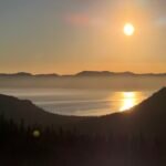
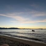
So this year, I reached Barcroft Gate with all four tires intact. Being a Saturday, there were a good deal of cars and trucks parked there. Finding a level spot, I pulled my Jeep to a stop and surveyed the area. I found a nice spot a little up the trail to watch the sunset and to test out my new camera. And then went to sleep in the back of my Jeep. It was easier than setting up a tent and was a pretty decent way to sleep.

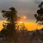
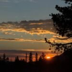
Waking up before sunrise, I had a couple of donuts for a quick breakfast and then set off up the trail.
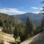
The trail was mostly a 4×4 trail that leads to the Barcroft Research Station and then all the way to the summit. I imagine it was created to build and support the radio/weather station equipment located at the summit.

After enjoying the sunrise from a nice spot along the trail, I passed the research station and then the small observatory dome. There were a few dips in the trail, but as I approached the last dip before the summit, I made sure not to hesitate. The previous year, I had seen the last dip and the final 1,000 foot climb and couldn’t continue. In situations like this, it’s better to just go for it and ignore the steep climb ahead of you.

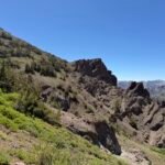
Then the switchbacks began. Not too many, but enough that the climb was slow going. I had to keep reminding myself that the trail was built for vehicles to reach the top, since otherwise the design made ZERO sense for hikers. Not only could they have avoided most of the dips in the trail by routing a thinner trail along the ridge line instead of over it, they could have shortened the switchbacks to be a more direct path to the summit.
Nonetheless, I made my way up until a snowfield blocked the path. Looks like there were 3 detours that people had used, so I chose the closest one (but not necessarily the easiest one).
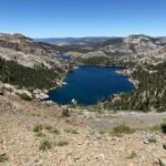
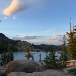
Just before reaching the summit, I saw a couple butterflies and I thought about all the butterflies I had seen the previous weekend at Lake Tahoe. But those two were all I saw, so it would not be surrounded by a spectacular swarm of butterflies as I was on Mt Rose.
As I stepped onto the summit, I realized the building they had constructed up there was similar to the stone hut on the top of Mt Whitney. Just a few antennas and instruments attached to the building, so not too imposing.
I celebrated my successful climb by signing the register and taking a LOT of pictures. I even had to take some safety pictures, since I was still figuring out all the new features of my new camera and and the first few pictures of me at the summit turned out to be blurry.

After enjoying the view, it was time to descend back to my Jeep at the gate. As usual, it took me longer to complete the hike than I expected, so I would not be able to get to Lone Pine in time to pickup my permit for Shepherd Pass that I planned to climb the next day (I’m a glutton for punishment). I found a spot with cell reception and called the Inyo wilderness office and had them put the permit in the night box so I could pick it up after the visitor center closed.
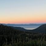
I did get treated to a spectacular view of the sun setting behind the Sierra Nevada Mountains and some clouds on my drive down 395, so that was a nice end to the day.
Onward to Shepherd Pass!!


Thelma Wong
September 3, 2019 — 11:56 pm
Very nice accomplishment, Jim. So happy to see that you made it all the way to your destination. Very proud of you!!! ^-^