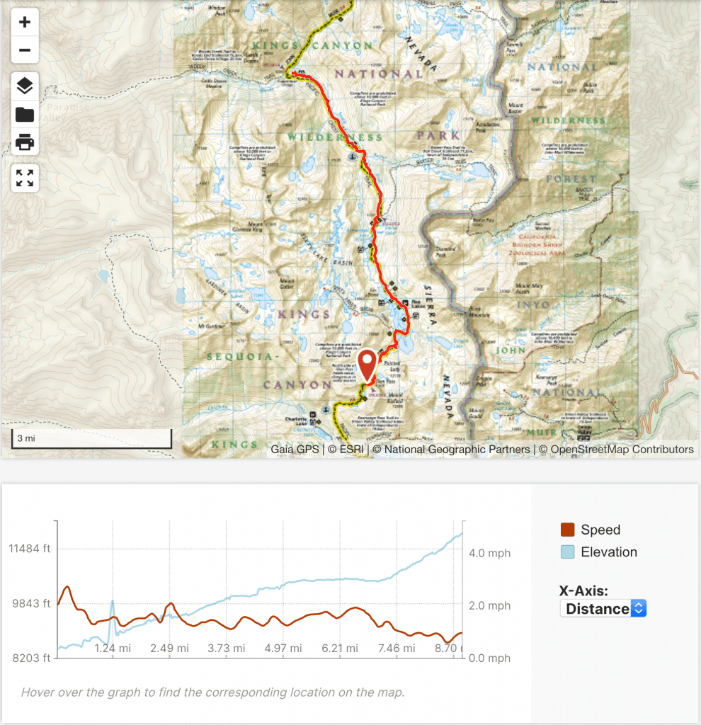
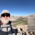
Goals for the day: Glen Pass (11,926 feet) and Charlotte Lake for Resupply
I woke up to hazy skies, but no rain or dark clouds. Despite the rain the day before, my clothes were all dry by morning. Packing up my gear, I started up towards Glen Pass (11,926 feet).
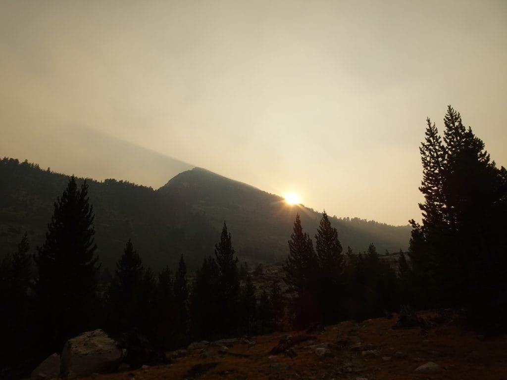
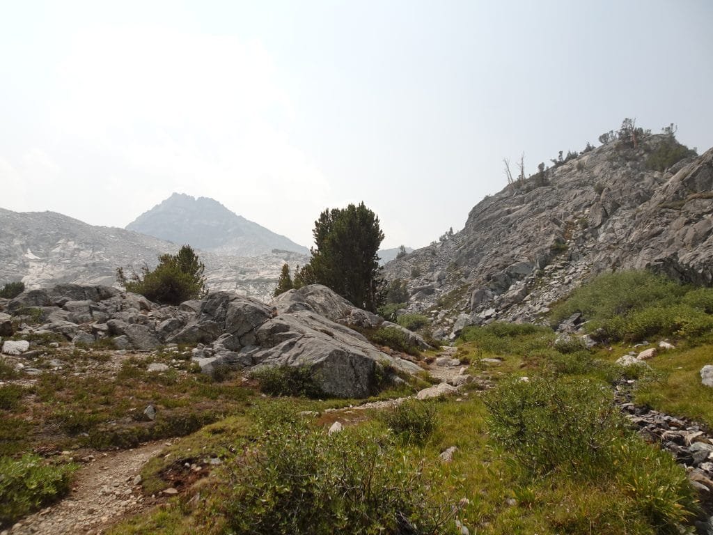
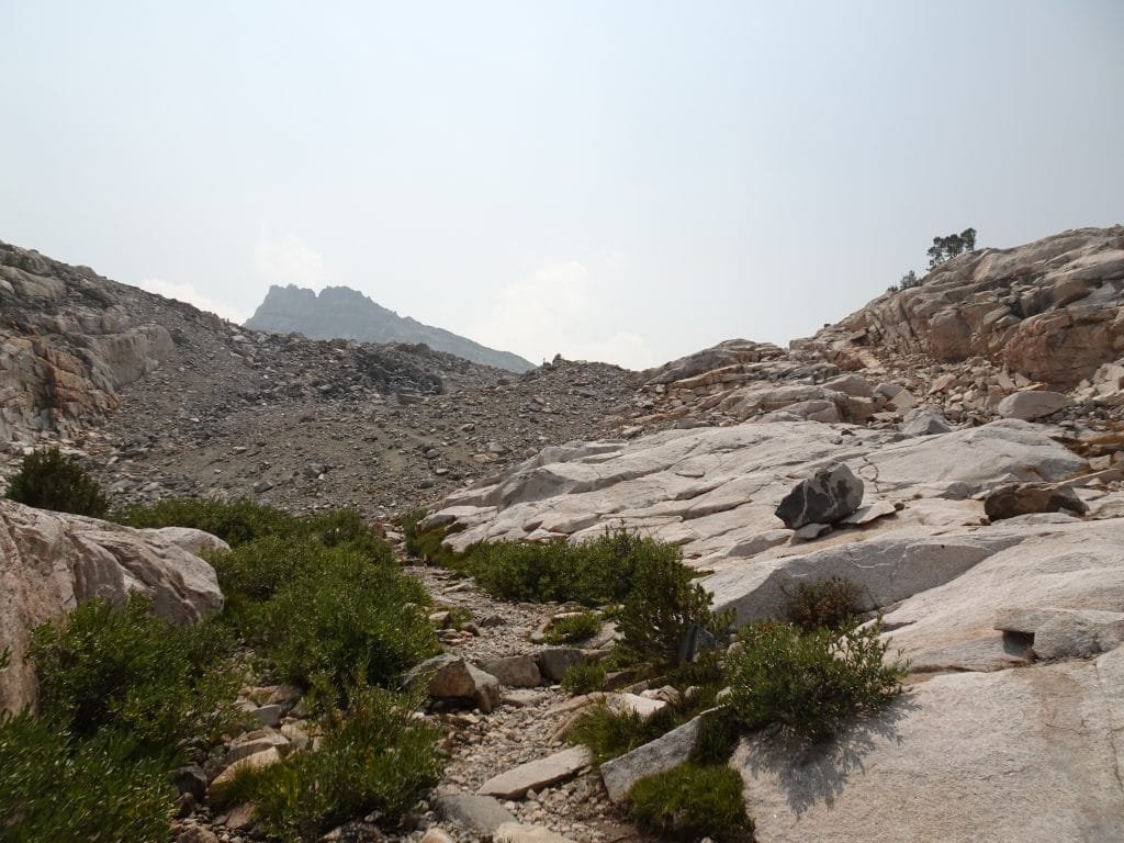
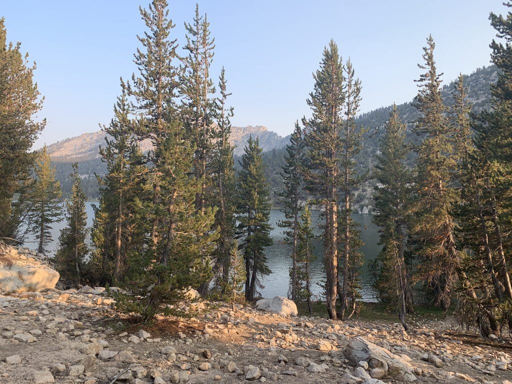
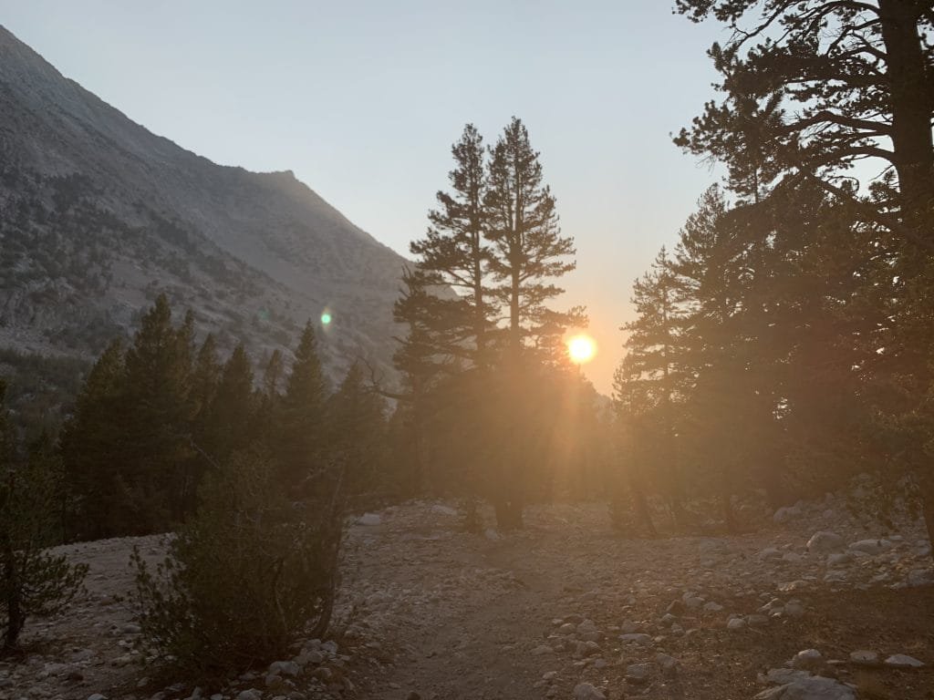
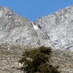
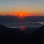
There were some nice views as I climbed up, with some color from the sunrise peaking out now and then.
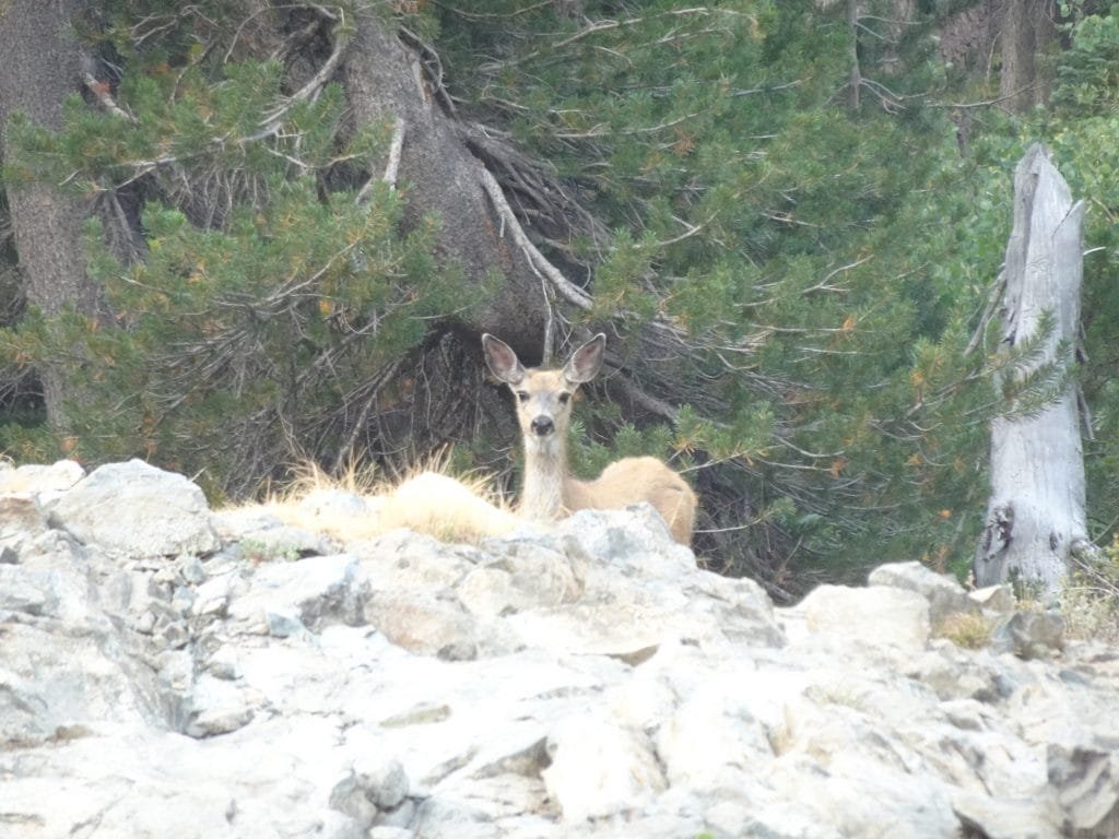
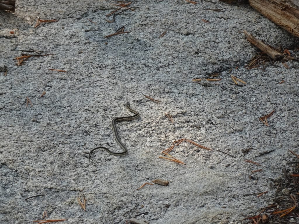
I saw a deer and then a… Snake!
Well, a tiny, little green snake. 🙂
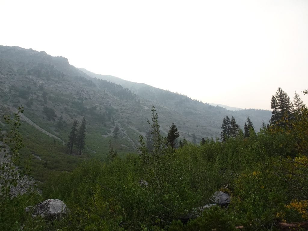
About half way through the climb to Dollar Lake, I started smelling smoke. At first, I assumed it was someone with a campfire nearby.
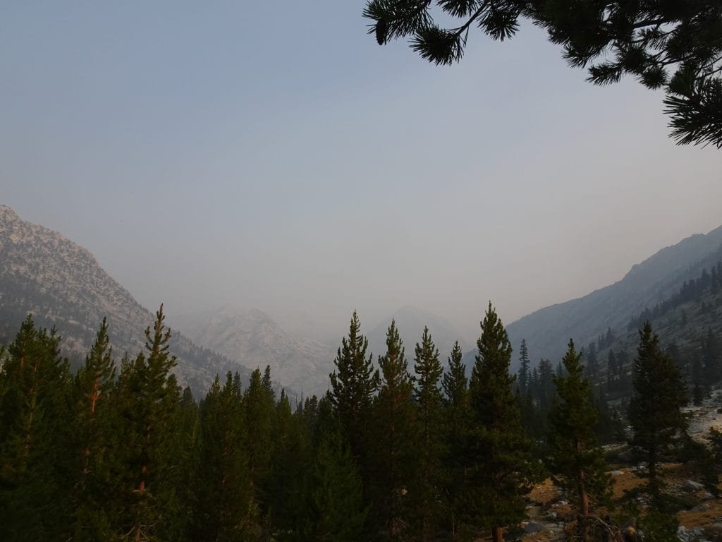

When the smell continued for quite a long time, I started to think about the haze that still hung in the air all around me. I had thought it was just a morning mist or light fog, but it was there for way too long and for way too far up the canyon.
The tint of the sun as it rose above the ridge line and cast its light through the haze kind of settled it for me. this had to be smoke from a fire somewhere. A big fire.
I looked all around, but couldn’t see any direct source of smoke and the thinness of the haze made me somewhat sure that it wasn’t nearby. Hopefully.
There was a side canyon ahead (leading to Baxter Pass) that might hide a forest fire. And there were forests behind and ahead of me.
That started me thinking about what I should do if I do see flames.
Baxter Pass was unknown to me and I hadn’t researched it at all, but could be an emergency exit route if it became necessary.
Trying to escape by going back down to Woods Creek had the benefit of being an area I had at least seen before, but it was also MUCH longer of an exit route compared to exiting via Baxter Pass or continuing towards Glen Pass and then exiting via Kearsarge Pass.
Glen Pass, of course, was where I wanted to go to complete the JMT. So, that did kind of tip the scales in that direction… even if that direction was UP.
But in the end the biggest factor was the fact that going back down to Woods Creek would mean that I was surrounded by trees that would just add fuel to any fire. Conversely, going up to Glen Pass would get me above the tree line within an hour or two. Less trees = less fuel to burn = less chance of me being trapped in a burning forest.
The lakes ahead of me would also help provide some safety, if needed.
So baring a wall of flames coming down at me from above, I decided to continue up towards Glen Pass.
After that since I had no cell service and only having basic info that I could get via Inreach, I relied on an old hiker’s information network:
Asking other hikers “what’s up”. 🙂
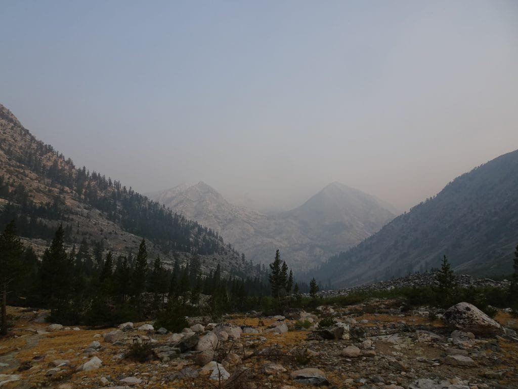
According to several hikers coming down from Glen Pass, there was no fire ahead. The word of mouth between hikers was that the smoke was coming from several large fires in the San Francisco Bay Area.
While that didn’t lift the haze from the skies, that did at least reassure me that I wasn’t in any immediate danger.
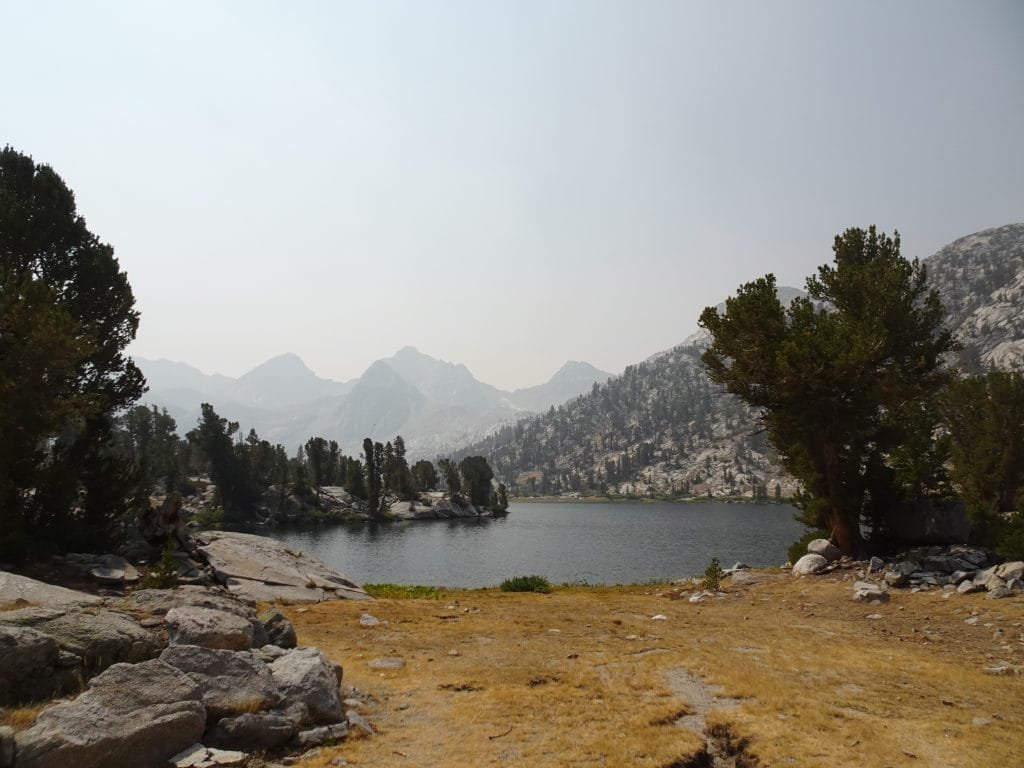
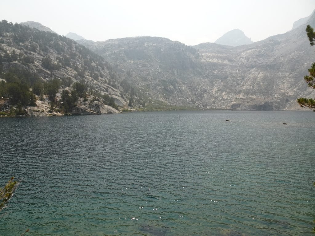
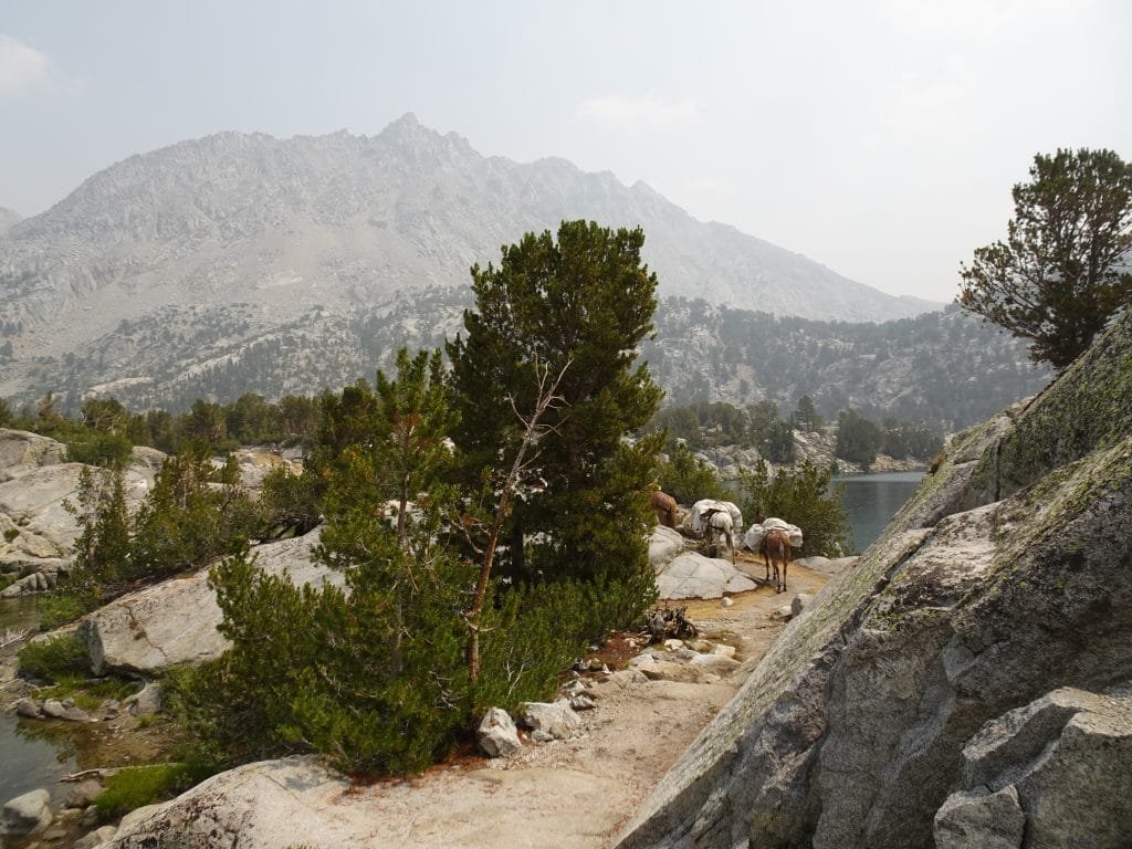
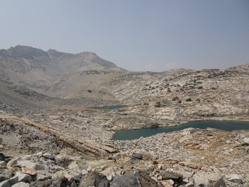
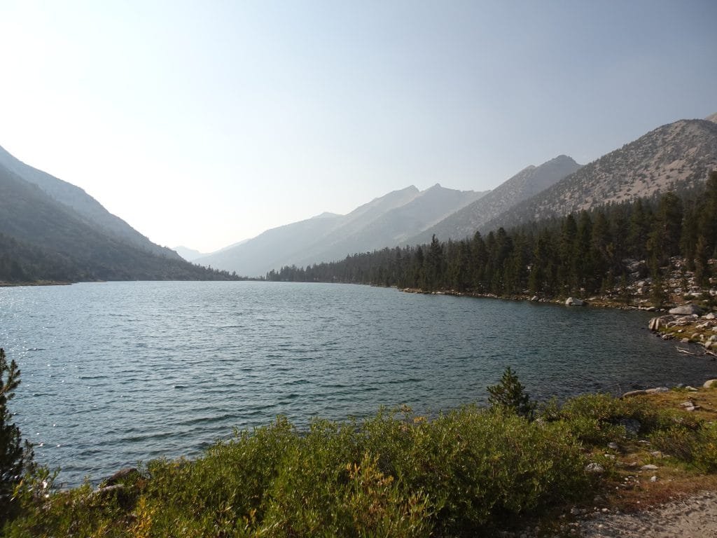
That made my hike past Dollar, Arrowhead Lake, and Rea Lakes much less stressful. Still was a pain in the legs, of course. 🙂
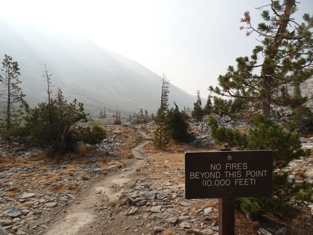
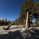
As I approached Dollar Lake, I passed an ironic sign.
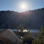
At Dollar Lake I confirmed I still had enough water and continued upwards after taking in the view of and from the lake.
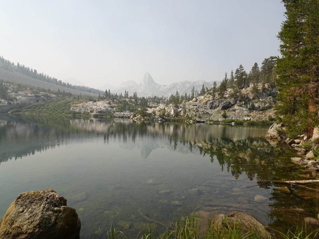
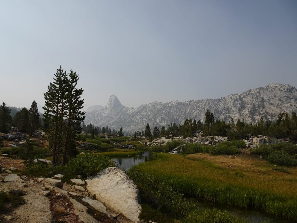
Fin Dome was a prominent landmark as I made my way up and did a great job of keeping me focused on moving forward (until I passed it, of course).

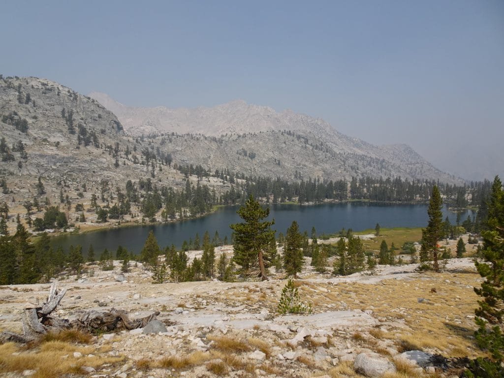
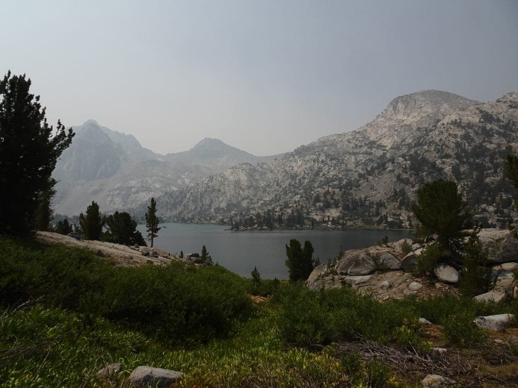
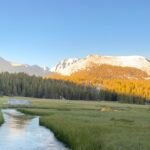
At one point (much earlier in the trek) I had thought that Rae Lakes would be a great place to stop for the night.
I was right. The lakes were a lovely area and I mentally added it to a list of places to re-visit someday and spend some more time at.
But during this particular trek, my goal was clear: Complete the entire John Muir Trail in a single, continuous trek.


Could I have taken a half zero day at the lakes and just picked up my resupply package from the bear box the next day? Yes, but that would mean I would have to eat granola for dinner (nothing else left 🙂 ) and would put me about 3 days altogether behind my original schedule.
Plus the haze in the sky made things look a bit tarnished and dull, so I decided to just enjoy a break at the lakes and then head up to Glen Pass.
While I was refilling water there and still trying to figure out why the filter wasn’t flowing right, I finally determined with near certainty that my Sawyer filter was the problem with not being able to suck water through my Camelbak very well. If I hooked it up to my backup squeeze pouch, I could squeeze water through it into my Camelbak. Then I could use the Camelbak without the filter in place and suck water directly. It took more time when I refilled my water, but it would work for me.
Unfortunately since I didn’t fully diagnose the problem until that point, I couldn’t ask Berners to bring a replacement filter in with my resupply package. But since I could get water through the filter using the squeeze pouch, hopefully it was properly filtering the water and I would be safe.
I didn’t have much choice in the matter. I wasn’t going to abort to Onion Valley because of it, not when I was this close. Some people swear that the water in the Sierra Nevada Mountains is clean and pure enough that they just dip and sip directly from the creeks and rivers. Since it mostly comes from snow melt that hasn’t gotten contaminated from flowing near Human cities and towns, they believe filtering is unnecessary. So, I may be able to survive the trek even if the filter wasn’t filtering anything.
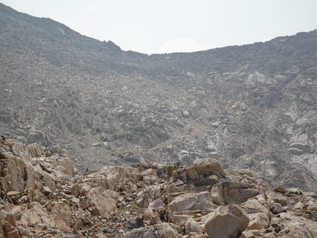
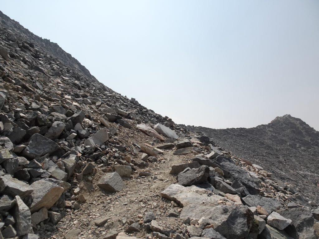
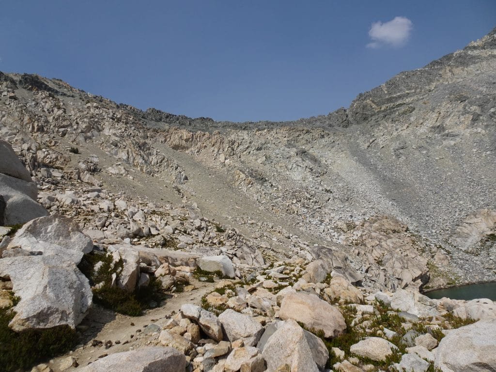
After leaving Rae Lakes, it wasn’t long until I almost decided to change my mind about going over the pass that day and turn around. The trail up from Rae Lakes turned into switchbacks fairly quickly and never really stopped.
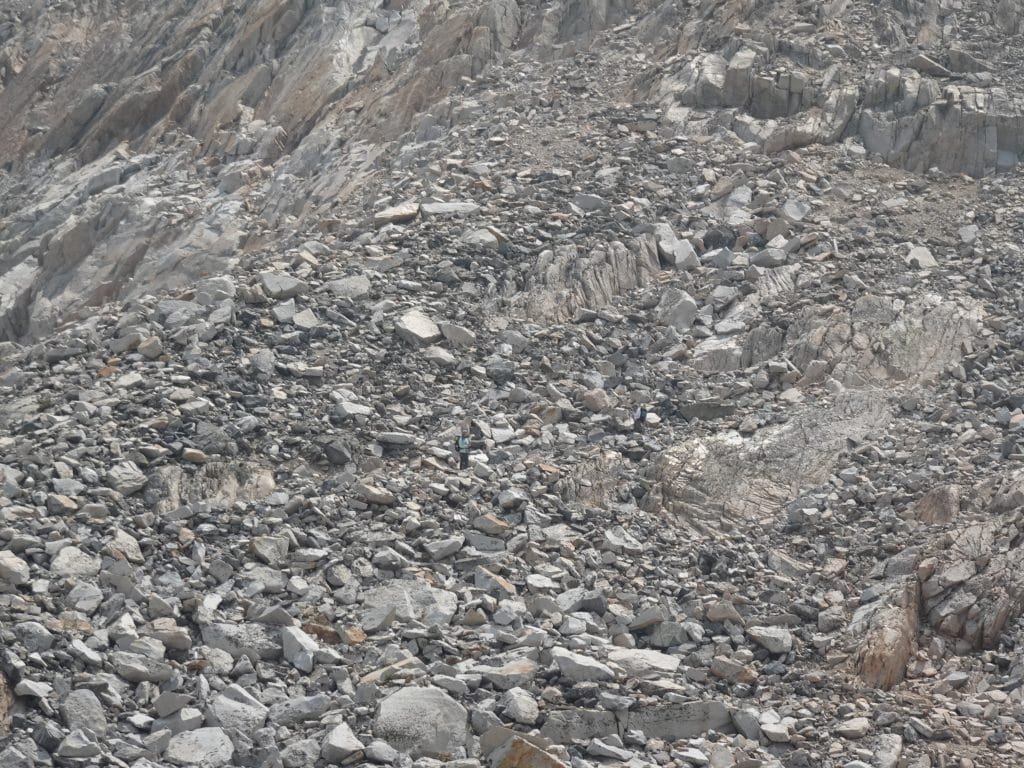
There were a lot of twists and turns and false routes that made you think you were close, but really weren’t. In fact, I did take a couple paths that looked correct, but that path soon disappeared and I had to retrace my steps back to the real trail.
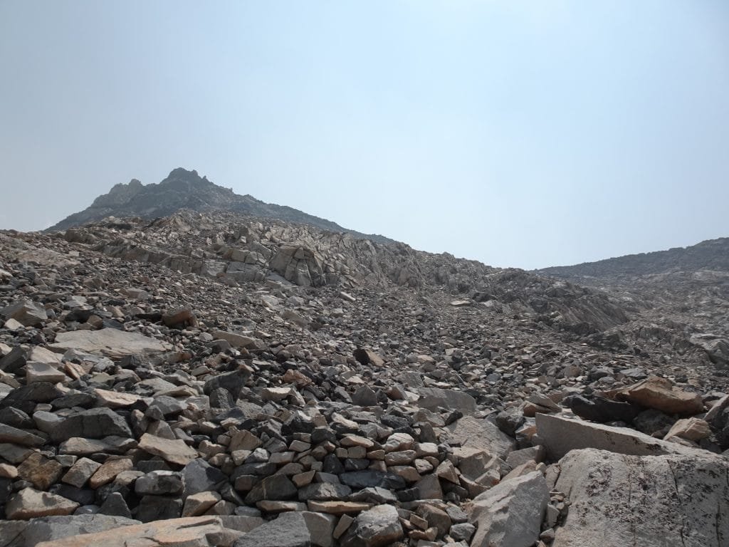
Maybe it was fatigue or just the endless piles of loose rocks that caused the missteps, but when I finally faced the ridge line that I thought held Glen Pass I had a moment worse than ‘Oh shit…’ I won’t say more than that to keep this report PG-13. 🙂
The mountainside I had to go up was really just a big pile of rocks and boulders with zero evidence of a trail or even a logical way to go up.
Whoever ‘Glen’ was, he was insane to think that was a viable pass to use to go anywhere. 🙂

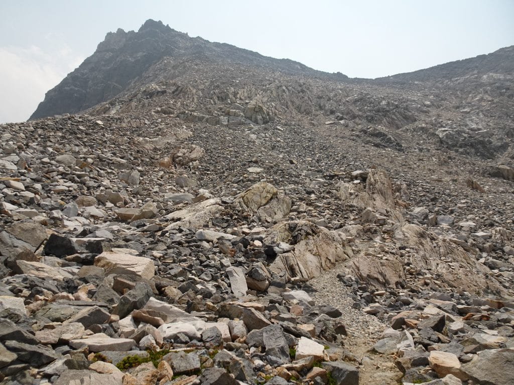
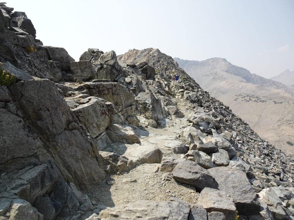
Slowly I followed the trail as best I could, thankful that at least up close the path forward was fairly clear. I didn’t want to take a wrong turn or a step too far that would send me tumbling down the mountainside.
As had happened several times before during this trek, I was saved somewhat when I saw some hikers descending from the path. Well, that helped me find that part of the switchbacks, at least. The entire path still was a bit hard to envision.
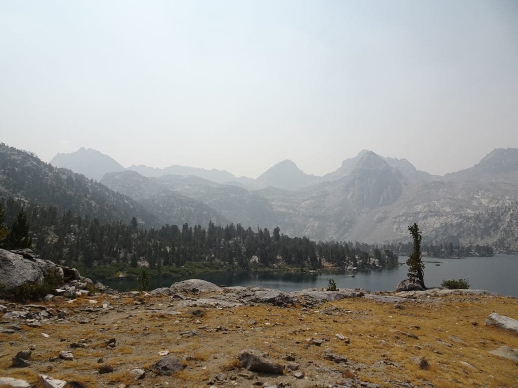
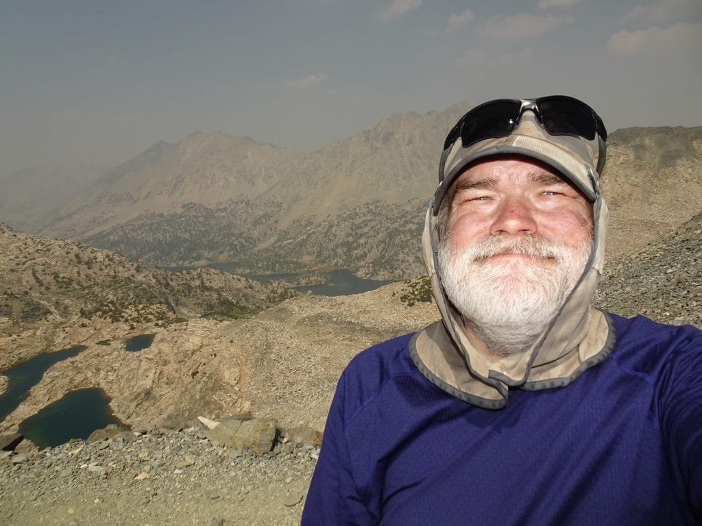
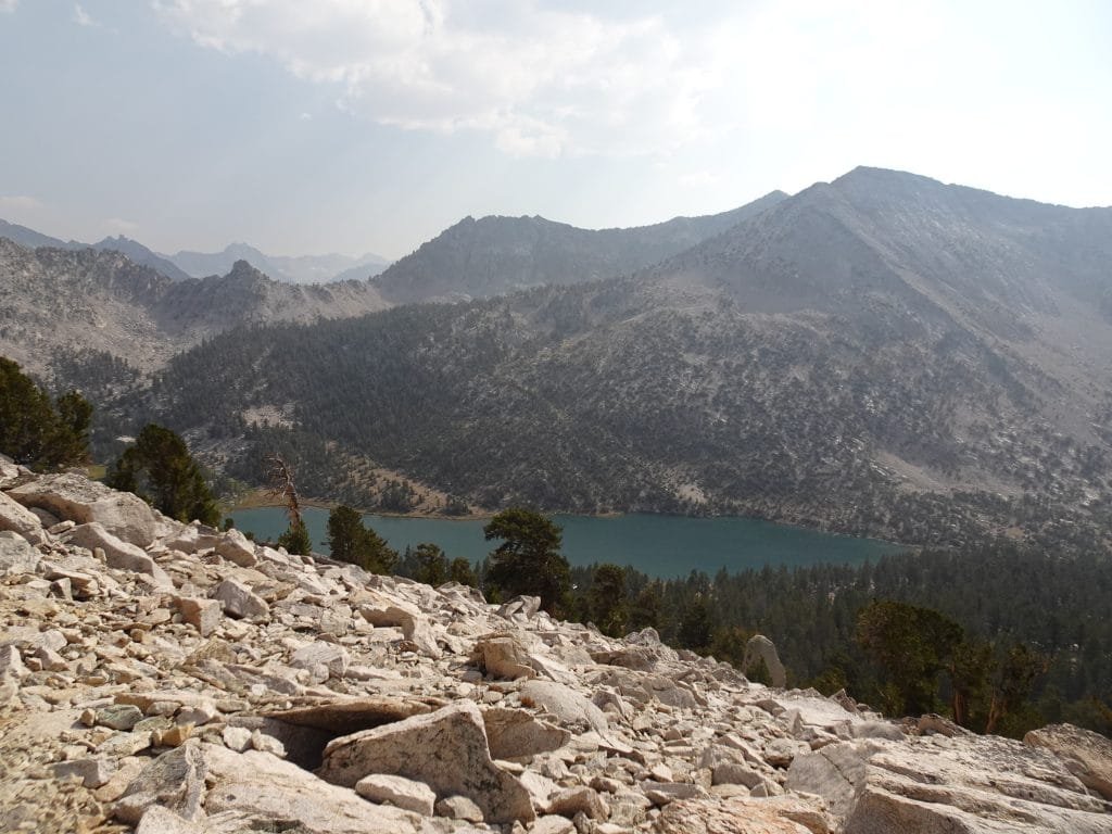
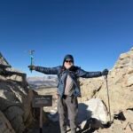
I had to check the times on my photos and my GPS tracks to know exactly how long it took to get up from the last Rae Lake (two and half hours, apparently), but I did finally see the top of the pass.
Ahhhhhhhh… sweet salvation!
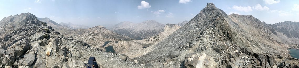
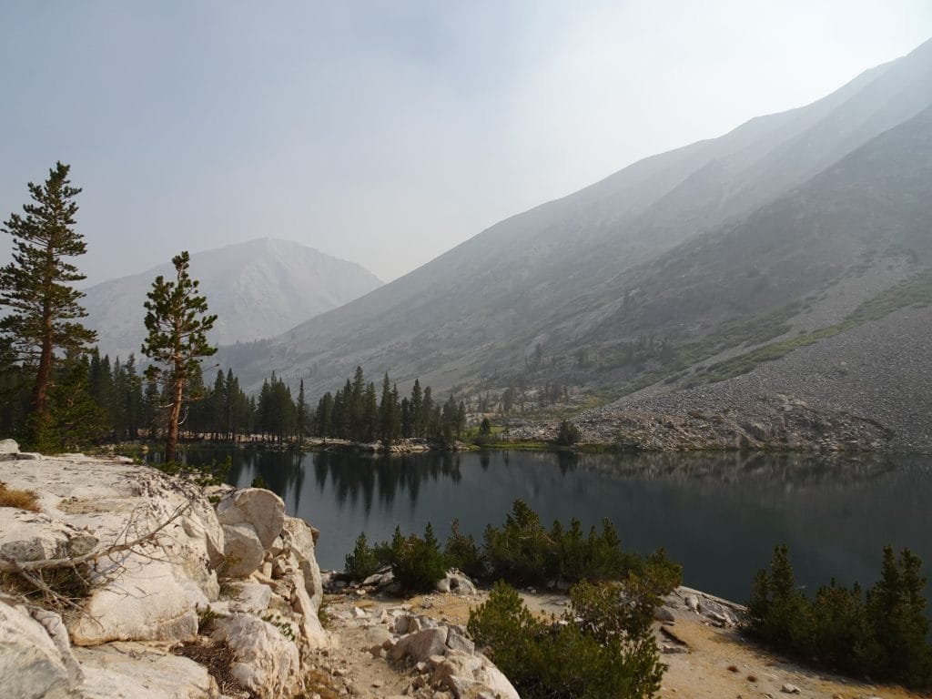
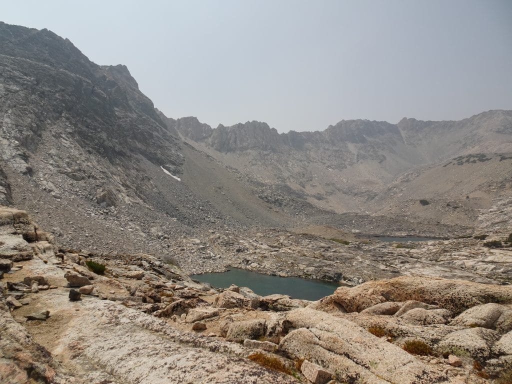
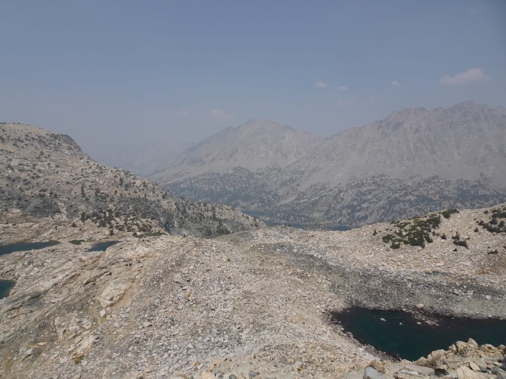
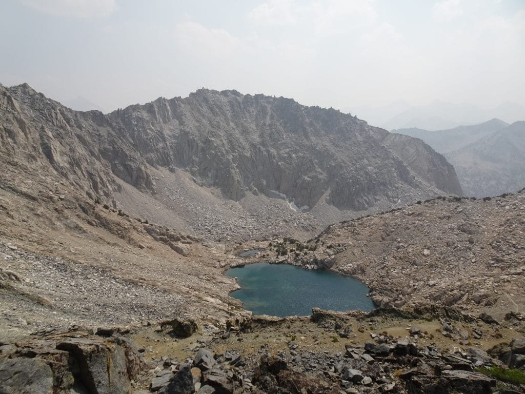
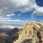
The view was great, but the smoke in the air limited how far and how much I could see.
The trail over the pass actually ran along the ridge the pass went over. Besides the mark on my GPS map, it wasn’t obvious where the exact ‘pass’ was, but that didn’t change the views that I could see.


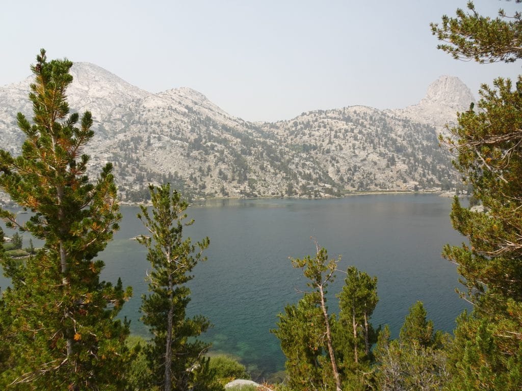
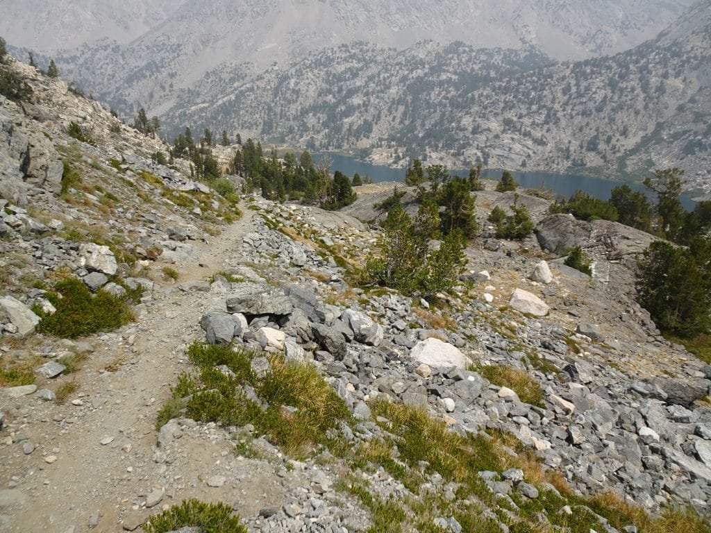
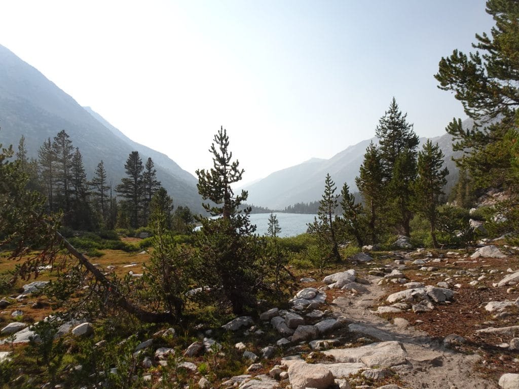
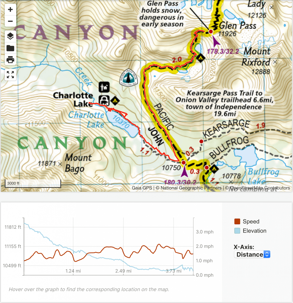
After enjoying the pass for a while I had to start down towards Charlotte Lake, but while it was only 2 miles to the Charlotte Lake Trail junction and then another mile to the lake it turned out to also be a very hard route. A lot of switchbacks and sections where I had to climb back up a bit before descending all over again. Even the final descent to the lake was made up of switchbacks. It looked a lot easier on the map, but then it normally does.


I also made the mistake of not filling up on water in the pond directly under Glen Pass. I thought I had enough, but the extra work to filter water at that point probably made me skip it in hopes that I had enough. With there not being any water beyond that until I got to Charlotte Lake and the sun finally being visible on this side of Glen Pass, I was a little thirsty once I reached the lake.
But at least I did reach the lake!

The bear box and most of the campsites were at the far end of the lake, so I still had more to hike that day. Along the way, I ran into a ranger returning from her 5 day ’rounds’. When I mentioned I was picking up my resupply package, she wasn’t happy. She said that the pack companies weren’t supposed to leave resupply packages there.
When I got to the bear box, my resupply package wasn’t in there. Thinking there might be another box a little further down the trail, I checked, but didn’t find anything. Tired and flustered, I had sent a Inreach message to Berners.
So that left:
1) Berners didn’t drop it off.
2) Someone stole it.
3) The ranger confiscated it.
4) There was another bear box.
Fortunately, it was #4. There was a bear box near the ranger hut and my package was in it!
I vaguely remembered Berners mentioning that they shared a bear box with the rangers, but that was 180 miles and a lifetime ago.
I did have a socially distanced conversation with the ranger when I picked it up. I guess the leaving of resupply packages was a pet peeve of hers, but Berners insisted it was allowed as long as it wasn’t left over 24 hours.
Returning to the original bear box (where I had stashed my backpack while I tried to locate the resupply package),I chose a campsite not too far away from it, but didn’t set my tent up right away as I usually do.
First, I had my first Diet Coke in a week and then a couple Golden Oreo cookies (Berners had found a small package and brought it out to me).
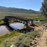
Then I jumped in the lake with most of my clothing on. Ahhhhhh…
Mostly to cool down since it was still pretty hot that day, even with the smoke in the air blockage some of the direct sunlight. But it also helped soothe my aching body and muscles. Not to mention it helped to wash some of the dirt off of me and rinse out the clothes I was wearing. Don’t worry, I didn’t use any soap in the water (or anywhere that night… I didn’t have the energy for that).
Back at my campsite, I first had one of my dinners from the resupply package (lasagna, I think), then setup my tent. I did a basic sort of my resupply package that night, but decided to leave most of it in the nearby bear box and fully go through the food and other items the next morning.
It was late, plus I was sore and tired from the… 13 (!) miles I had hiked that day. Besides the 15 mile day I had done hiking down to and around Tuolumne Meadows (some of it without a full pack), that was the longest I’d hiked in a single day during this trek. And since it was mostly up towards Glen Pass, this was a LOT harder hike than that day’s hike.
Then I saw the time… 12 hours (which included some longish breaks at Rae Lakes and Glen Pass) altogether. I probably should have waited to come down to get my resupply package after all.
I went to bed around a hour late and had a little trouble sleeping. Thankfully, I had planned on a light hiking day the next day.
Oh… for the first time since day 10, there was no hint of rain this day!
13 miles hiked, 12:00 hours, 4,200 feet climbed
180 total miles hiked on the JMT
31 Miles to Go! (+11 miles to get out to Whitney Portal)
Highlights:
• Glen Pass – 11,926 feet (Pass #9 Conquered!)
• Can of Diet Coke and a jump in Charlotte lake to cool off, relax, and knock some dirt off.
• No rain!
• Daily Goals Achieved! (barely)


Comments by WanderingJim
JMT 2020 Day 3
"I'm afraid I have no idea. Not really a fisherman, so don't..."
JMT 2020 Trek Day by Day
"Yeah, but with 9,000 pictures, it's hard to label each one..."
Kilimanjaro – October 2019
"Everest Base camp is on my list too. Mostly since I know..."
Kilimanjaro
"You started hiking with Kilimanjaro first? Even I worked my..."